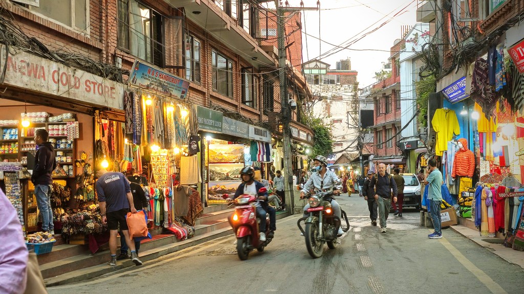
From Pokhara (our previous Nepal post) we headed back to Kathmandu by bus for a couple more rest days and to make final preparations for our planned 23-day journey to Everest Base Camp (as well as the 18,375′ summit of Kalapathar, Cho La Pass at 17,800′, and Goyko Lake)! We had been keeping our eyes on conditions for the flight to the tiny town of Lukla (the traditional start and finish to the Everest Base Camp Trek – and also a notoriously dangerous airport for take-offs and landings). Our team informed us that 4,000m of visibility was needed to safely land at Lukla – unfortunately, for the last five days the weather had not cooperated. Even the well trained Nepalese pilots, experts in flying through difficult Himalayan terrain, had been unable to safely land any flights at the airport. This meant over 1,750 trekkers were stranded and backlogged in the small town of Ramechhap, unable to begin their own Everest journeys.
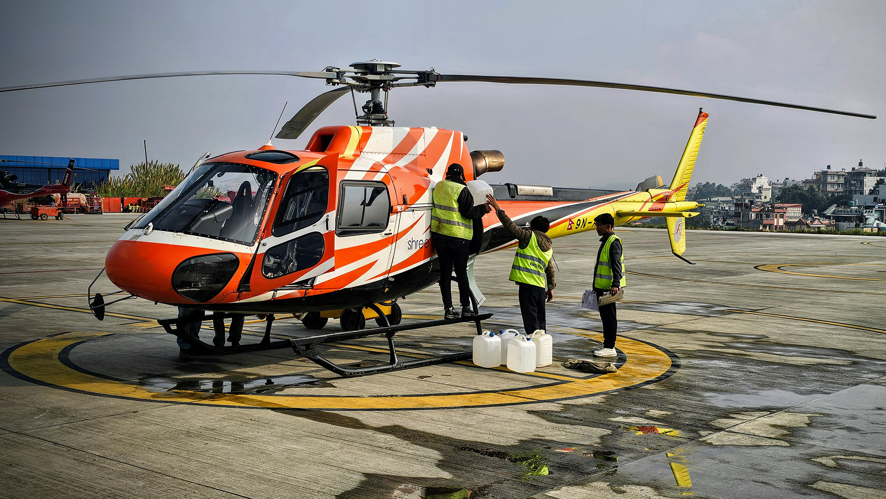
So, we had a couple of options: (1) Continue with our initial plan – bus to the small town of Ramechhap and join the backlog of trekkers, waiting our turn for a weather window for a traditional flight to Lukla, potentially being stranded for several days. (2) Add 4-5 more days to our planned trekking itinerary and jeep/hike to a different town to begin our EBC journey. (3) Attempt a helicopter transfer directly from Kathmandu to Lukla – which would only require 1,500m visibility to fly, versus the 4,000m visibilty a propeller plane required. Of course, each of these options had associated risks, benefits, time constraints, and costs to consider. The recent flooding and completely washed-out roads and bridges also added a layer of complexity. In the end, we opted to stay a few extra days in Kathmandu, and then attempt a direct helicopter transfer to Lukla.
Our trek coordinator was able to secure a reservation for helicopter transfer within 3 days, however even with a reservation there was no guarantee we would actually fly. We kept a close eye on conditions in Kathmandu and Lukla, constantly updating the hourly forecast while we waited. Fog, fog, rain, fog, rain, fog, more fog … as the days passed, backlogs of trekkers continued to grow and grow. We even watched the YouTube live-feed from the Lukla airport obsessively. At this point we were just emotionally torturing ourselves.
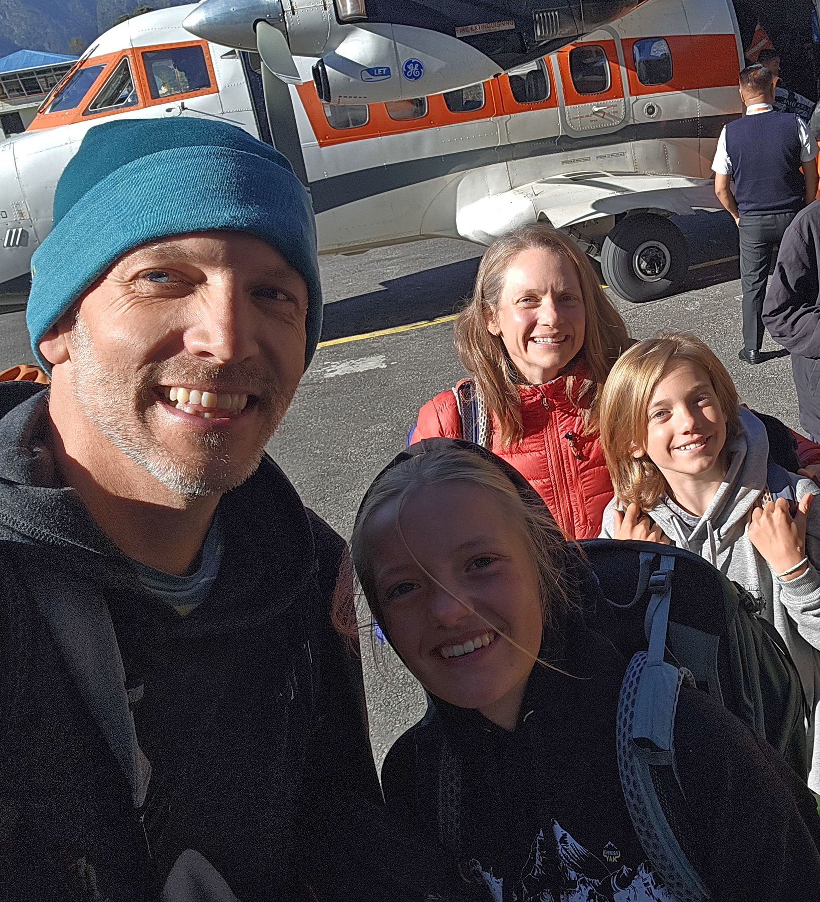
The morning of our helicopter reservation arrived. After having reviewed the weather forecast, and being fully aware that no one had successfully landed in Lukla for over a week, our expectations were very (verrrry) low. But our trekking coordinator had faith. We headed to the Kathmandu airport, were wisked through “security,” and loaded on to a van that brought us to the tarmac. The sun was breaking through as we loaded onto the helicopter, with blue skies above our heads! Our pilot let us know it was still too foggy to safely navigate a landing at the infamous Lukla airport, but he would try to get us “as close as possible.” So with that, we took off… not knowing exactly where we were landing.


Sidenote: for those who have never flown in a helicopter before (like me!) – I wouldn’t recommend flying in the Himalaya under less-than-ideal weather conditions as your first experience. It was… a lot.
As our flight progressed, we could hear our pilot communicating with ATC in Lukla – landing conditions still weren’t ideal. Then, we popped over a ridge and heard our pilot chuckle a bit. He seemed to be having a colorful discussion with the crew in Lukla – convincing them the conditions were acceptable and he was preparing to be the first aircraft to land at their airport in more than a week. The clouds separated, the sun broke through, and the legendary Tenzing-Hillary Lukla airport came in to view! Our pilot skillfully navigated the final approach, and 45 minutes after our take-off from Kathmandu we were again safely on the ground. Our family, along with our guide Indra, were the first trekkers to arrive in over a week!
As you can imagine, there were many spectators at the airport (mostly stranded trekkers trying to leave at the end of their EBC journeys). The craziest part?! As soon as we landed, the clouds socked-in again. Only one other helicopter flight had enough visibility to land that day!

It was with this dramatic arrival in Lukla that our three week Everest Base Camp journey began.
(Howie is taking over the next portion of this blog entry … as I would summarize the next three weeks as “21 days of really big mountain vibes and quite a bit of vomiting.” Howie prefers a bit more detail.)
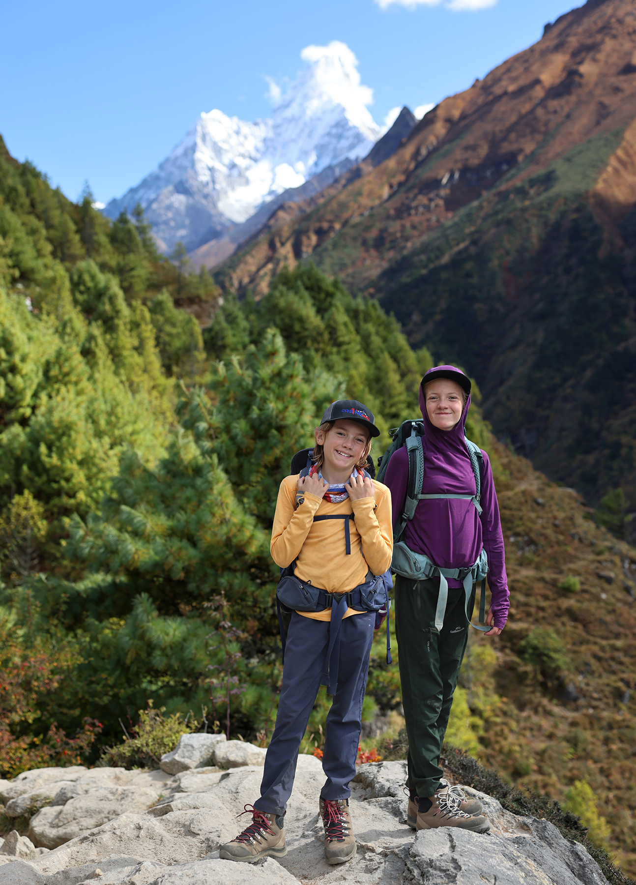
Everest Base Camp Trek Day One! Luka (9,383 ft) to Phakding (8,562 ft)
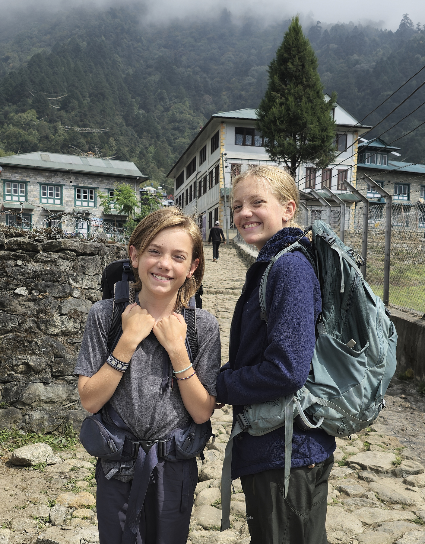
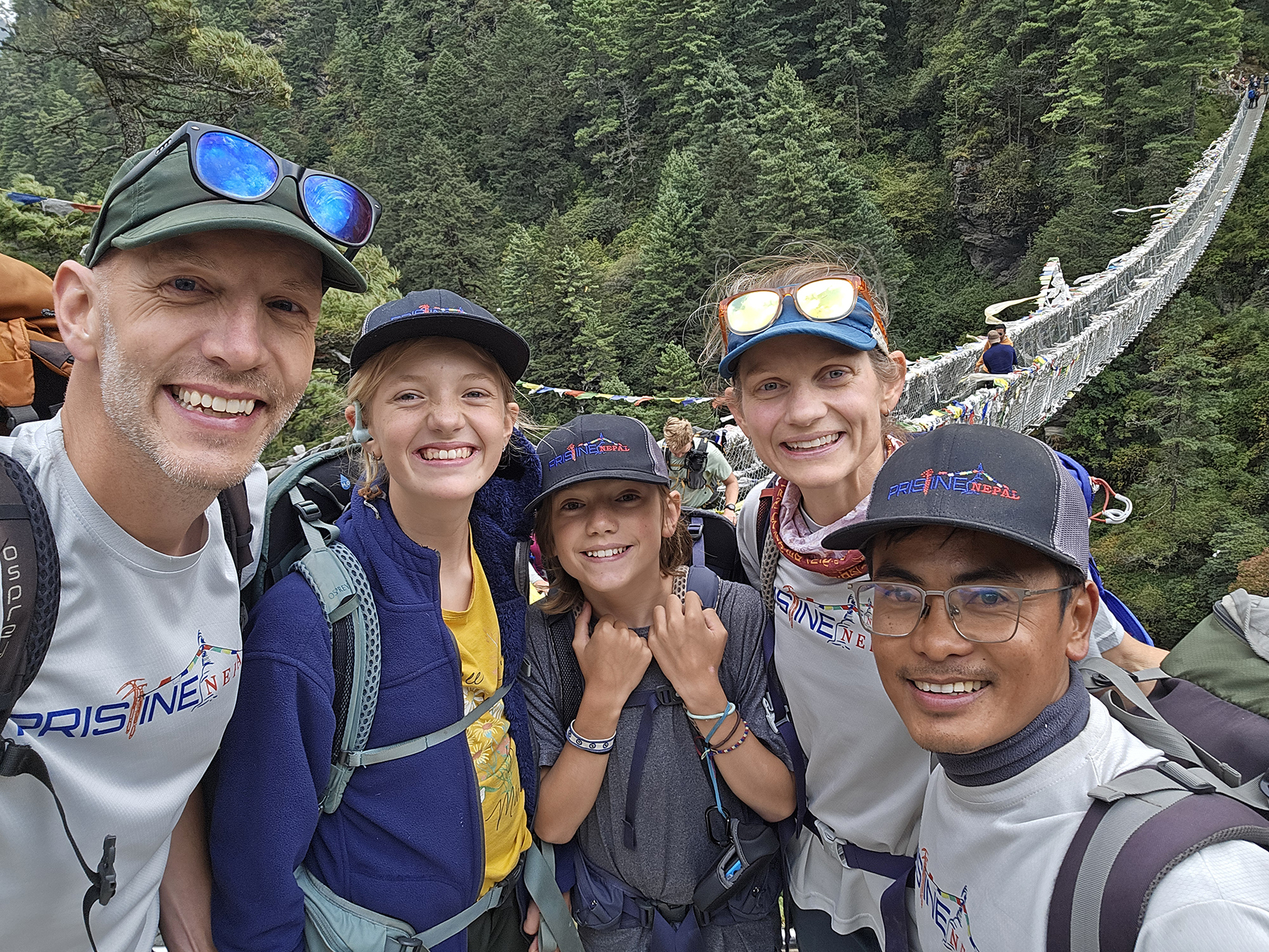
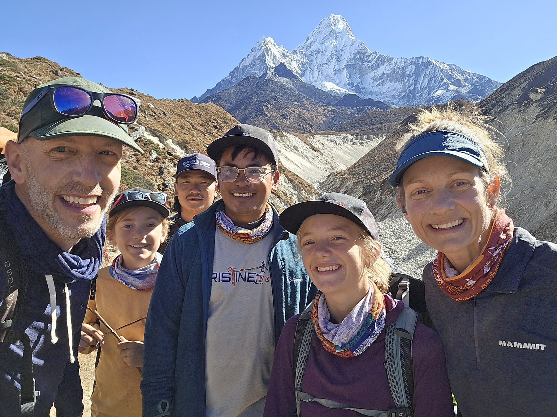
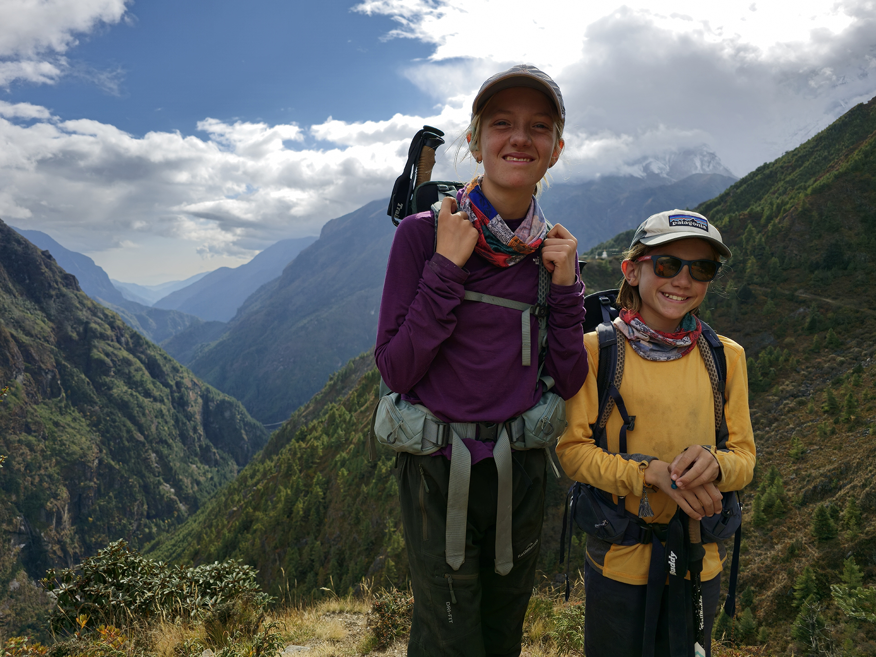
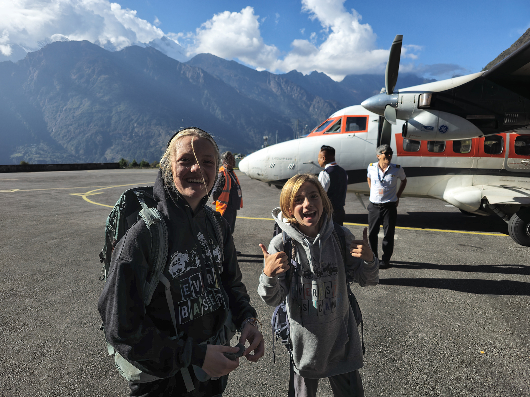
Stepping off of the tarmac in Lukla, I could hardly believe that we were about to begin a trek I’d been dreaming of for more than twenty years. All of our anxiety for the last few days had been focused on just getting to Lukla to start the trek – and now that we had arrived I couldn’t wait to hit the trail! I had mentally prepared myself for a days-long delay due to the ongoing weather issues that had recently stranded hundreds of trekkers, so our successful arrival by helicopter took me somewhat by surprise! We met our amazing porters BBC and Naresh on a scramble out of the airport’s exit gate, and then took our first steps on what we hope will be a three week adventure through the Himalaya.
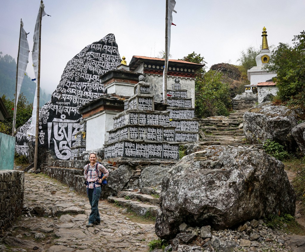
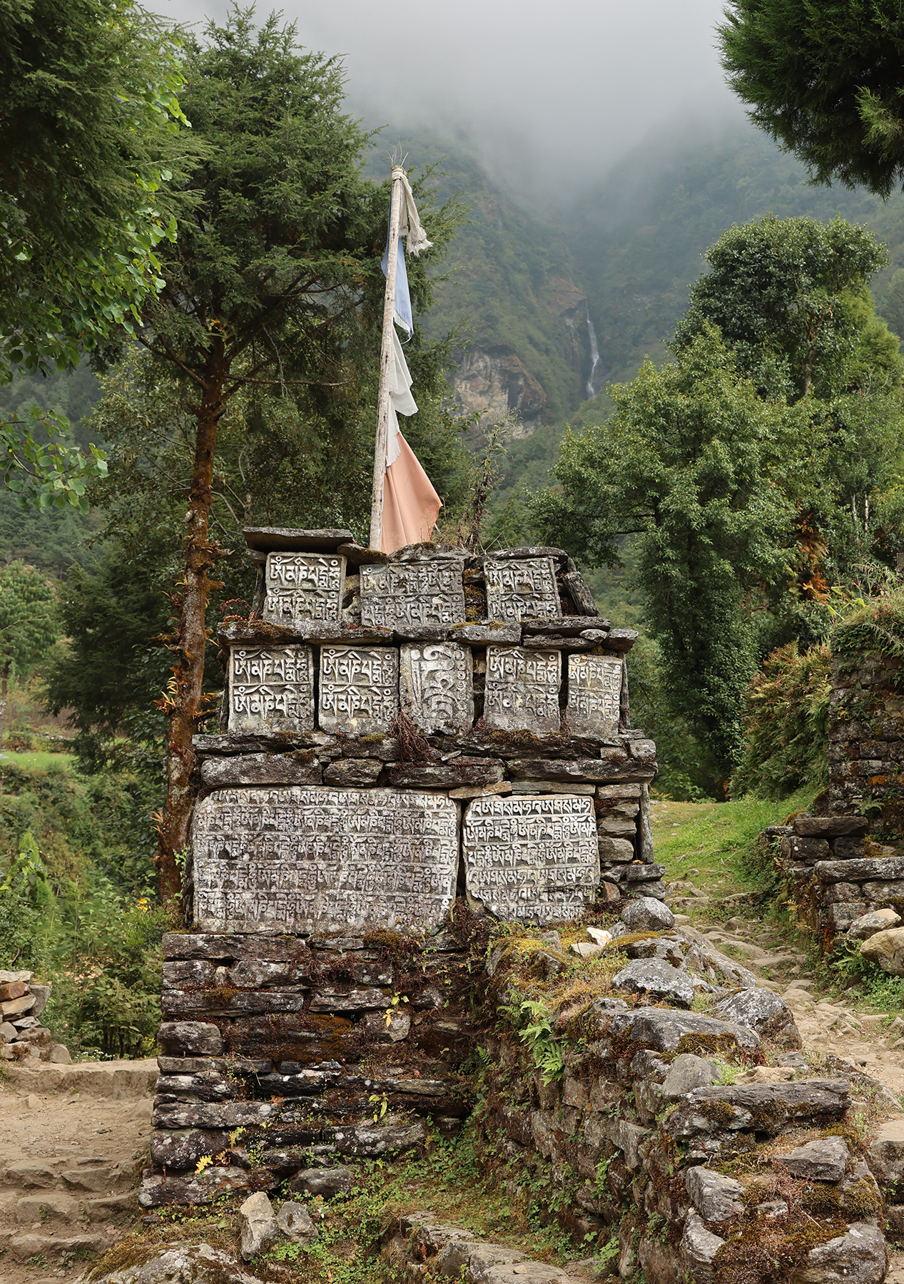
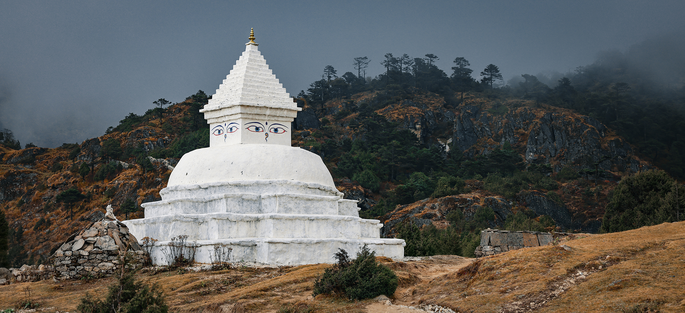
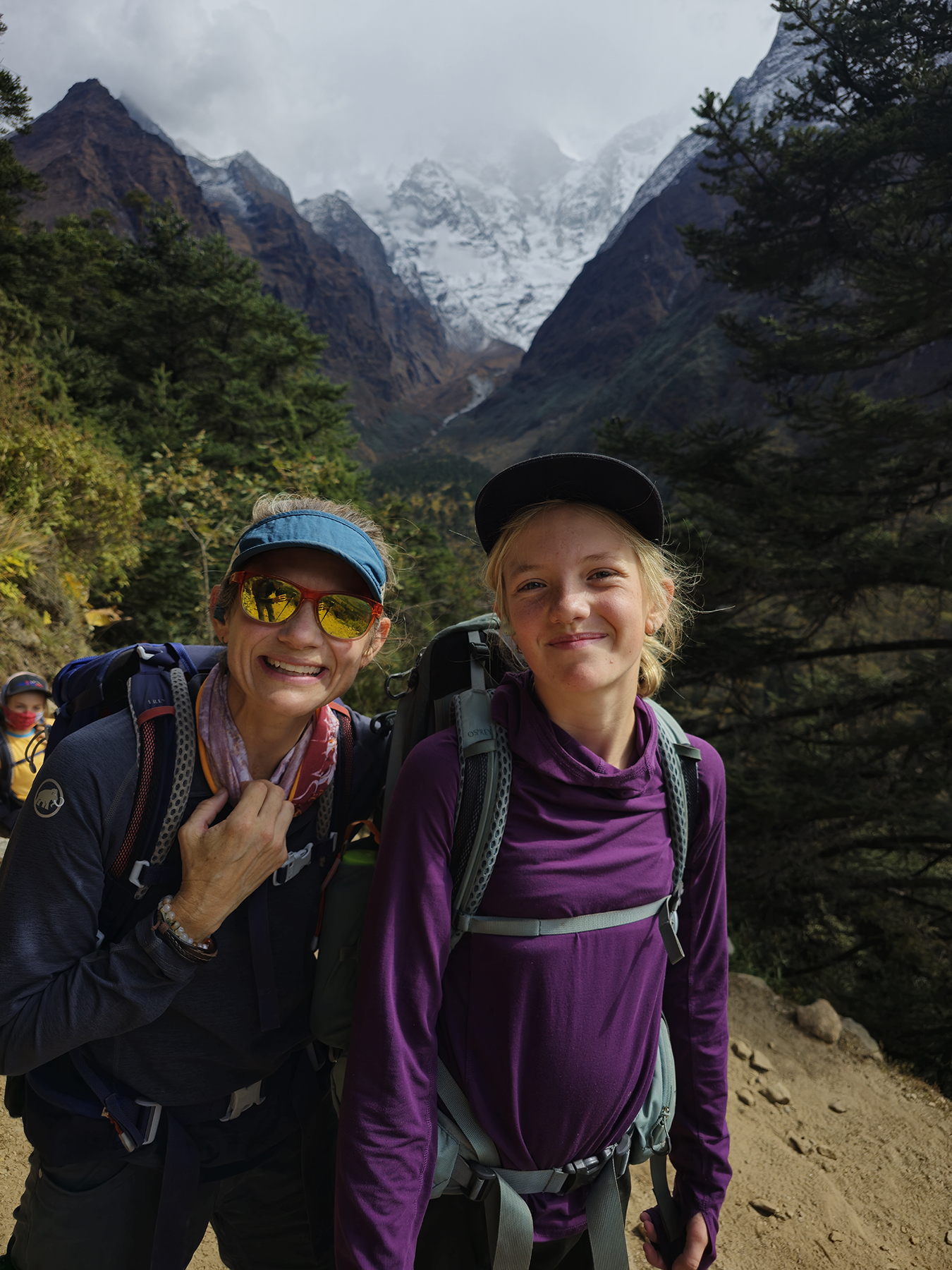
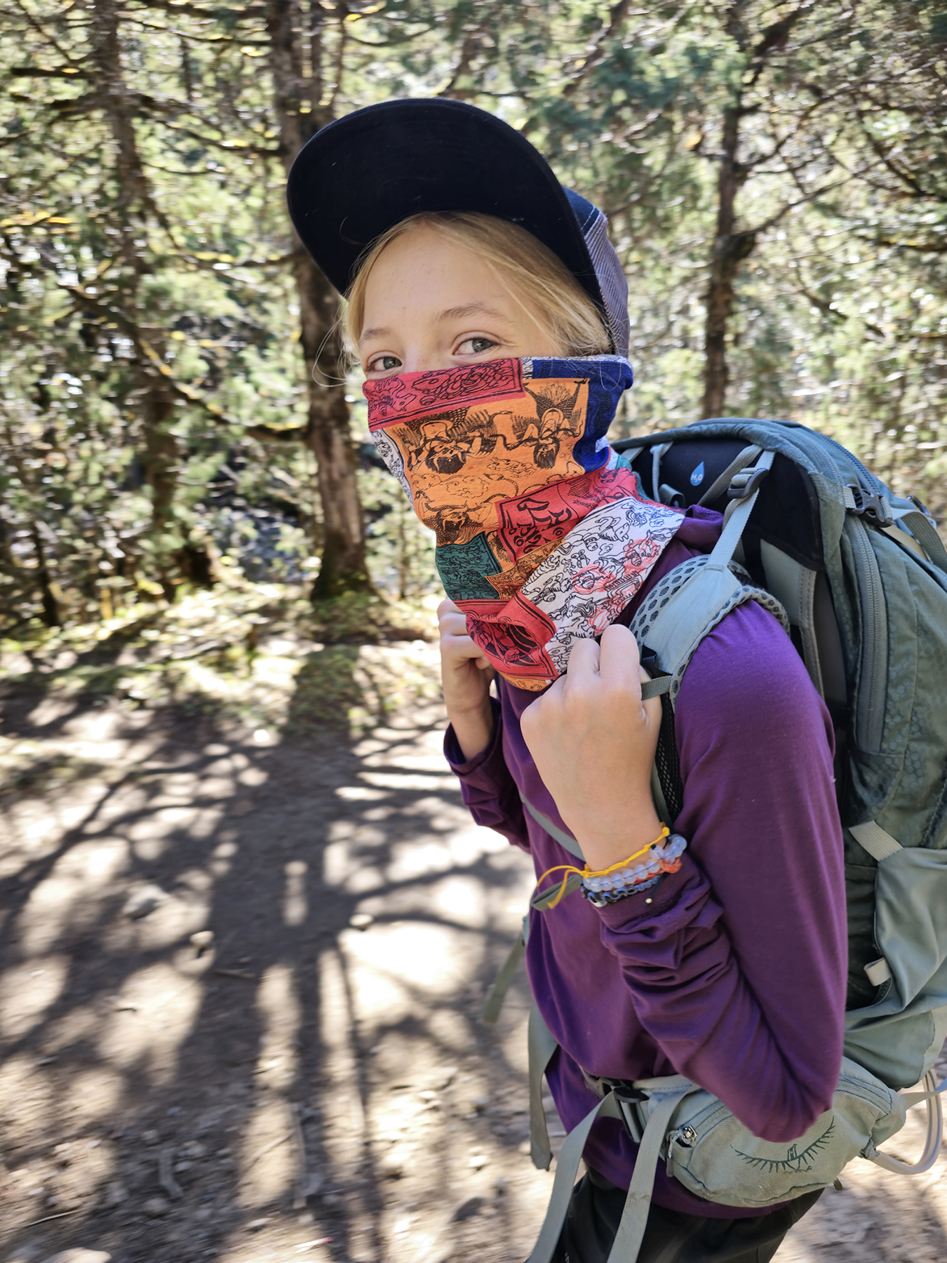
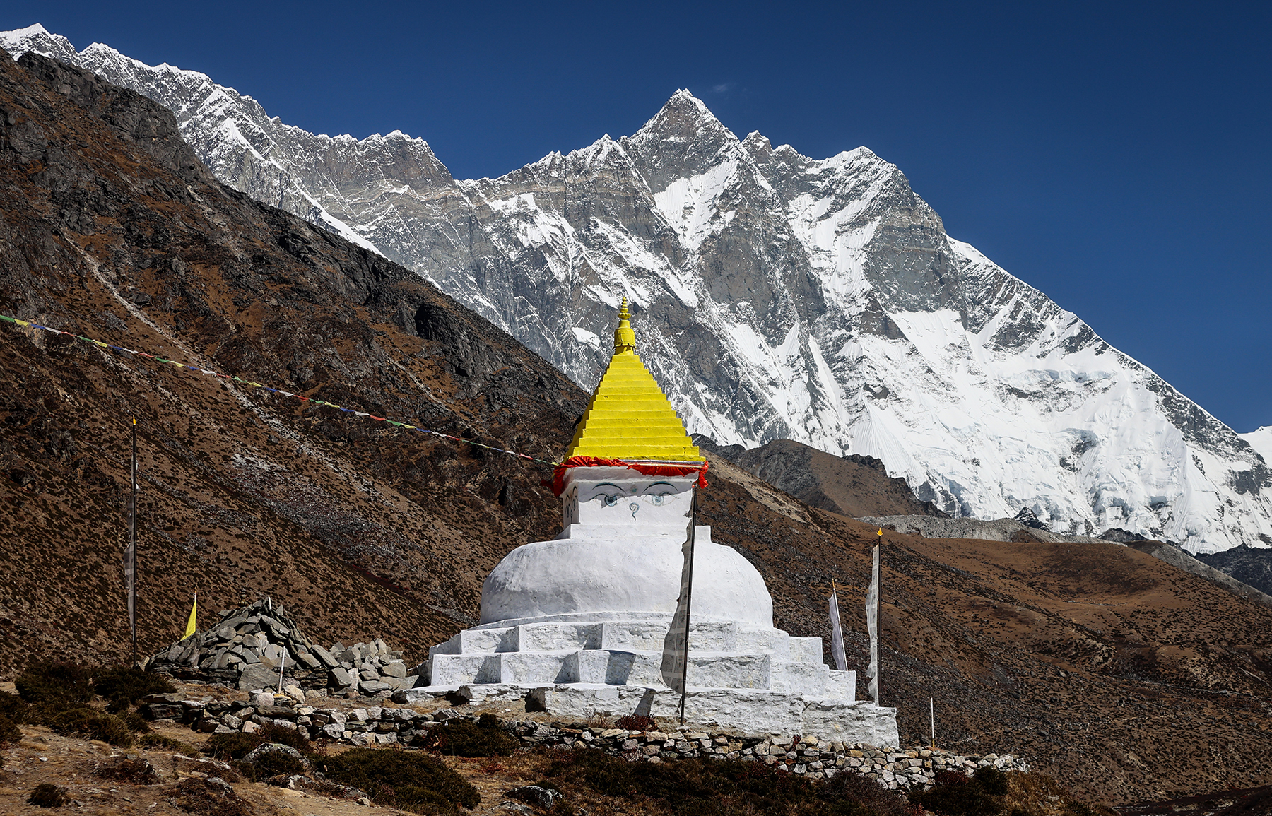
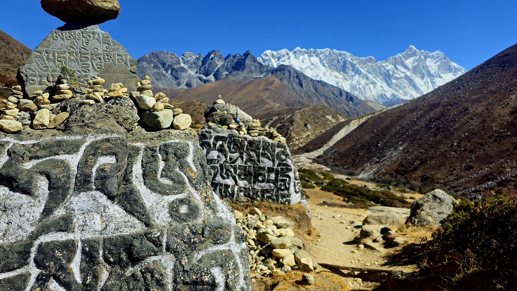
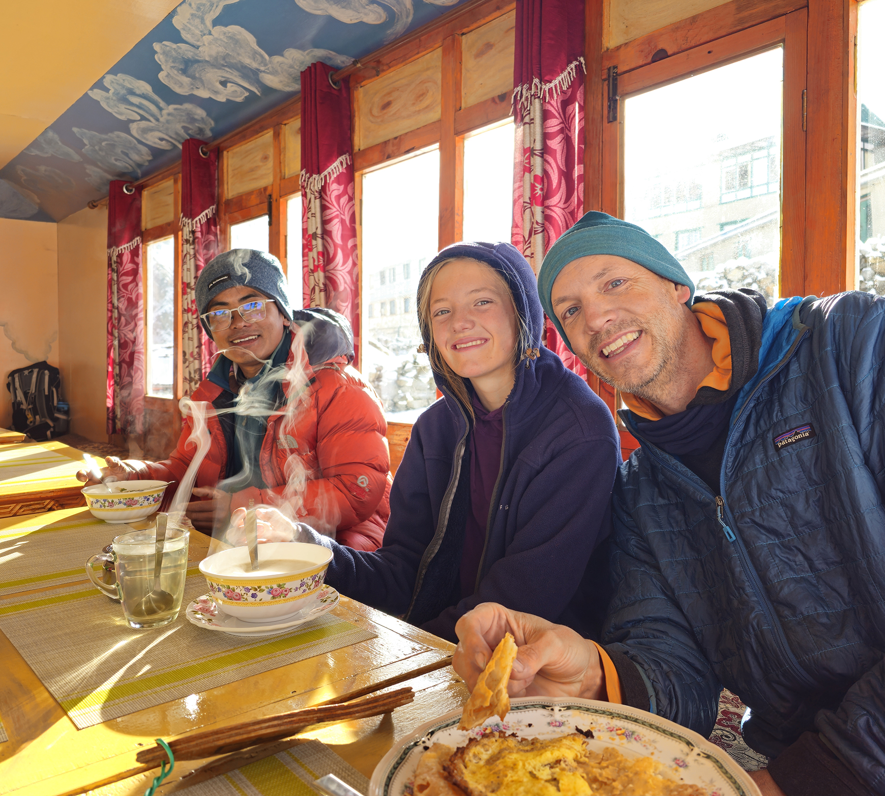
After a quick lunch of dal bhat, we headed out along the rocky trail out of Lukla. My last visit along this path was in 2001, at the tail end of 20+ days of trekking to Mera Peak and the Amphu Lapscha Pass. As we hiked past waterfalls, small stupas, and mani stones carved with repeating Buddhist mantras, clouds descended to obscure any views of the high peaks that rose thousands of meters above us. Unfortunately, with each step I noticed an increasing sense of nausea overtaking me. I began to have unpleasant flashbacks to my Mera Peak trek, which similarly started with three days of vomiting outside my tent in a soggy downpour at the tail end of the monsoon. Poor little H was also struggling with nausea, and it was all we could do to put one foot in front of the other to reach a teahouse in the small town of Phakding just as dusk arrived. Shaking uncontrollably, H and I immediately crawled into bed, loaded up on medications, and tried to fall asleep to help our bodies fight off whatever bug we had picked up. I honestly don’t remember much of this first evening – it passed in a disoriented blur of nausea, though I miraculously avoided ever spitting up! Poor H was not as fortunate, though we will kindly spare you the details.


Day 2! Phakding (8,562 ft) to Namche Bazaar (11,286 feet)
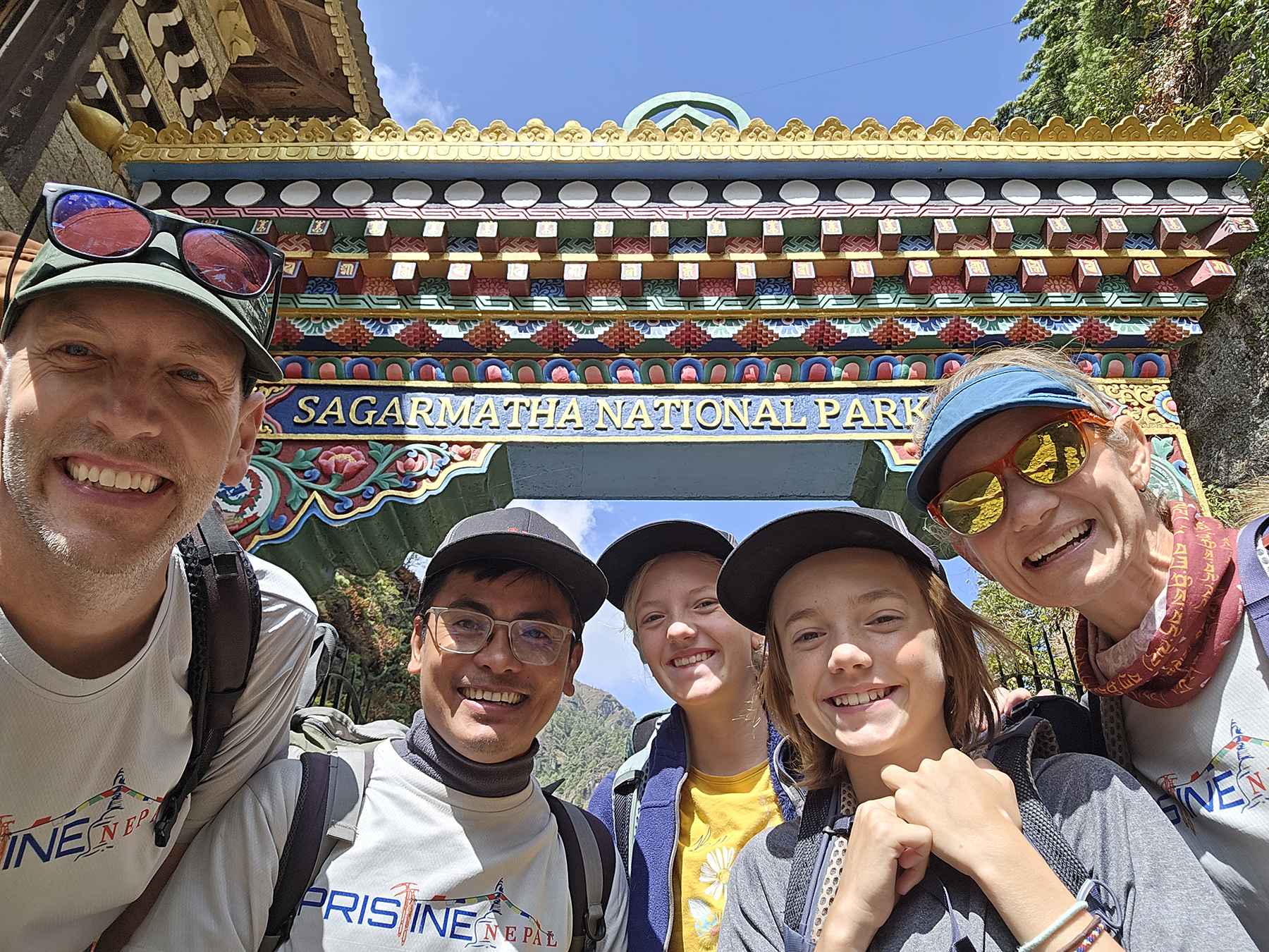
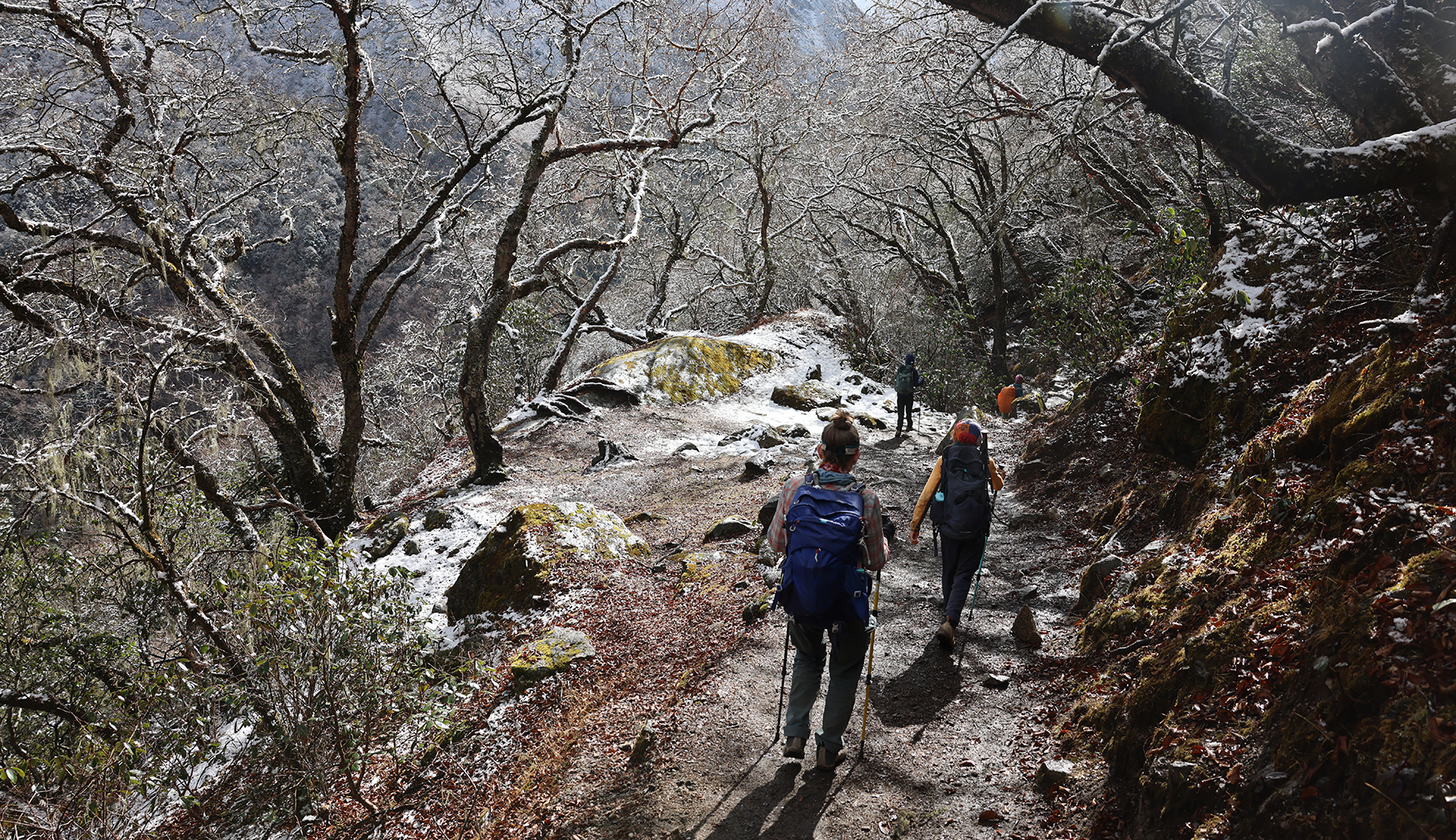
I awoke the next morning feeling weak, though the extreme nausea of the night before seemed to have subsided. H was unfortunately also still feeling quite run down. I skipped breakfast, as it seemed that any food I consumed would not likely stay down, though the thought of our upcoming ascent of the switchbacks leading to Namche Bazaar made me nervous to approach on an empty stomach. We set out along the busy trail and made our way up the narrow valley, crossing the occasional suspension bridge over the Dudhkoshi River. I felt surprisingly better after a few hours of trekking, though poor H had a few more vomiting episodes on the side of the trail. We made it through a busy checkpoint at the entrance to Sagarmatha National Park, and stopped for lunch in Monjo just before the beginning of the day’s largest climb.

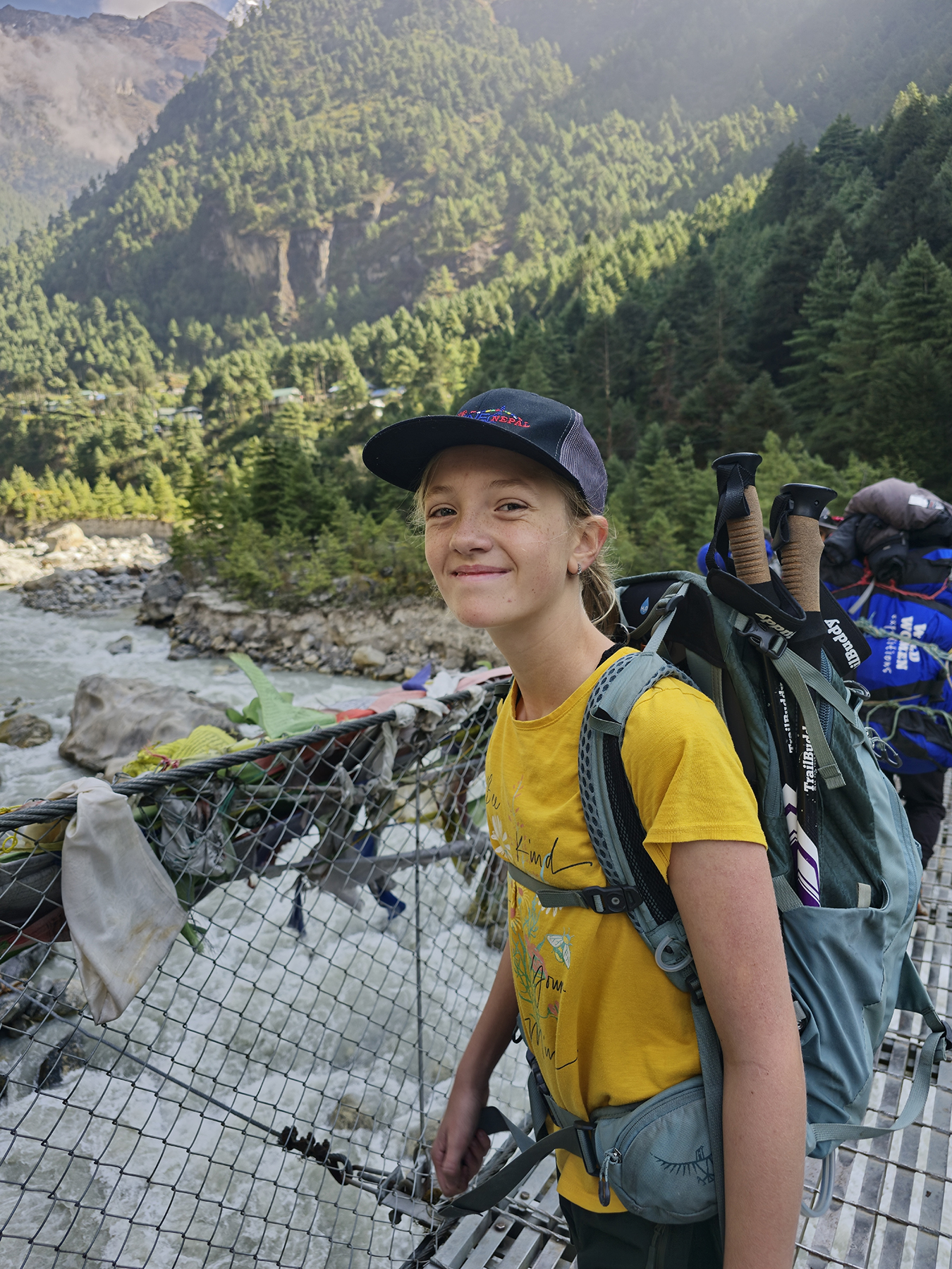


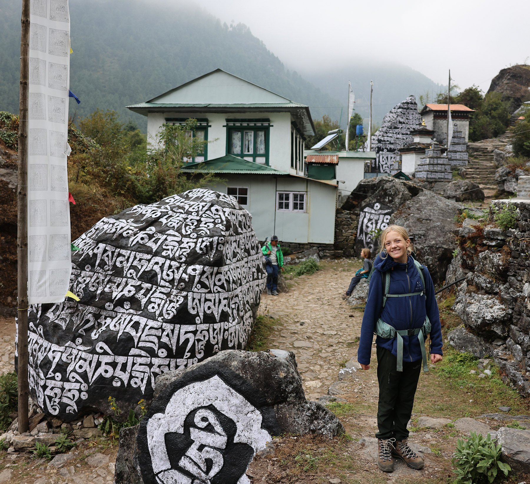
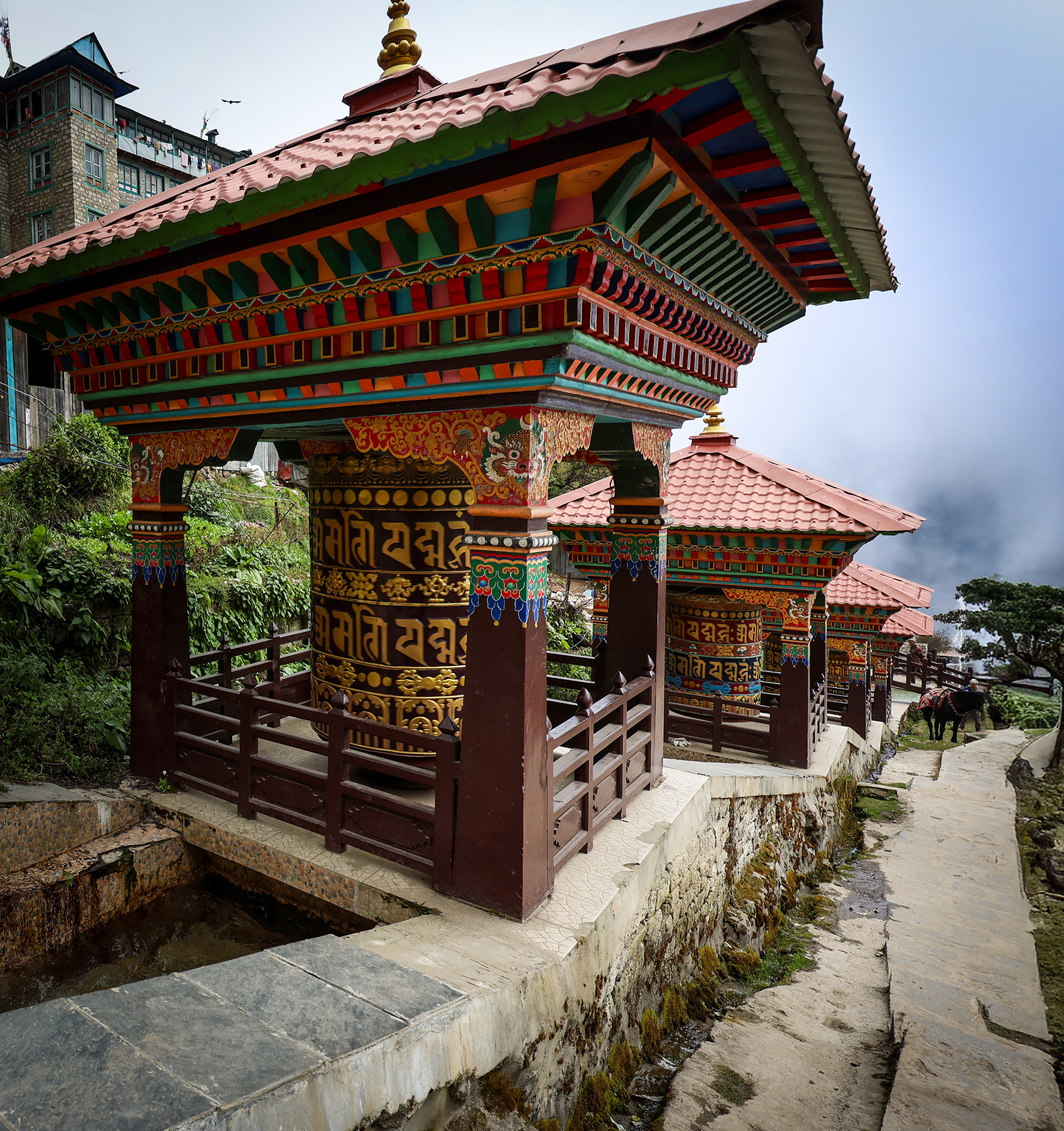
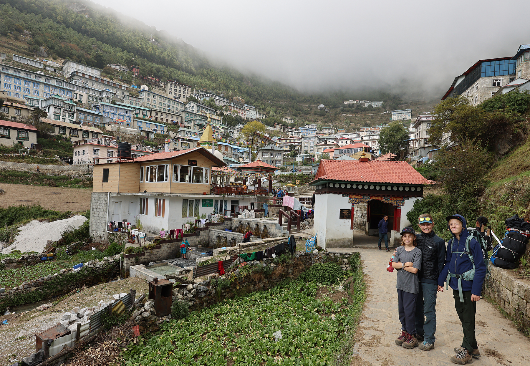
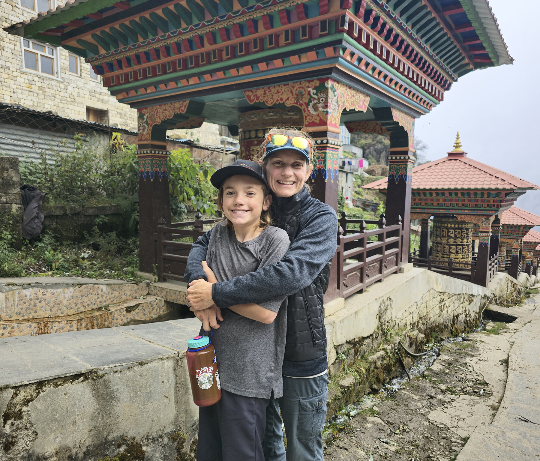
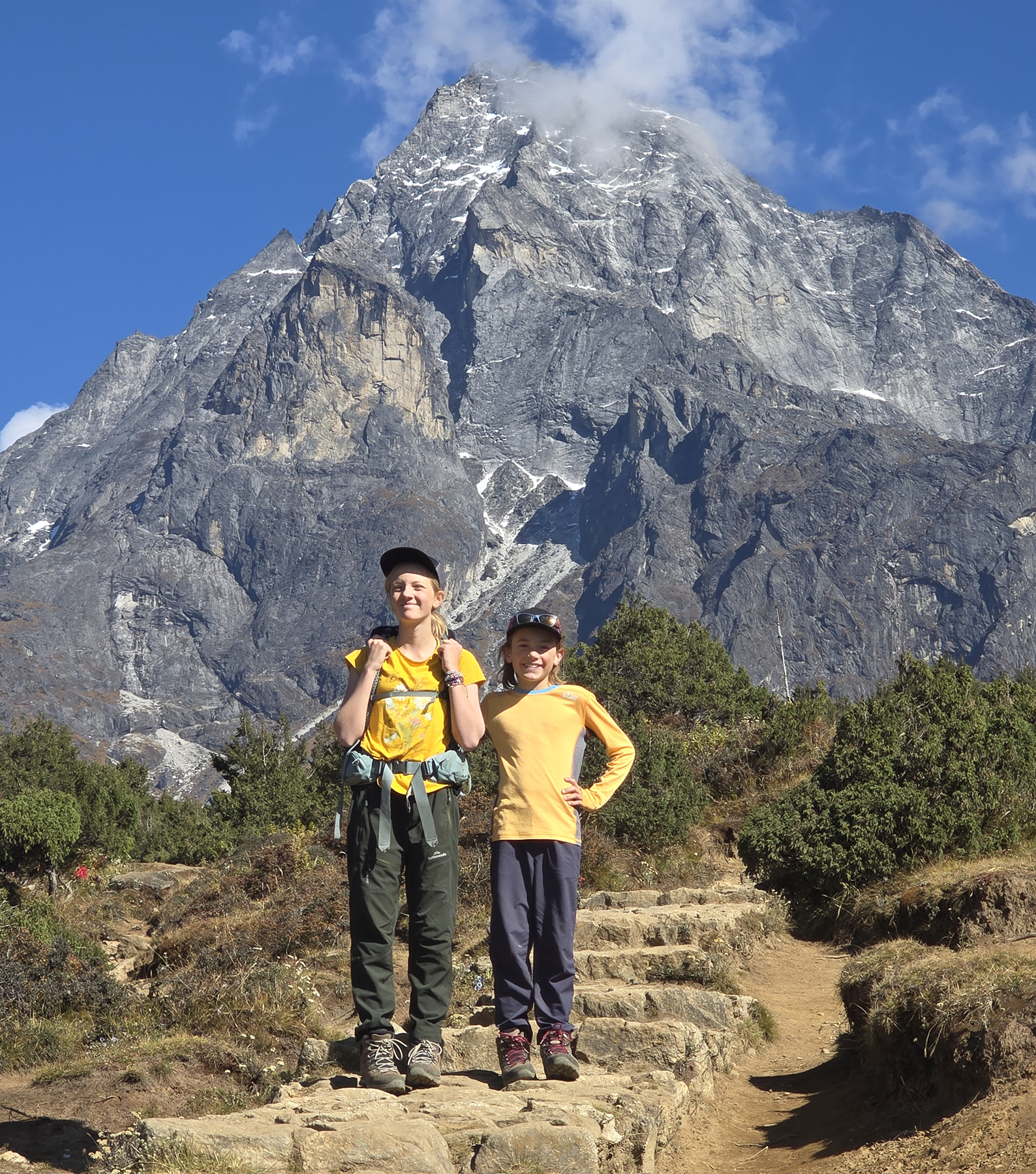
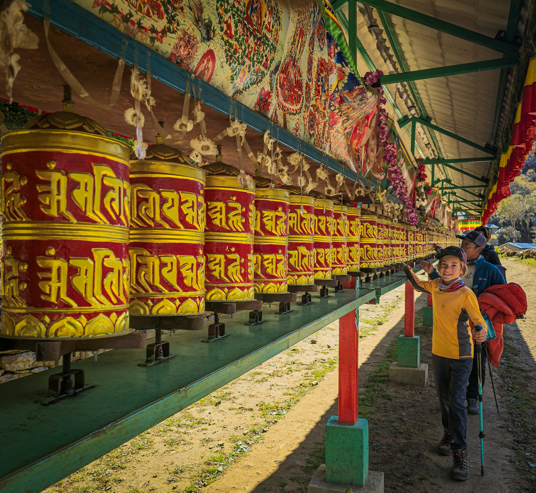
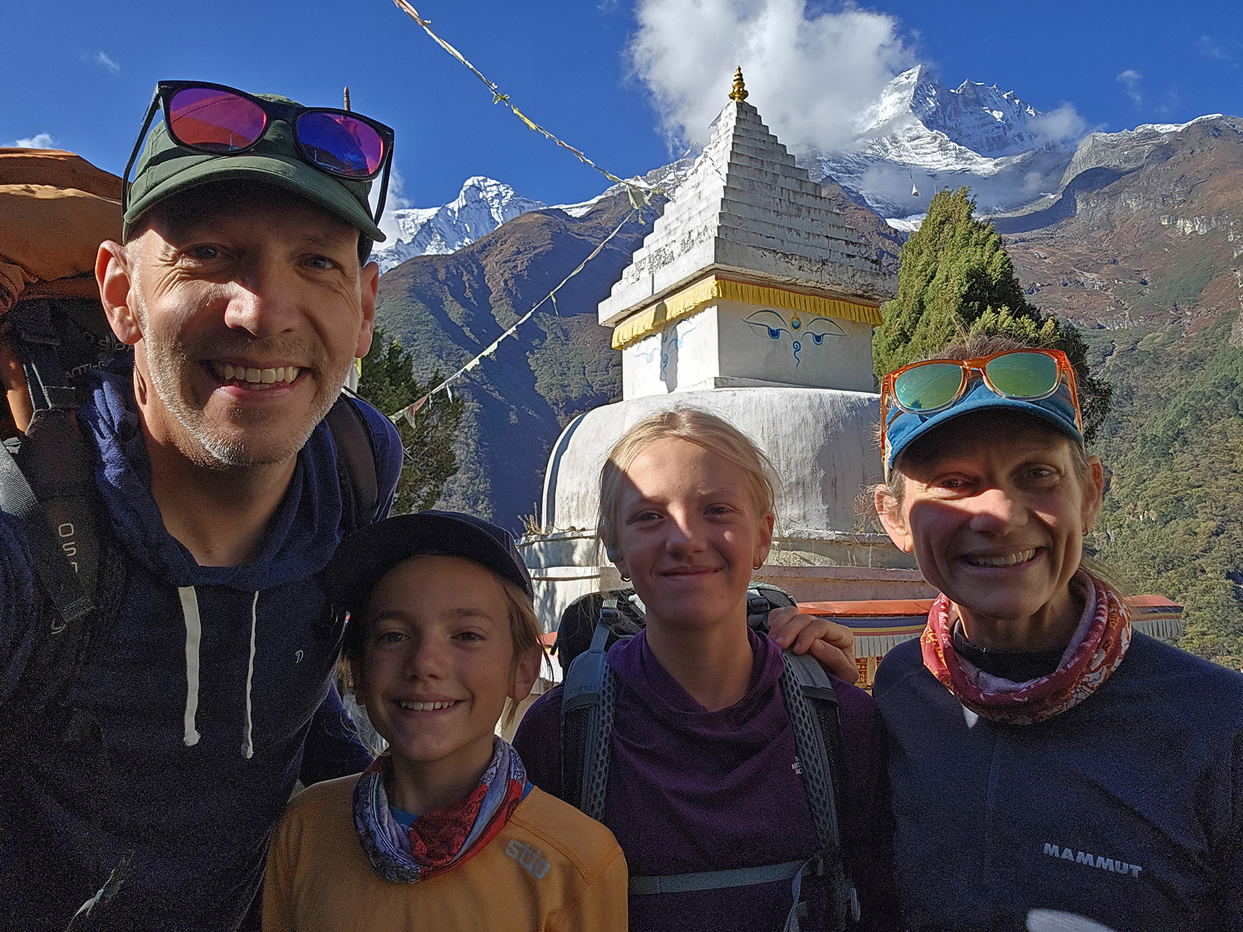
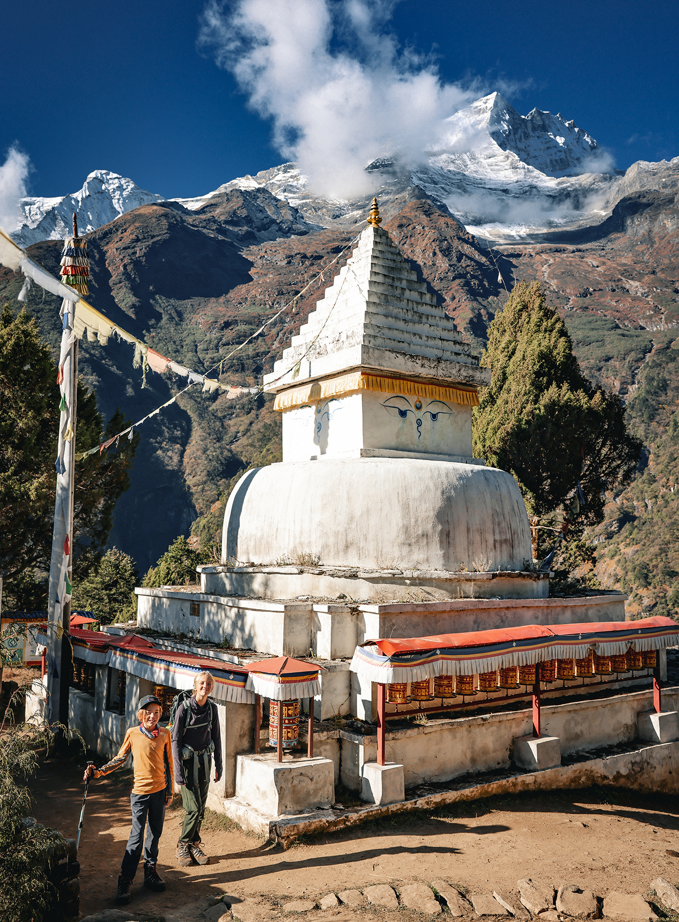
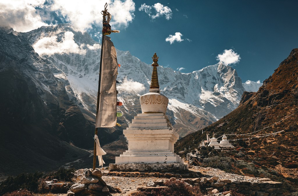
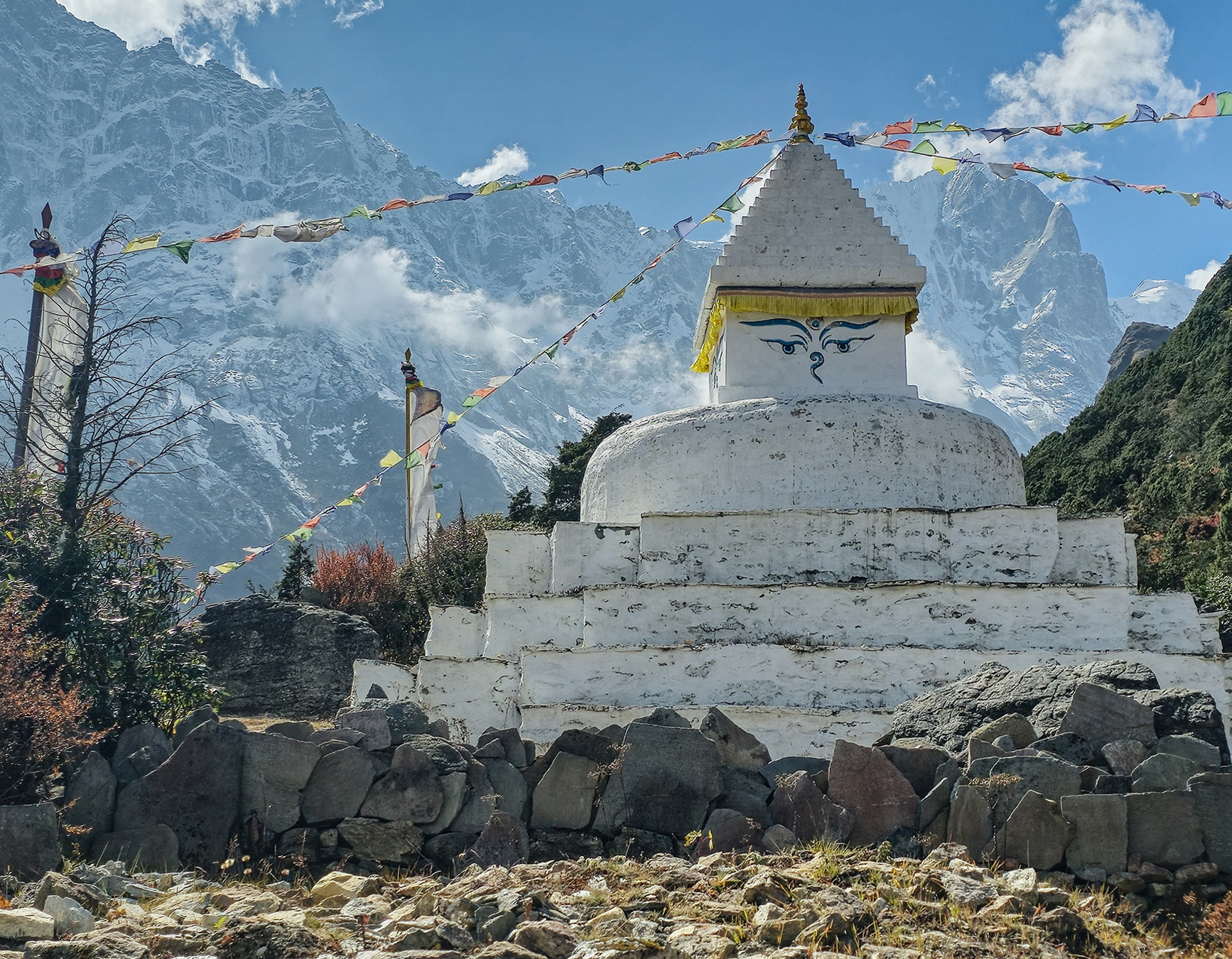
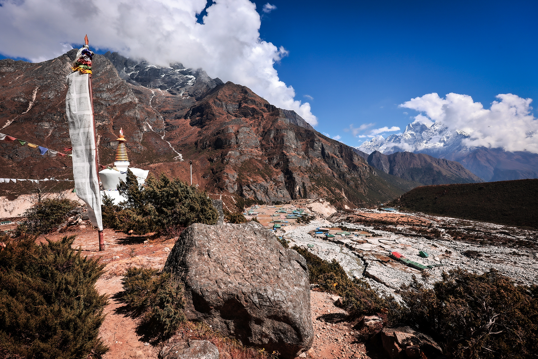
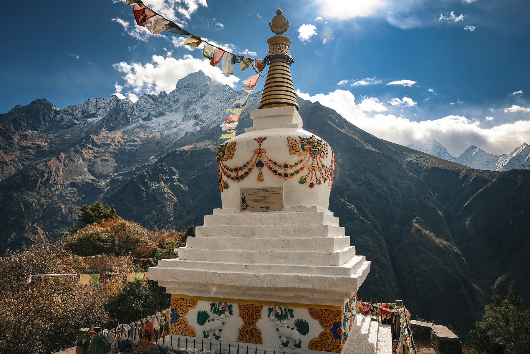
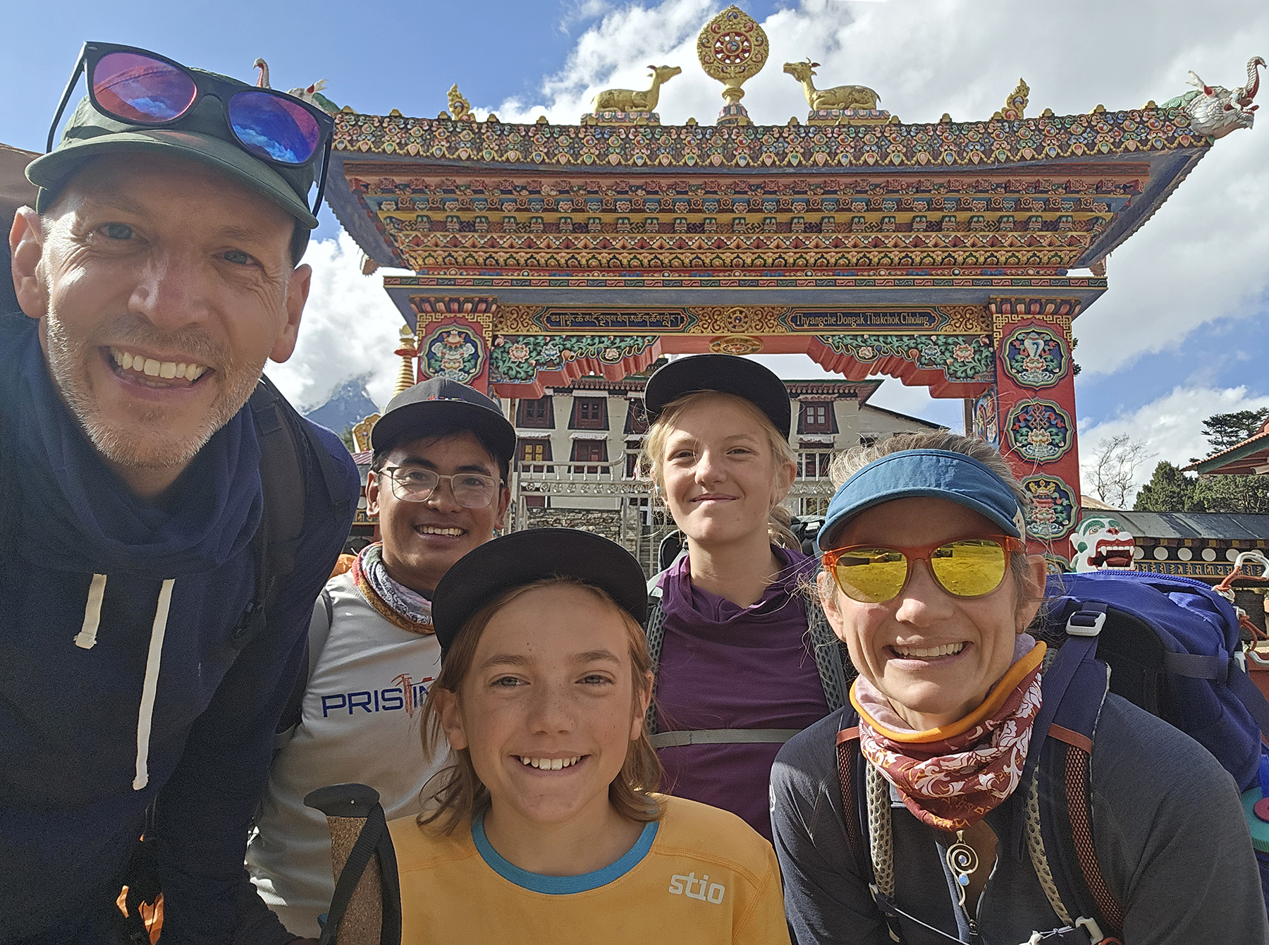
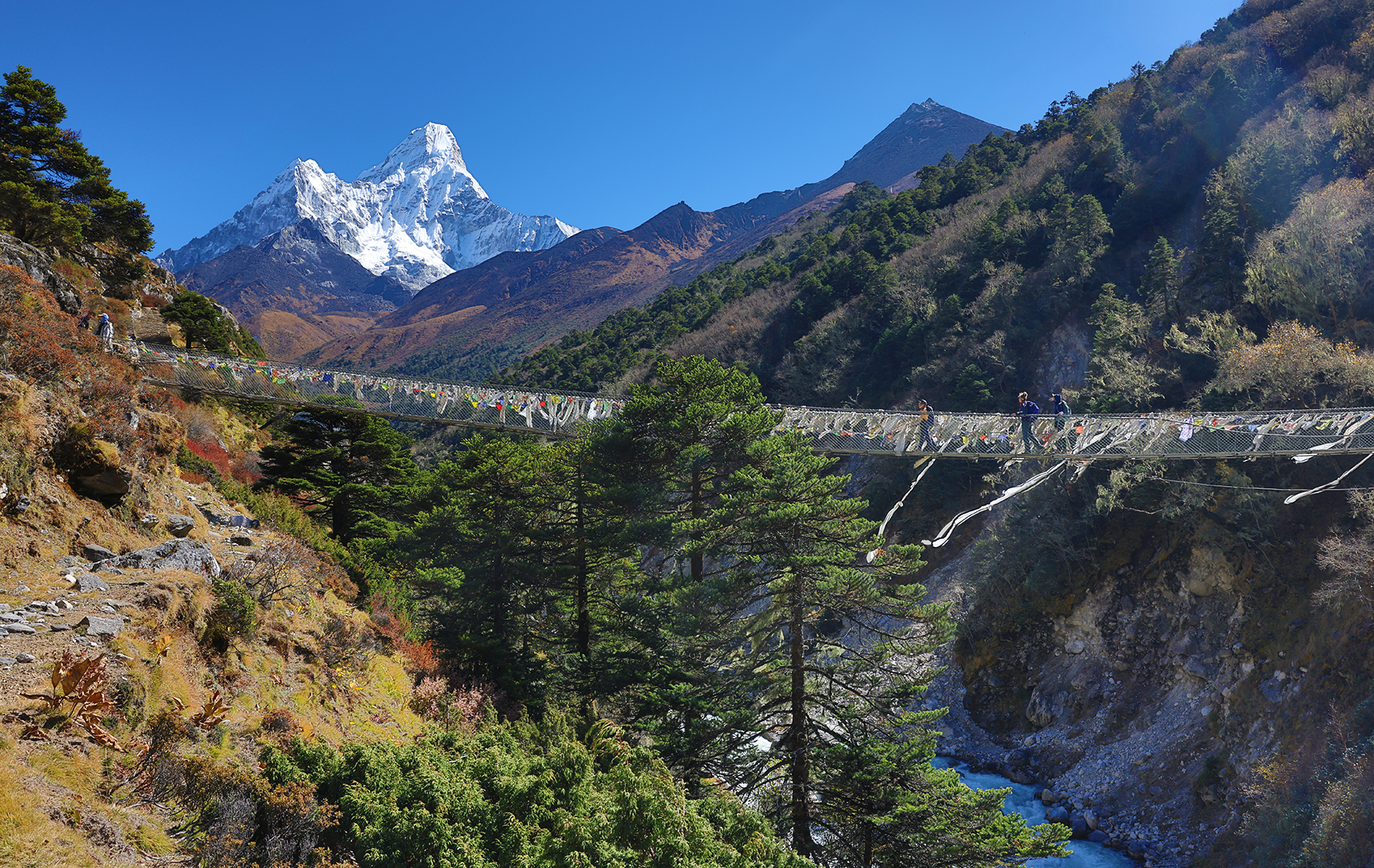
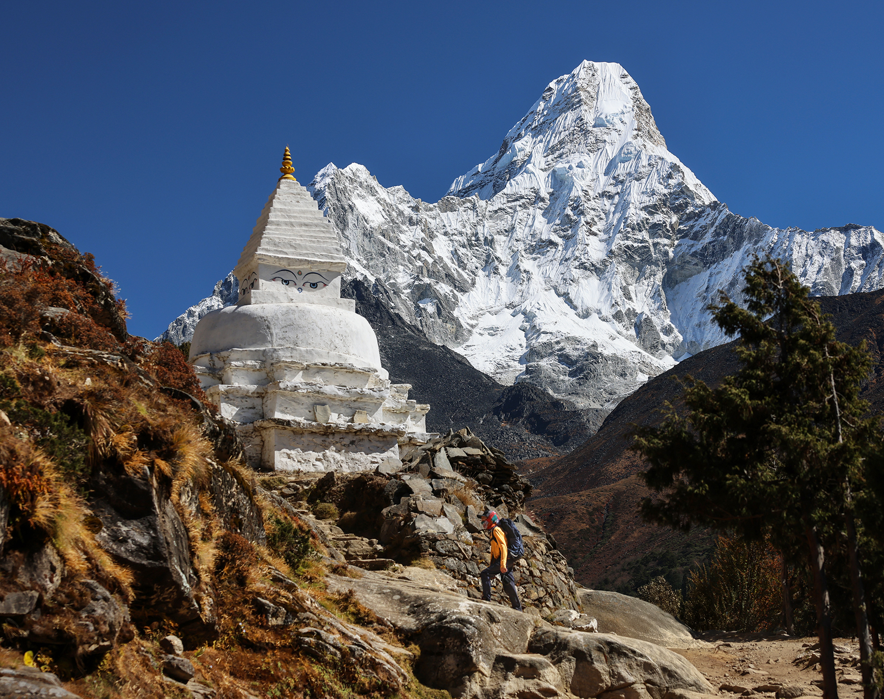
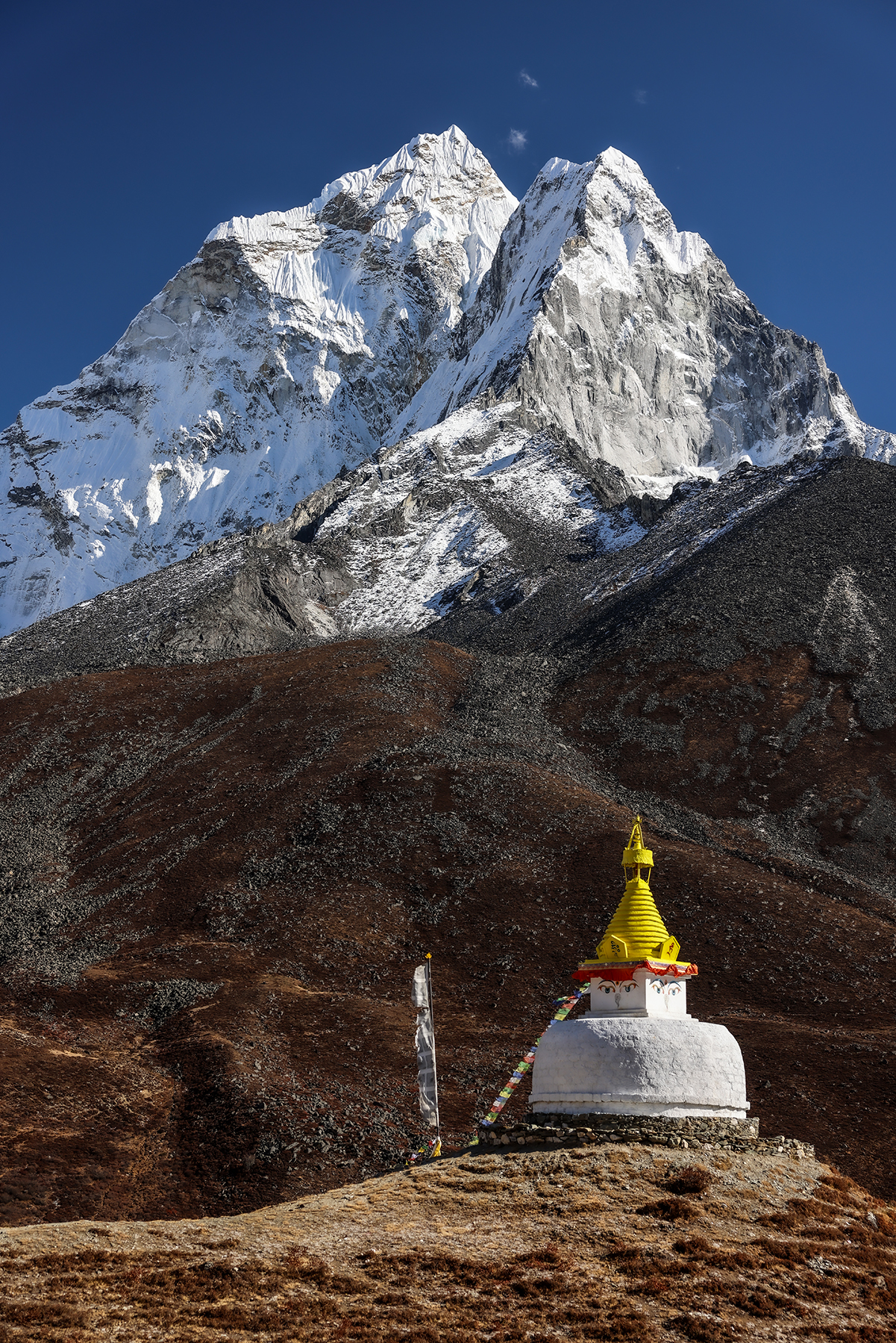
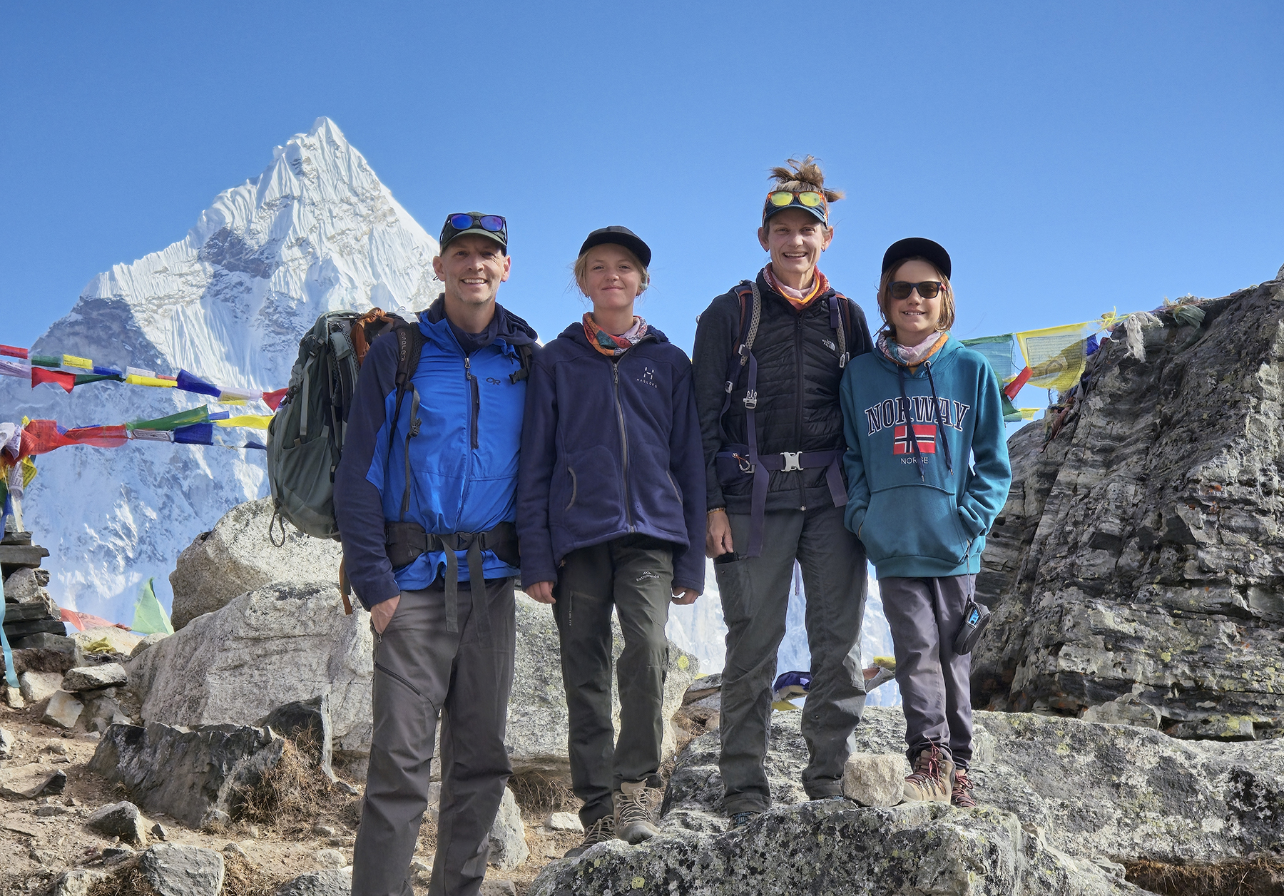
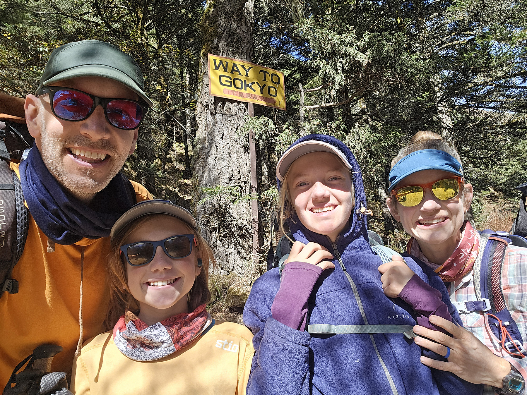
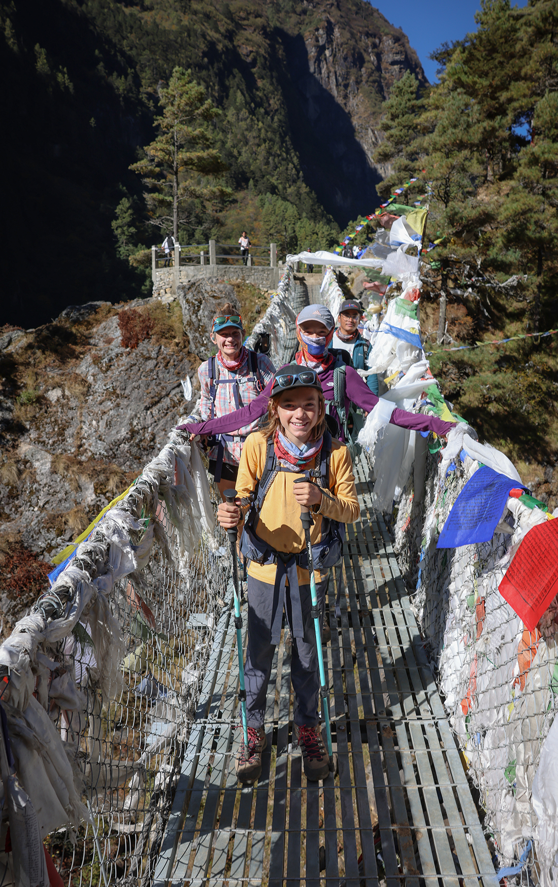
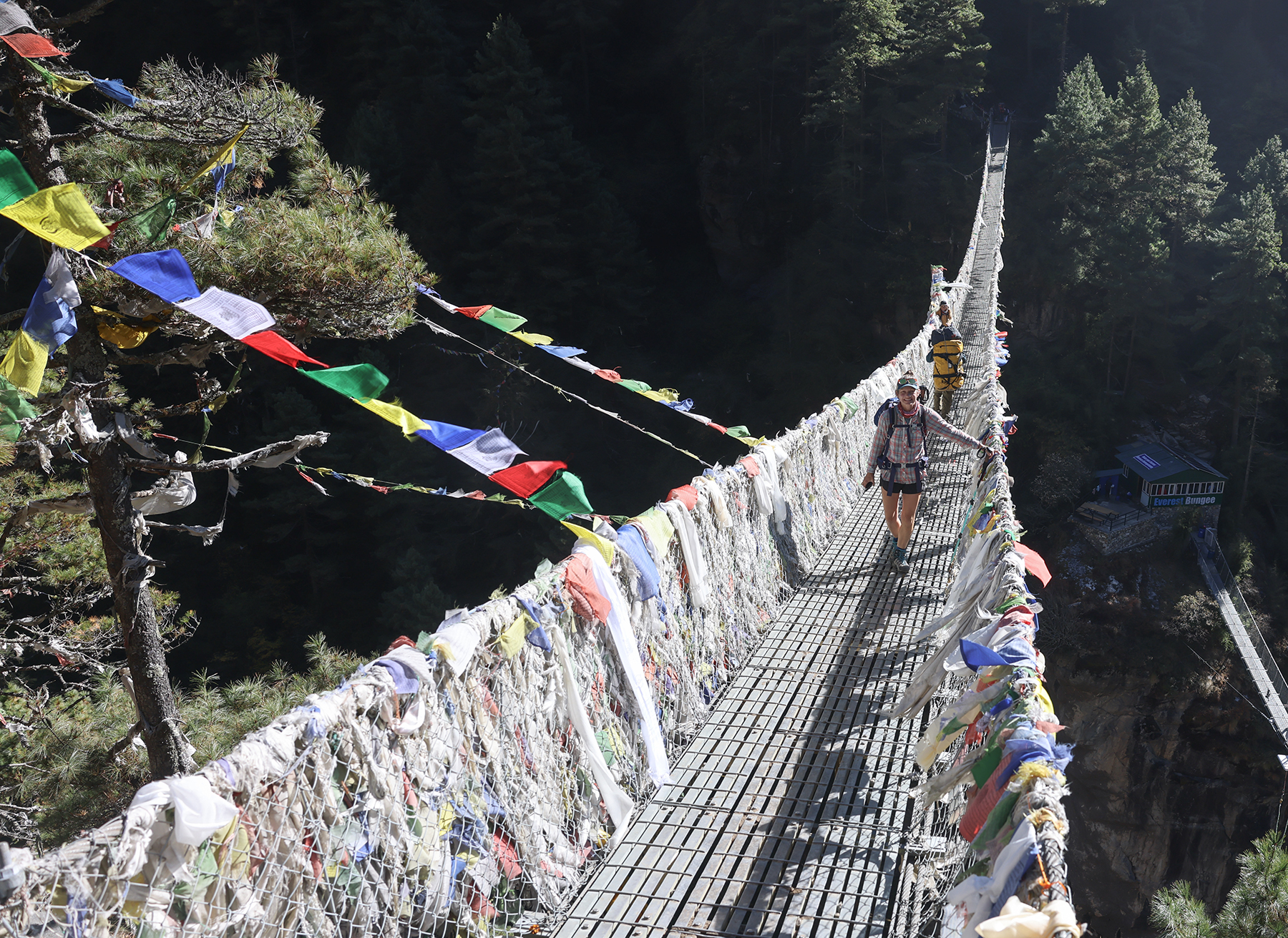
After lunch we arrived at the iconic Hillary Bridge, a spectacularly scenic footbridge that serves as a gateway to the Everest region. We crossed the span and began the long series of switchbacks through the forest. MB was clearly enjoying her acclimatization from our previous trek in Mardi Himal, and cruised past a number of trekking groups on the ascent. After a couple of hours heading uphill we arrived in Namche Bazaar, the central gateway village to the Everest region, in the late afternoon sunshine. At the entrance to the town we passed by a bright white stupa and a series of large prayer wheels turned by a rushing stream, at which point H declared Namche to be the most beautiful town we had ever visited.


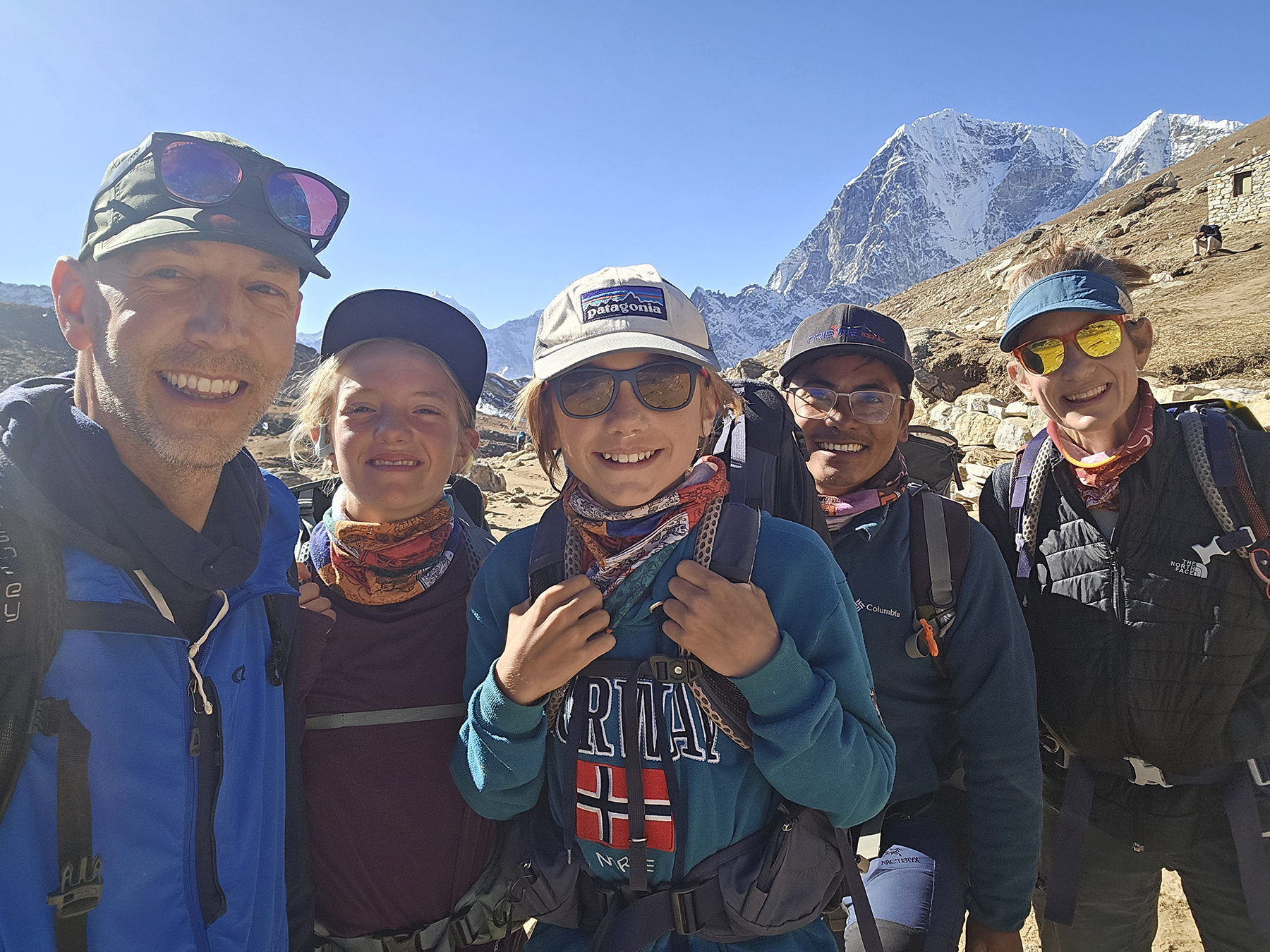
Days 3 and 4! Acclimitization hikes around Namche: to Everest View Hotel (13,000 ft), Khumjung, and Thame Village (12,467 ft)
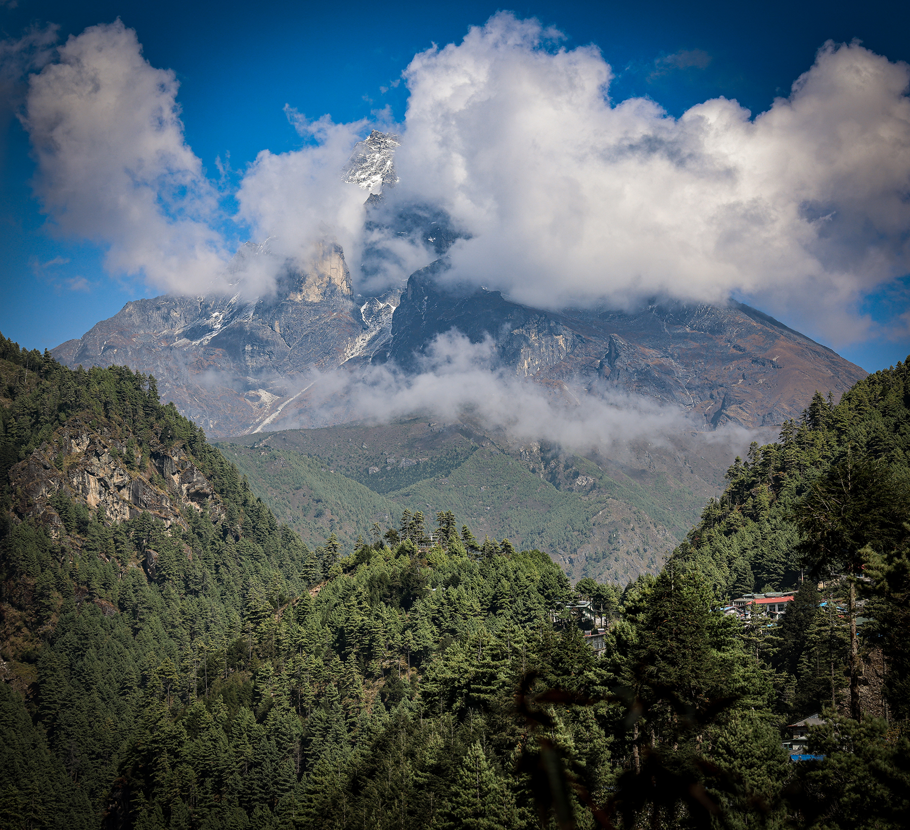
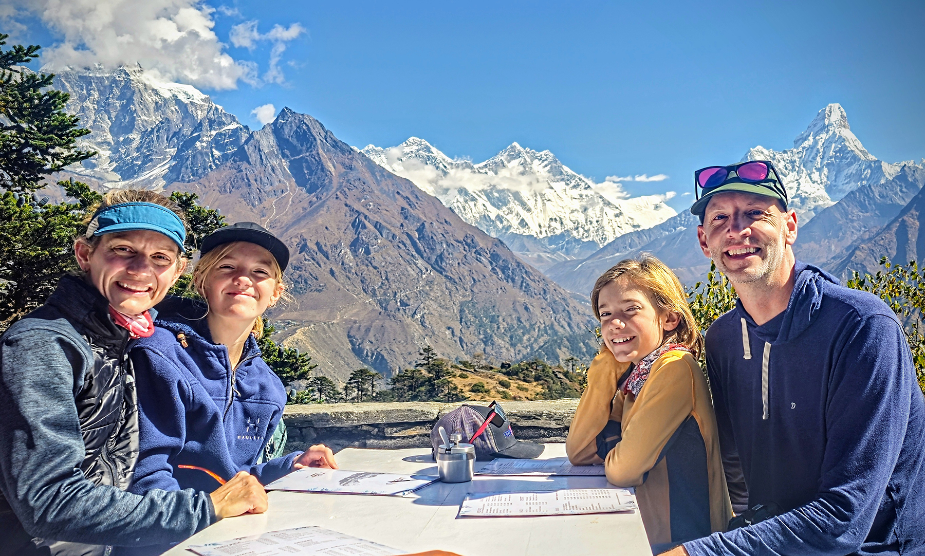
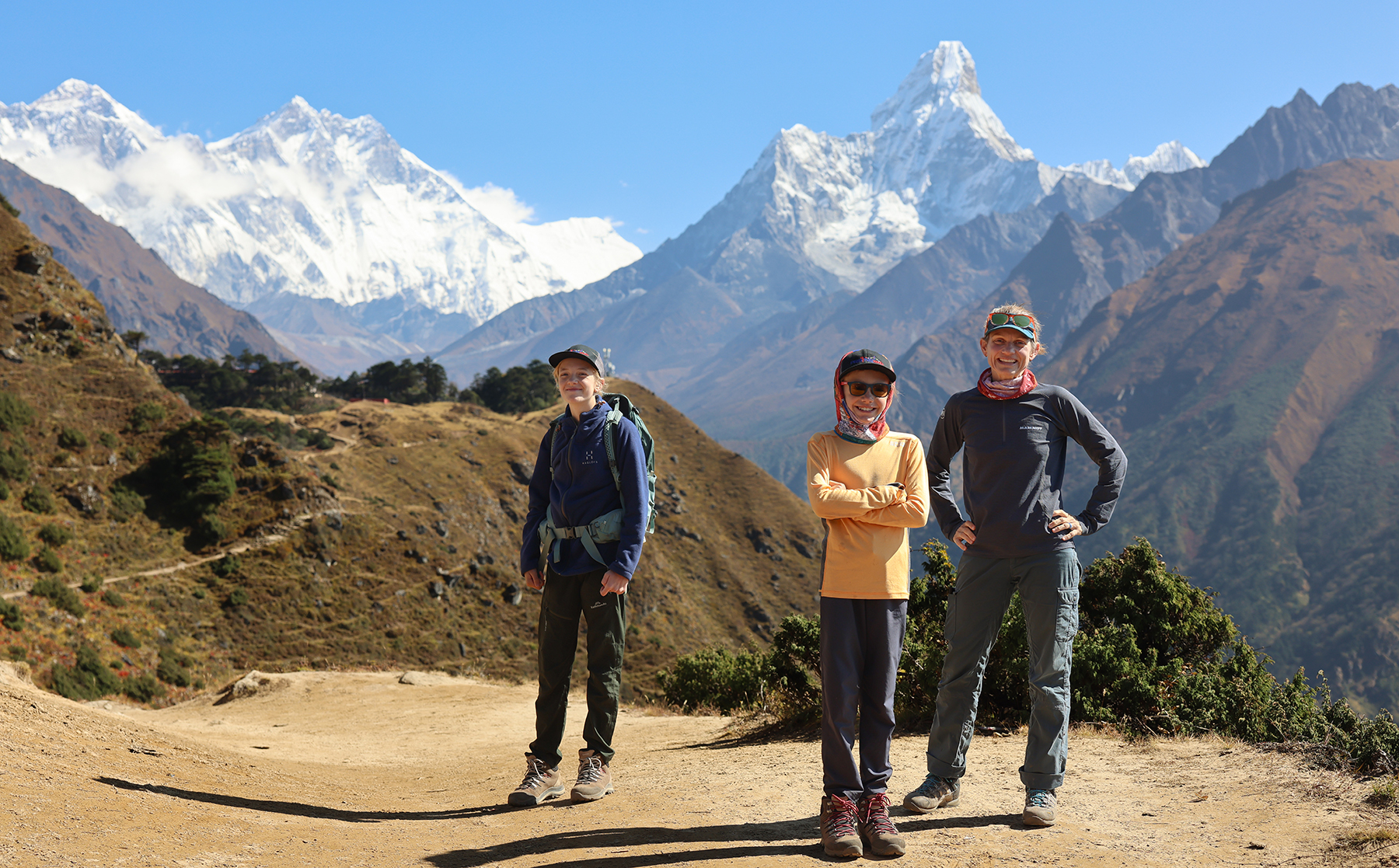
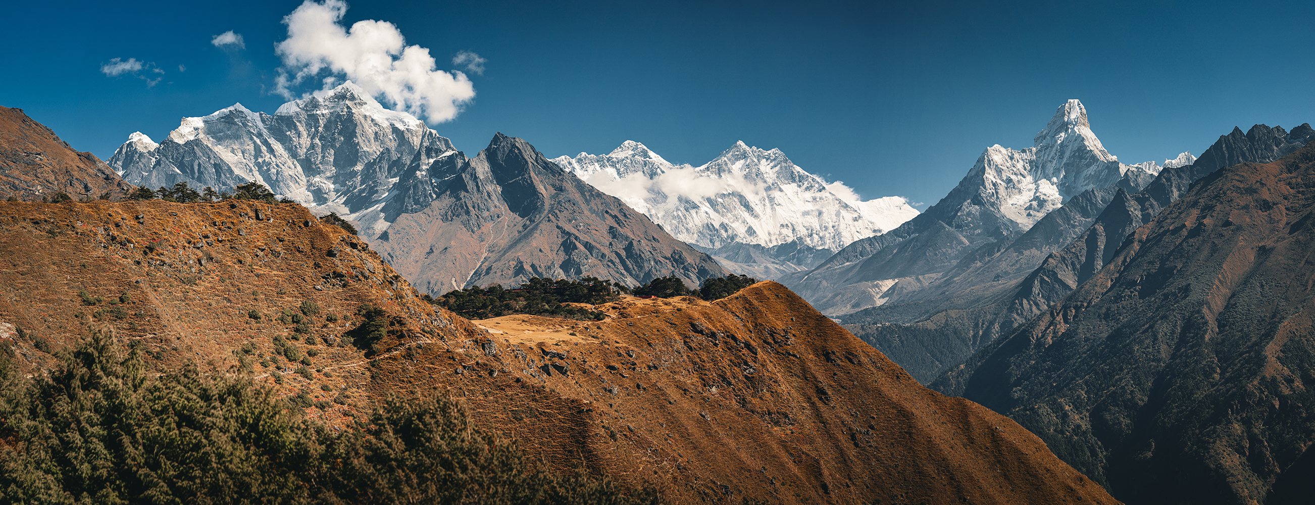
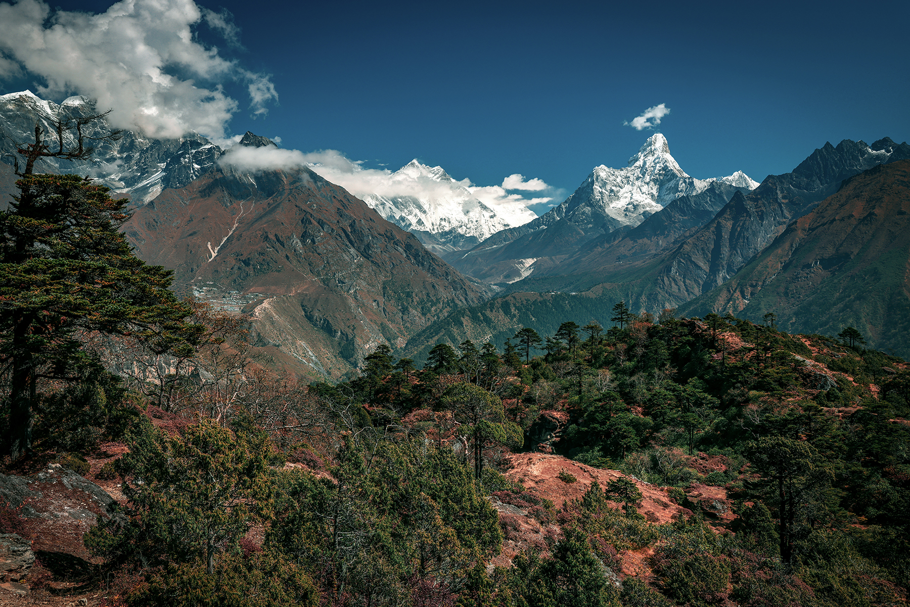
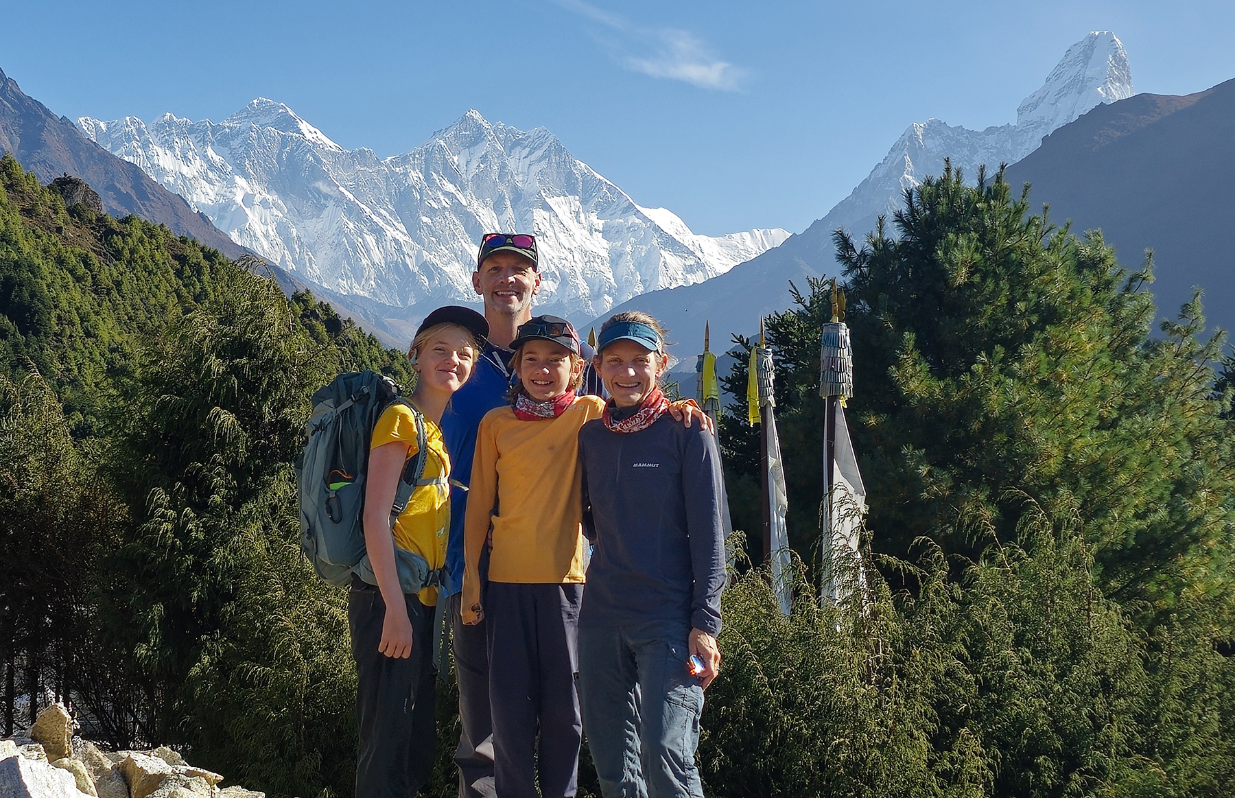
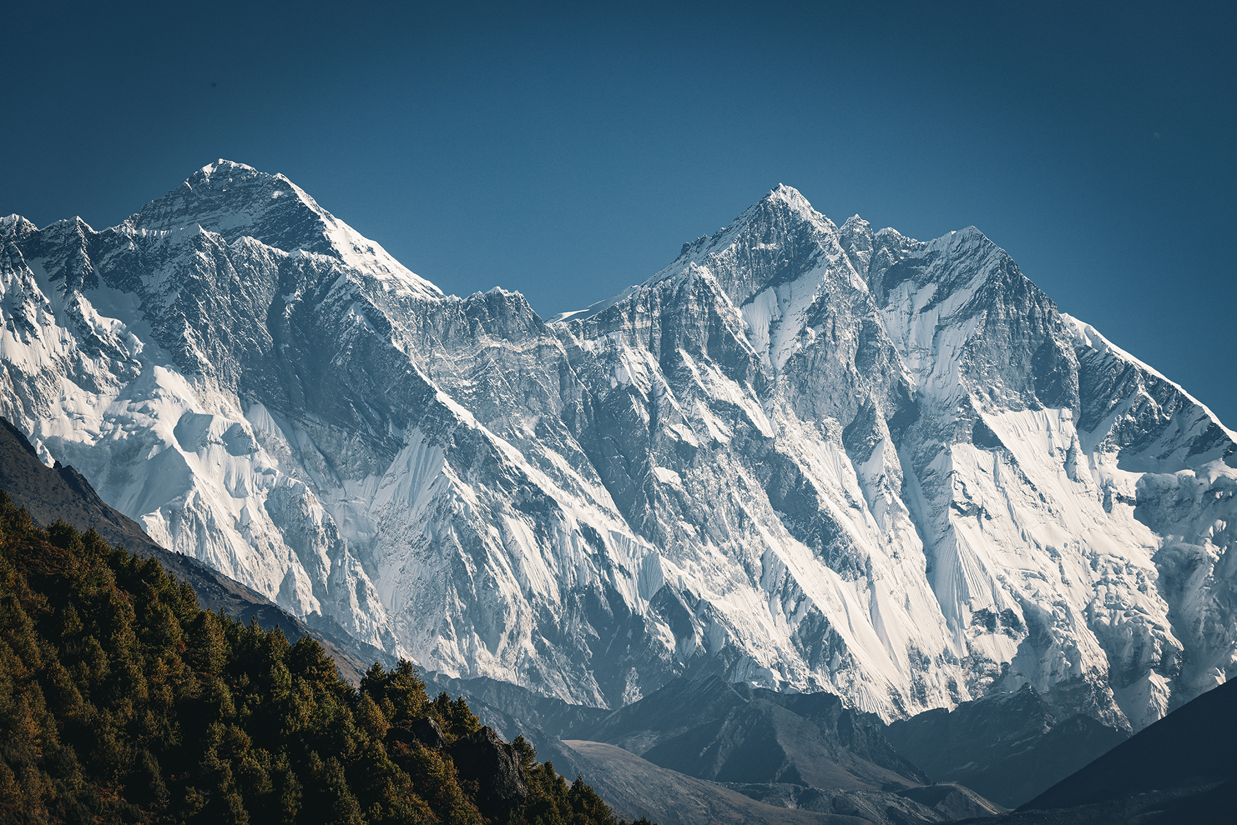
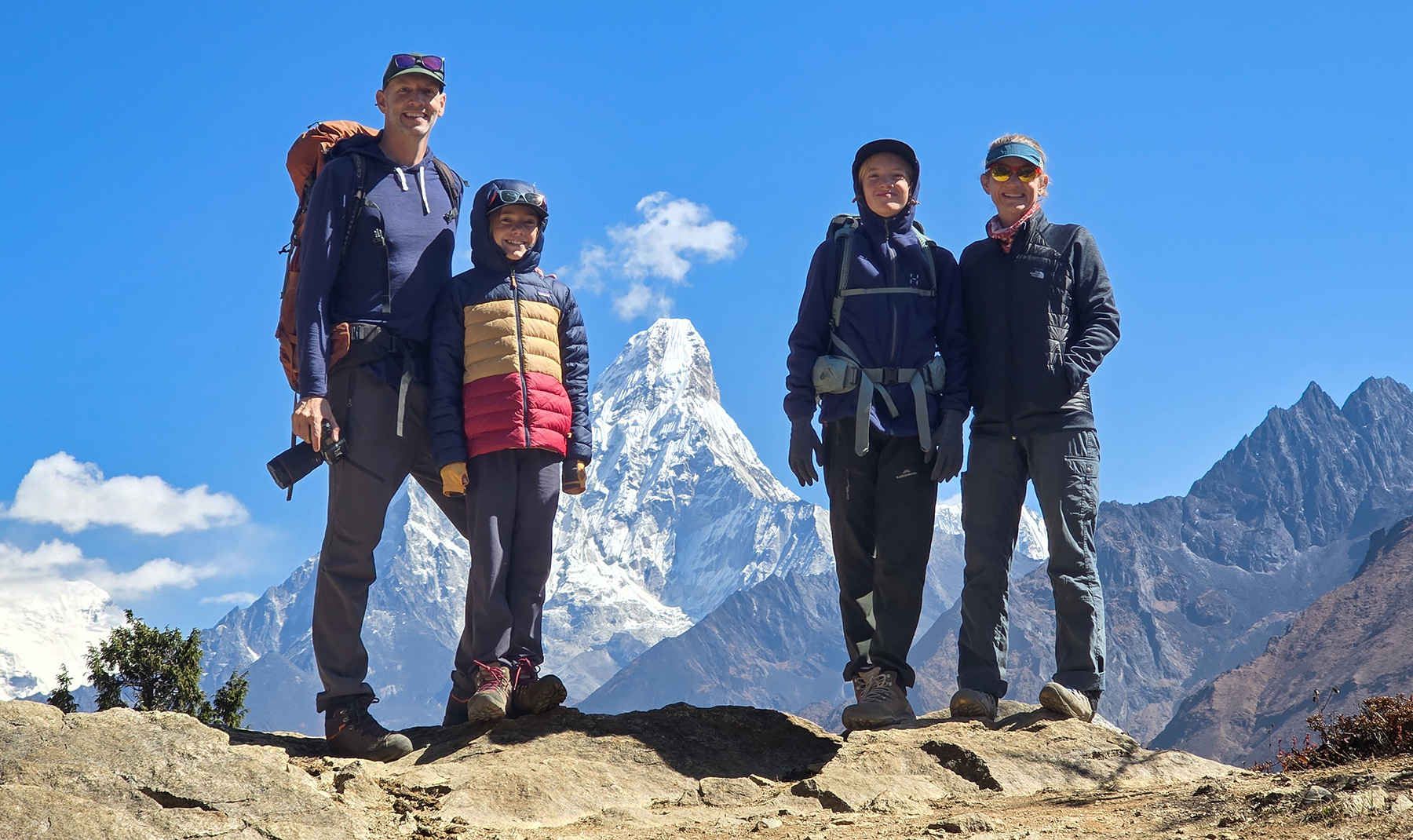
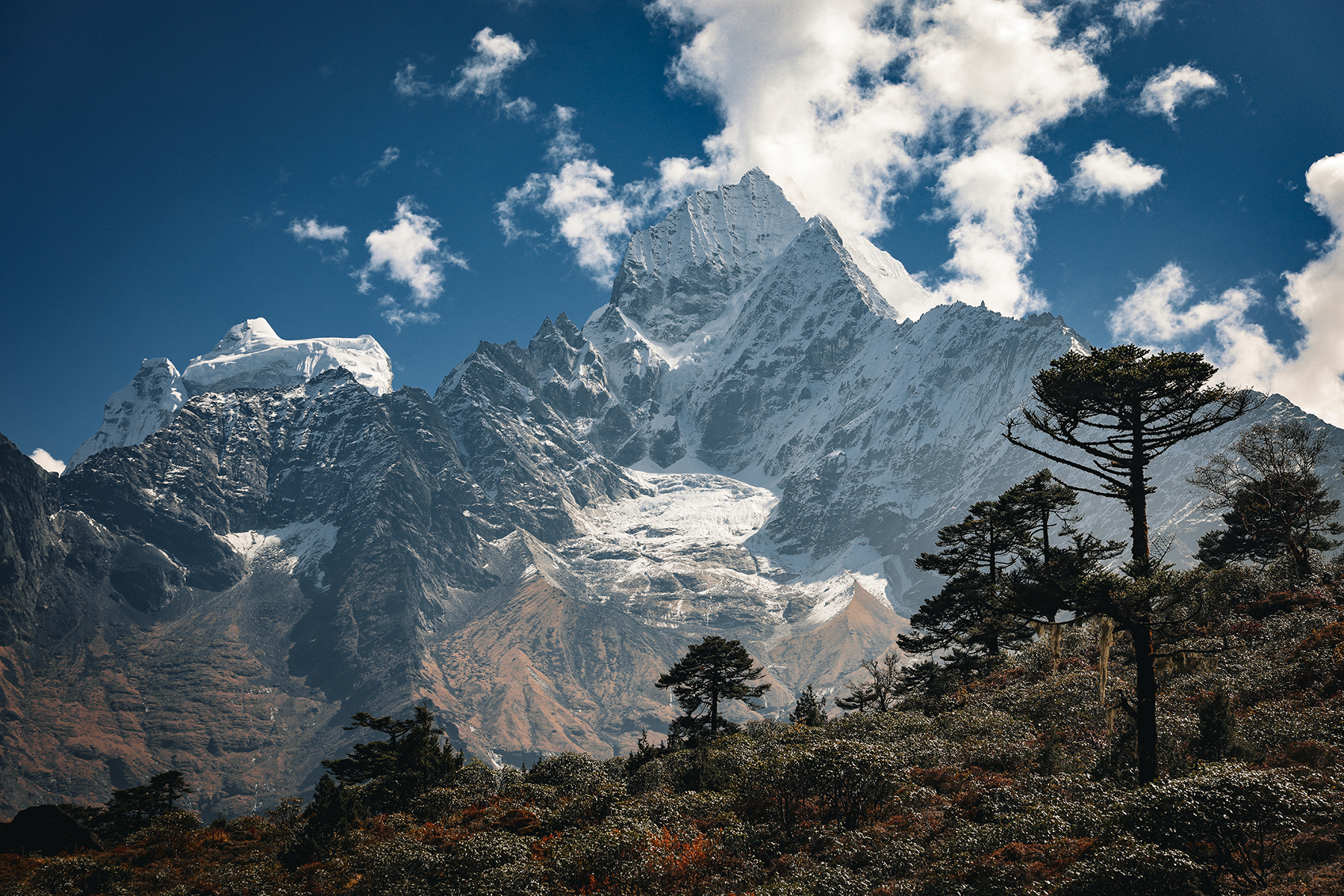
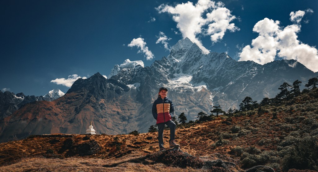
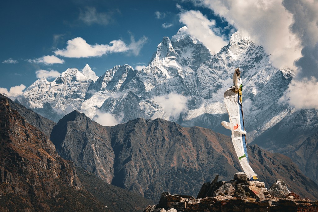
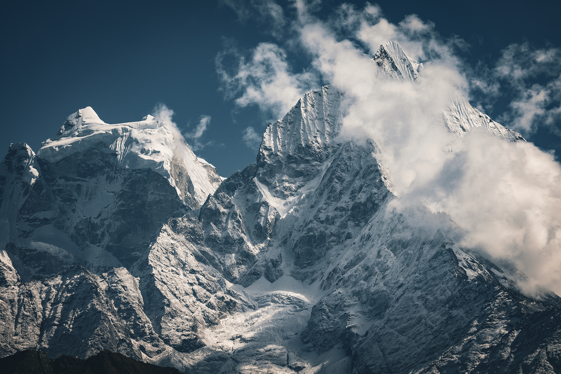
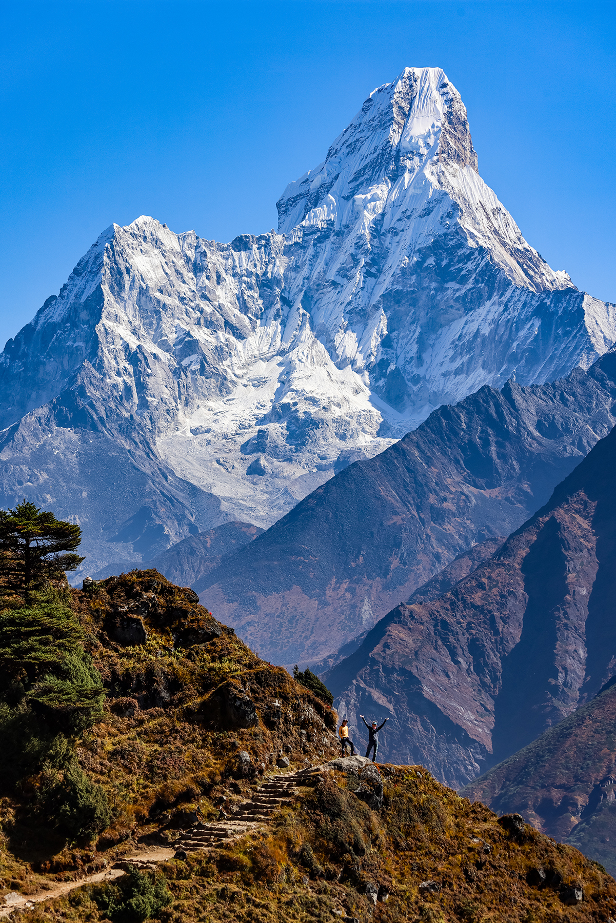
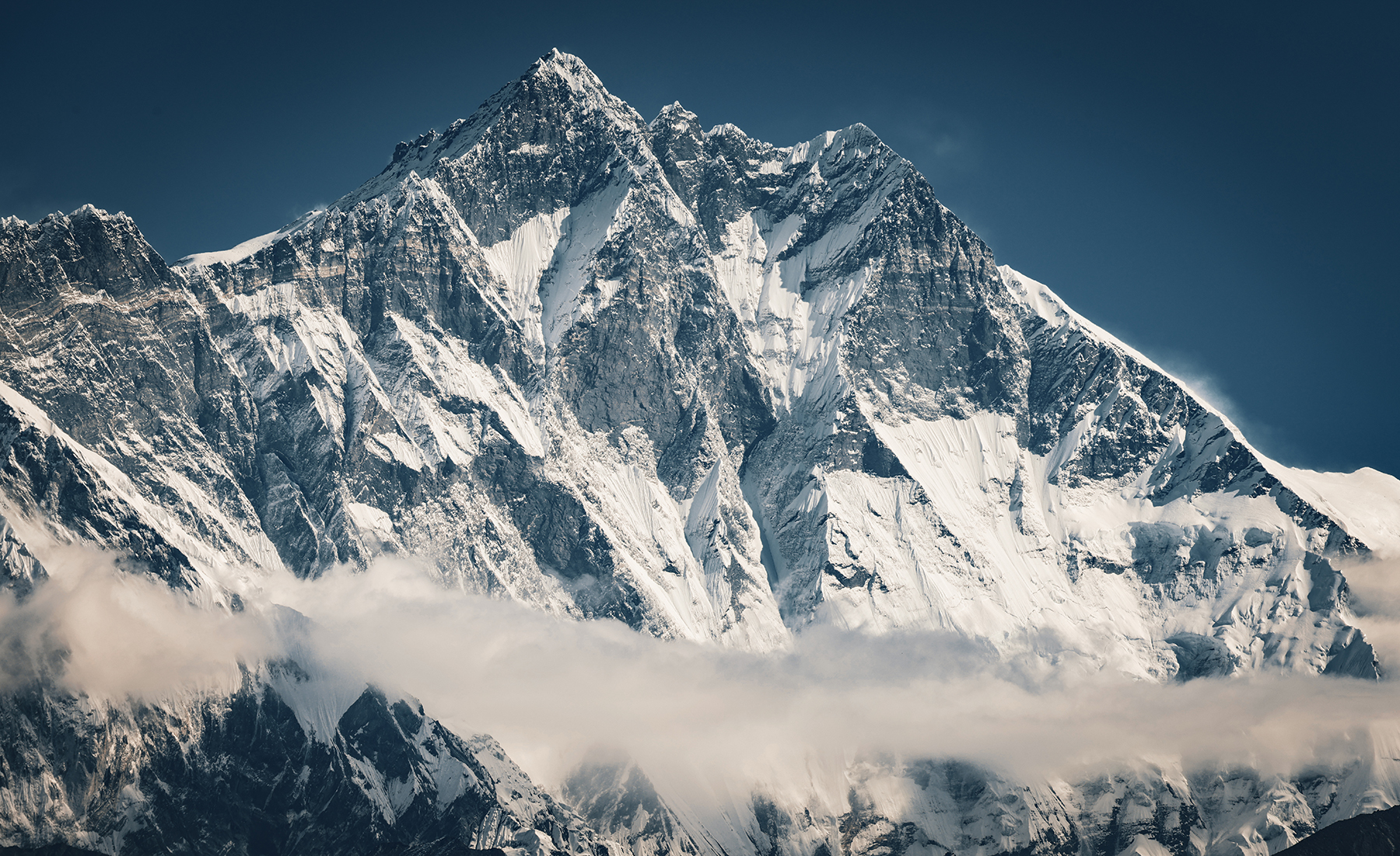
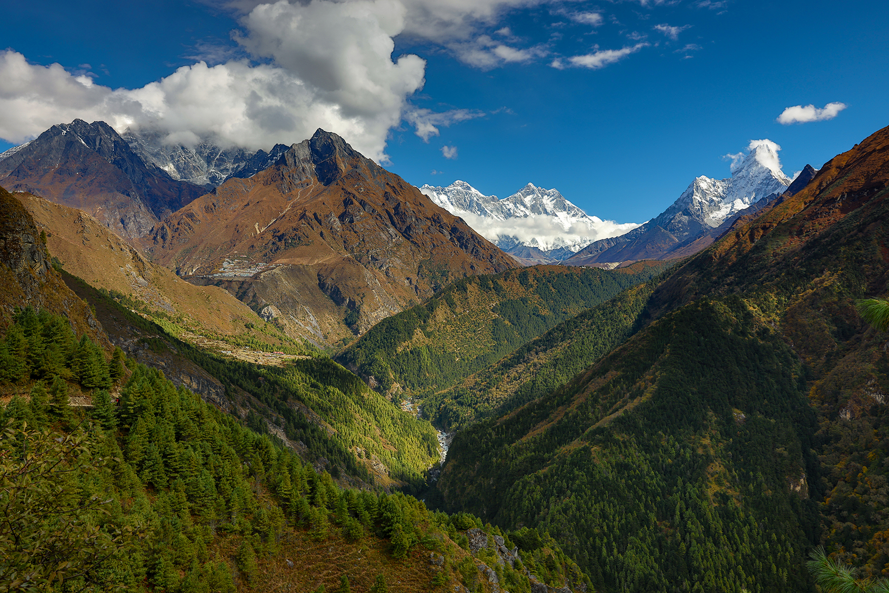
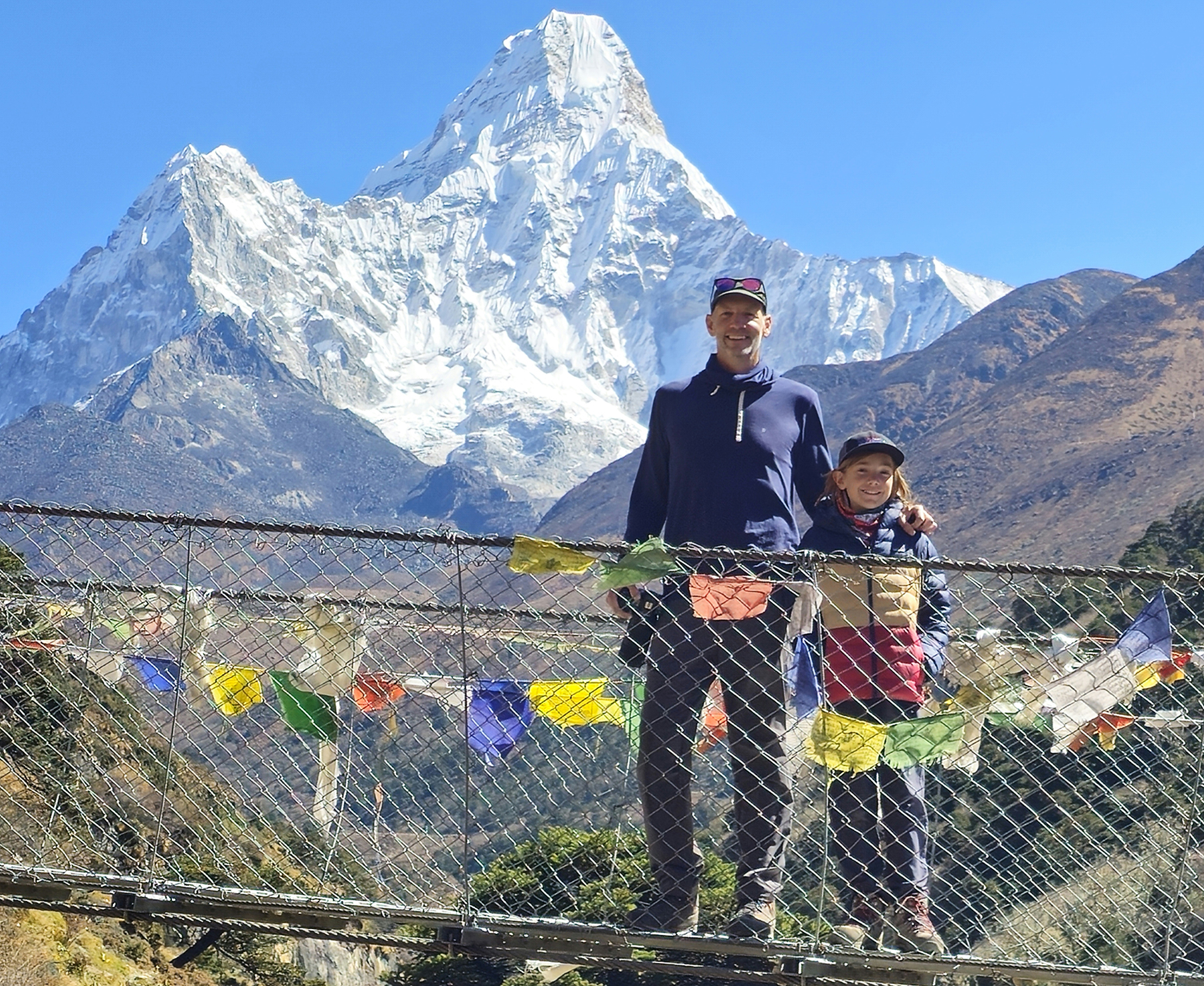
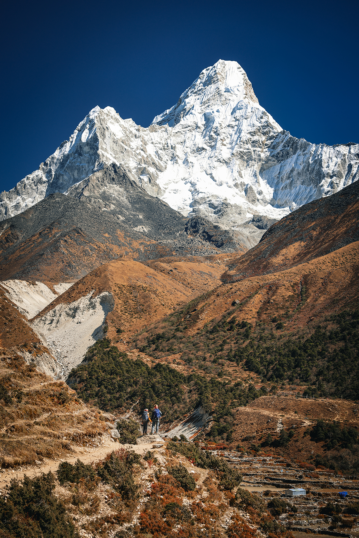
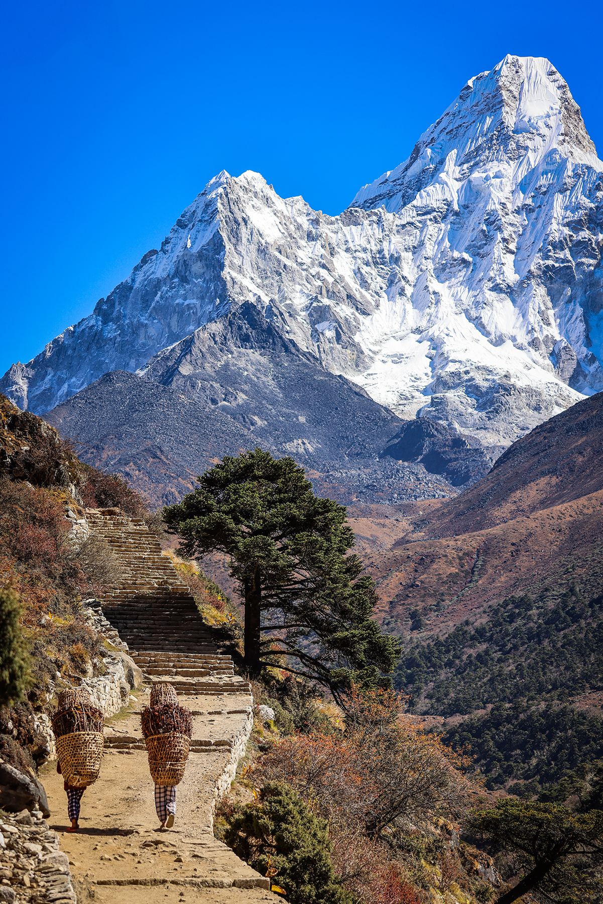
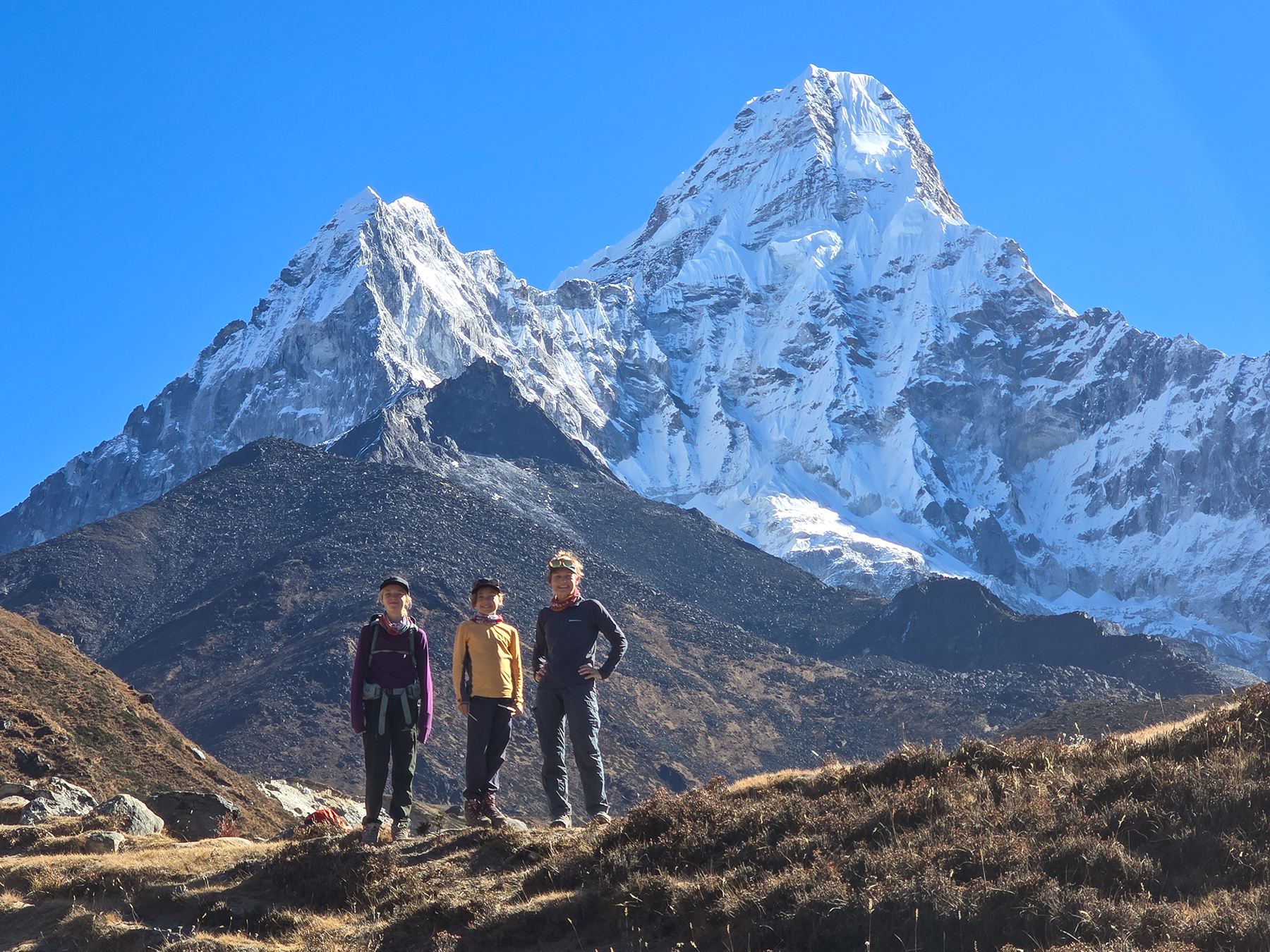
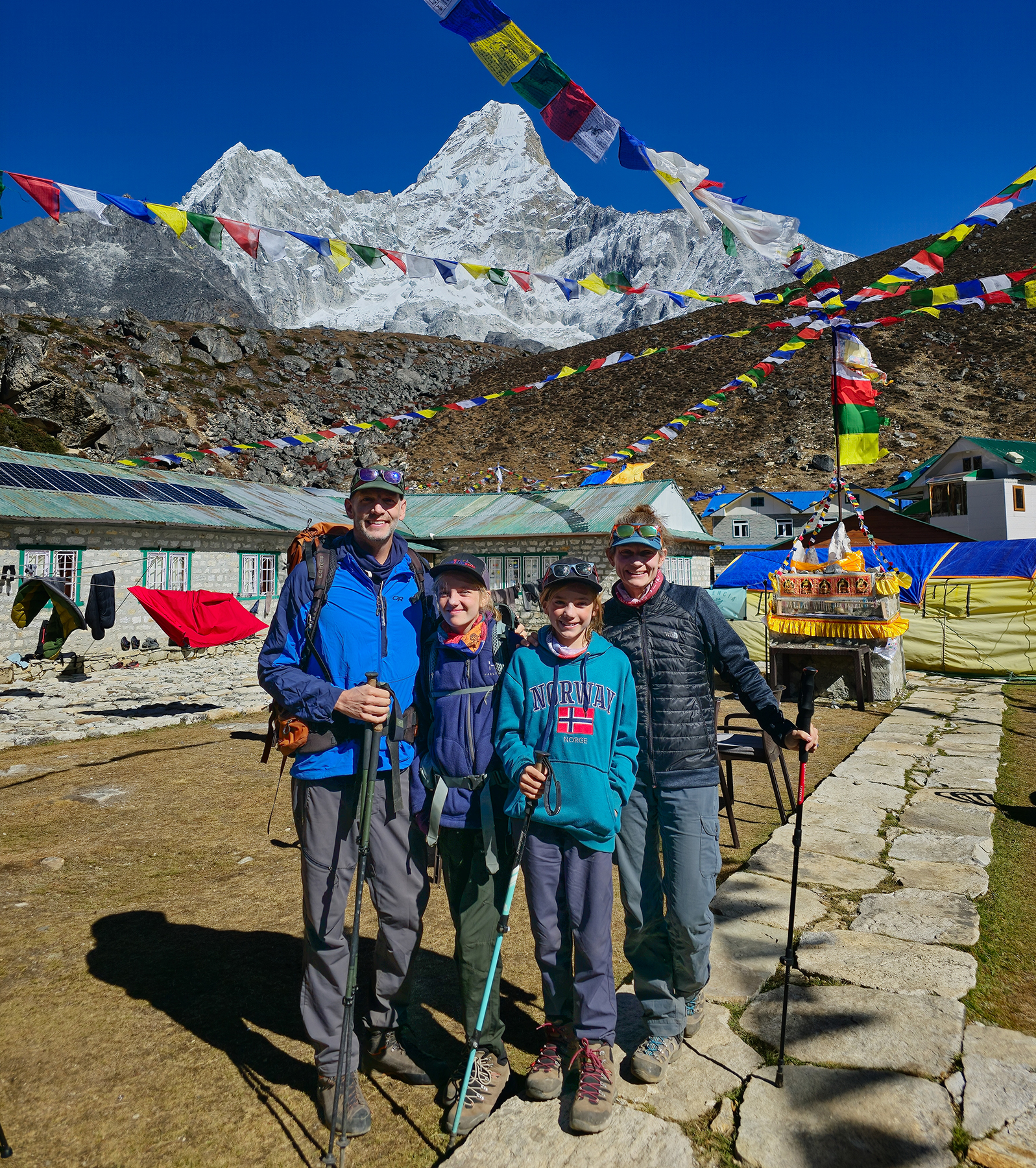
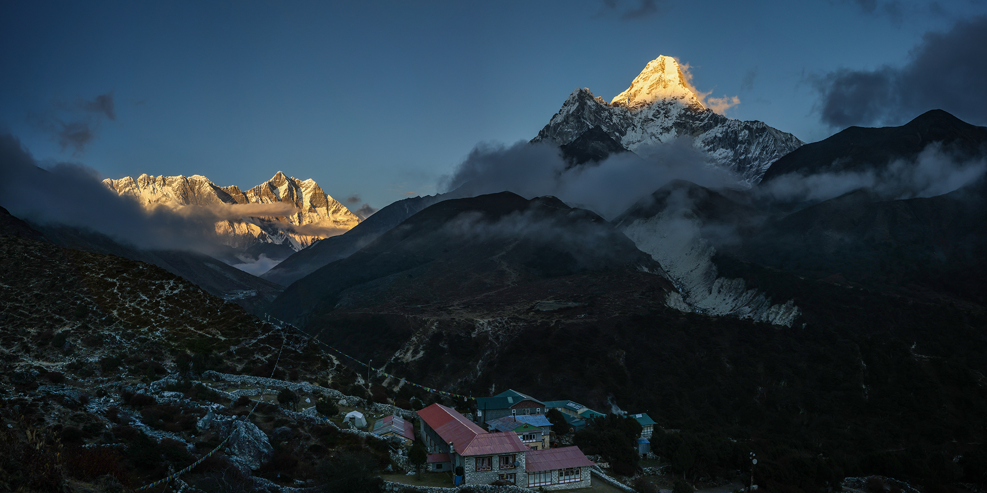
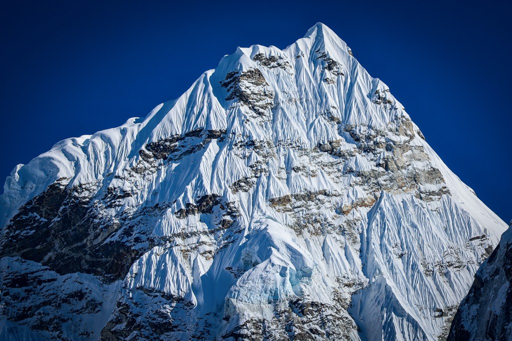
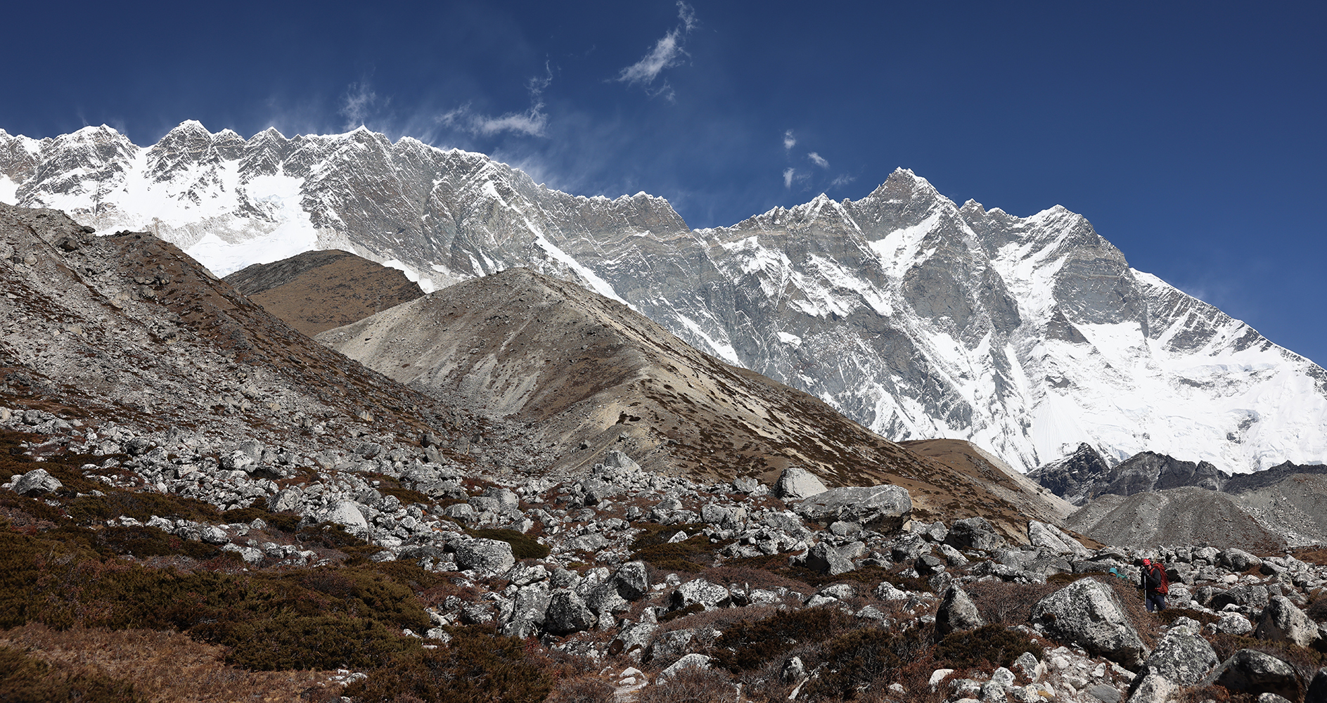
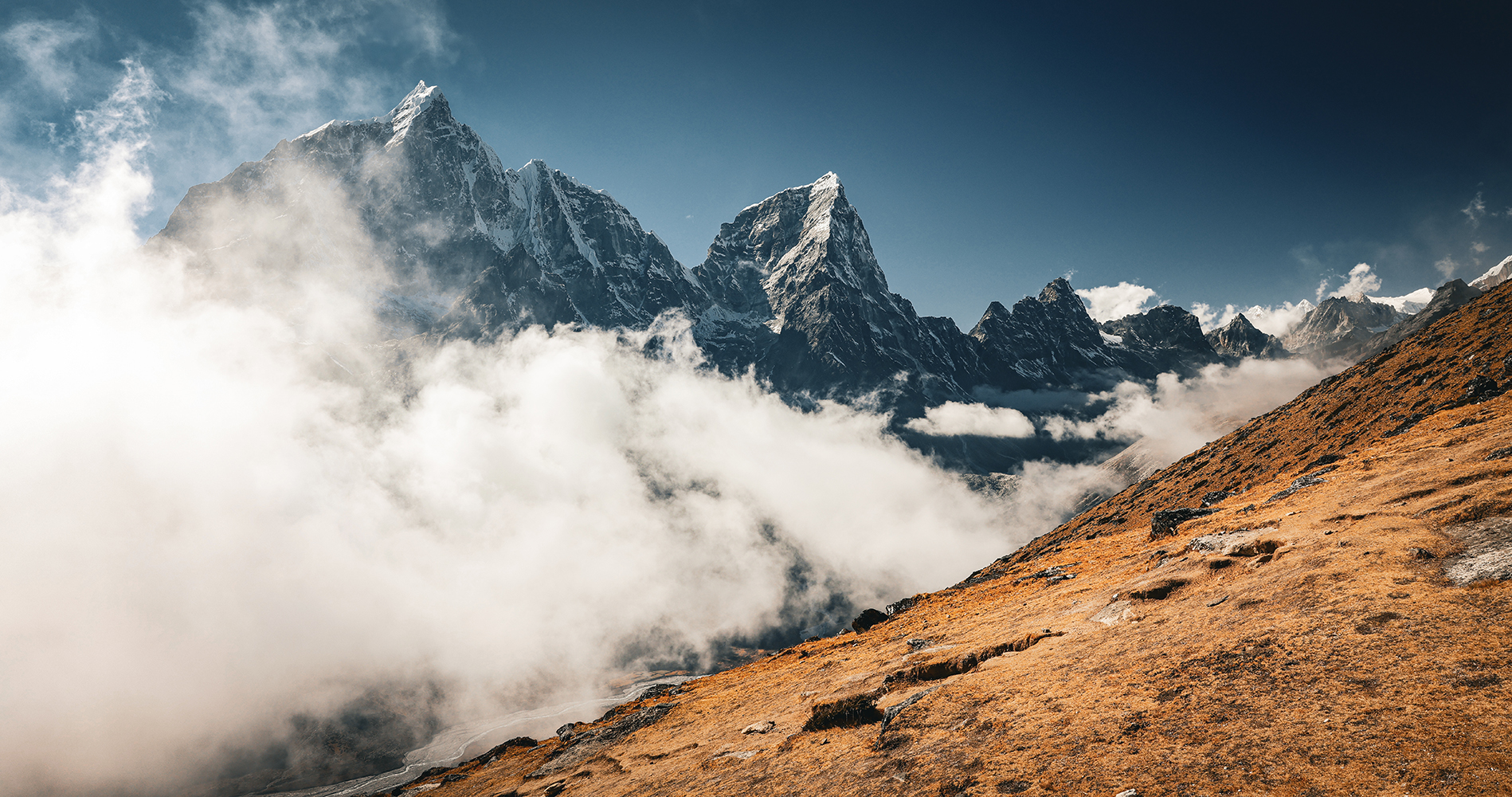
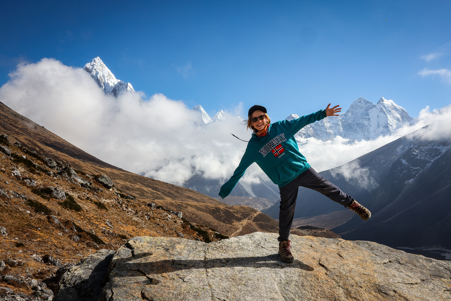
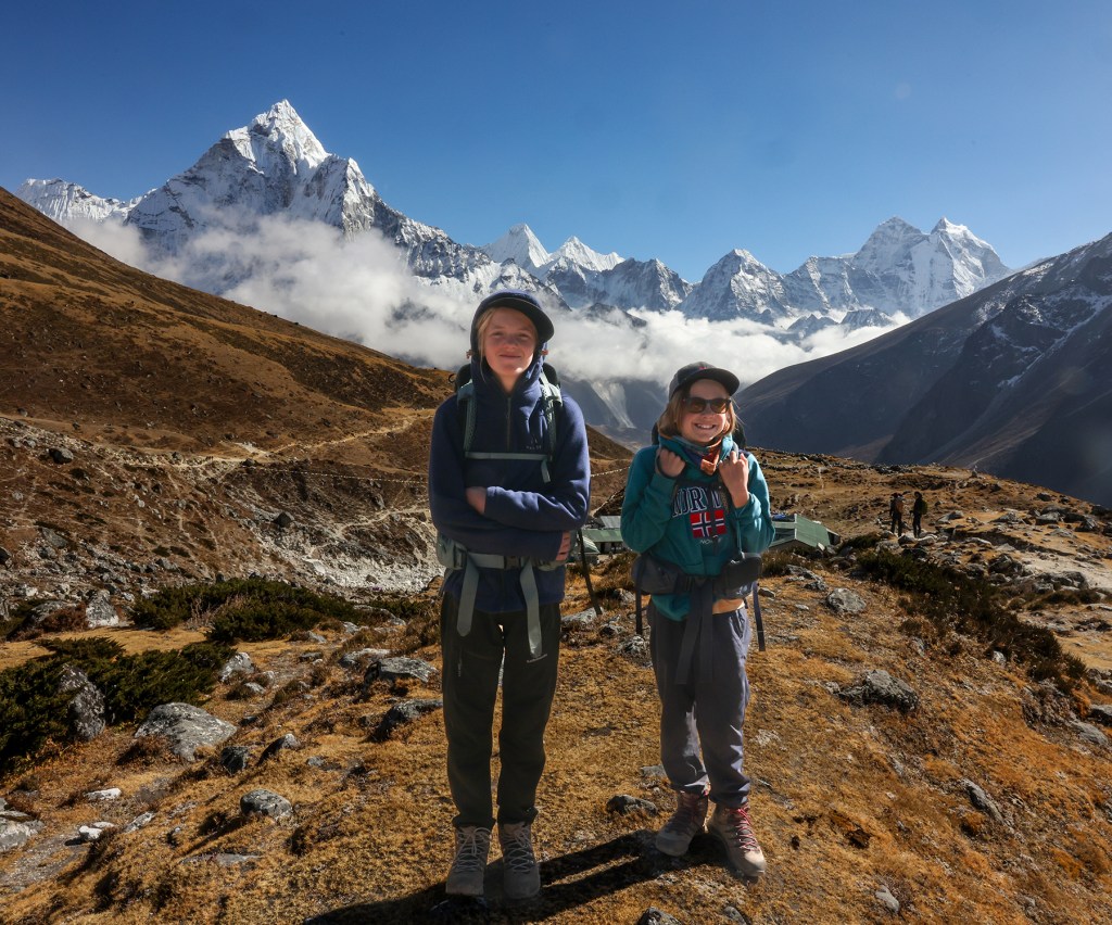
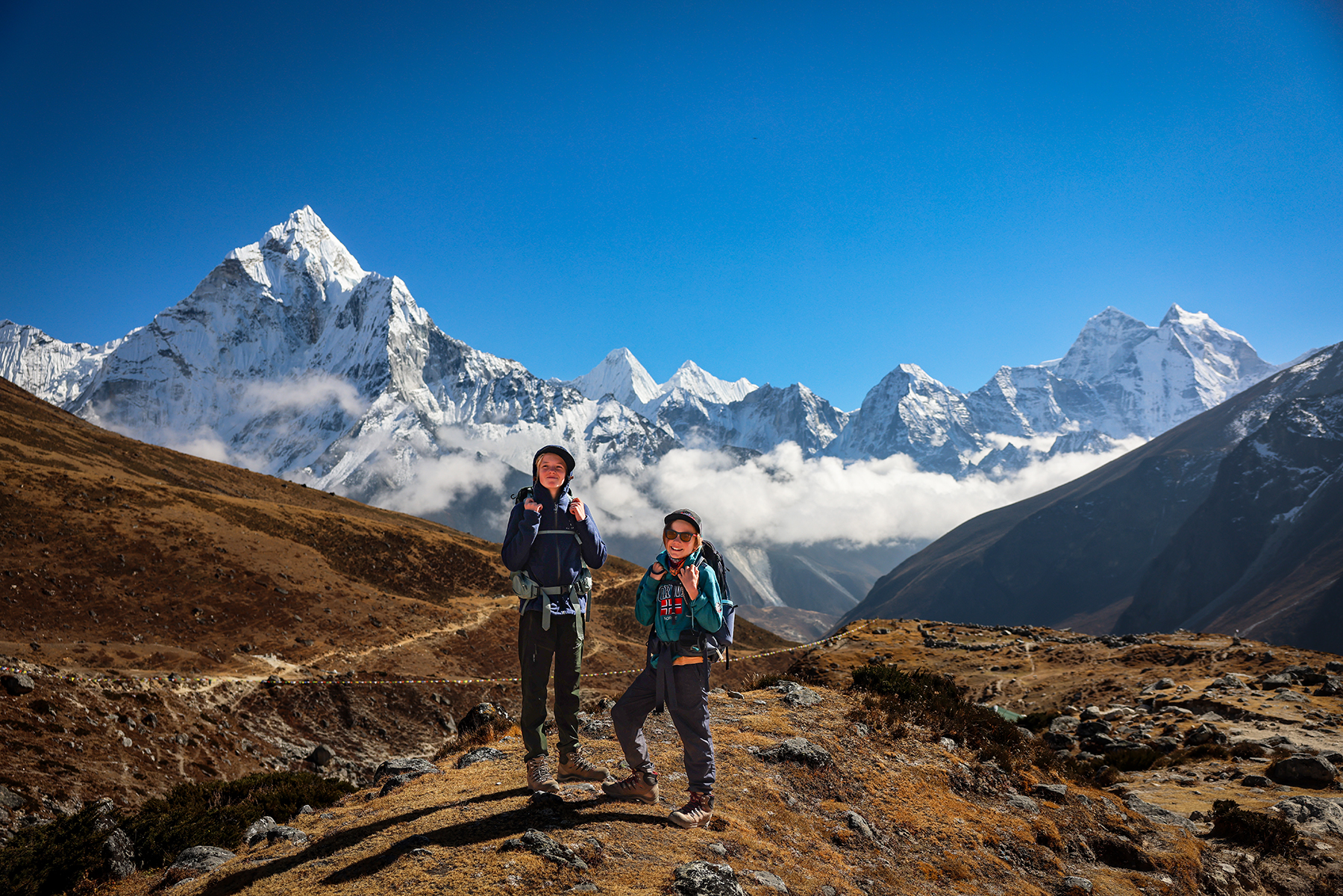
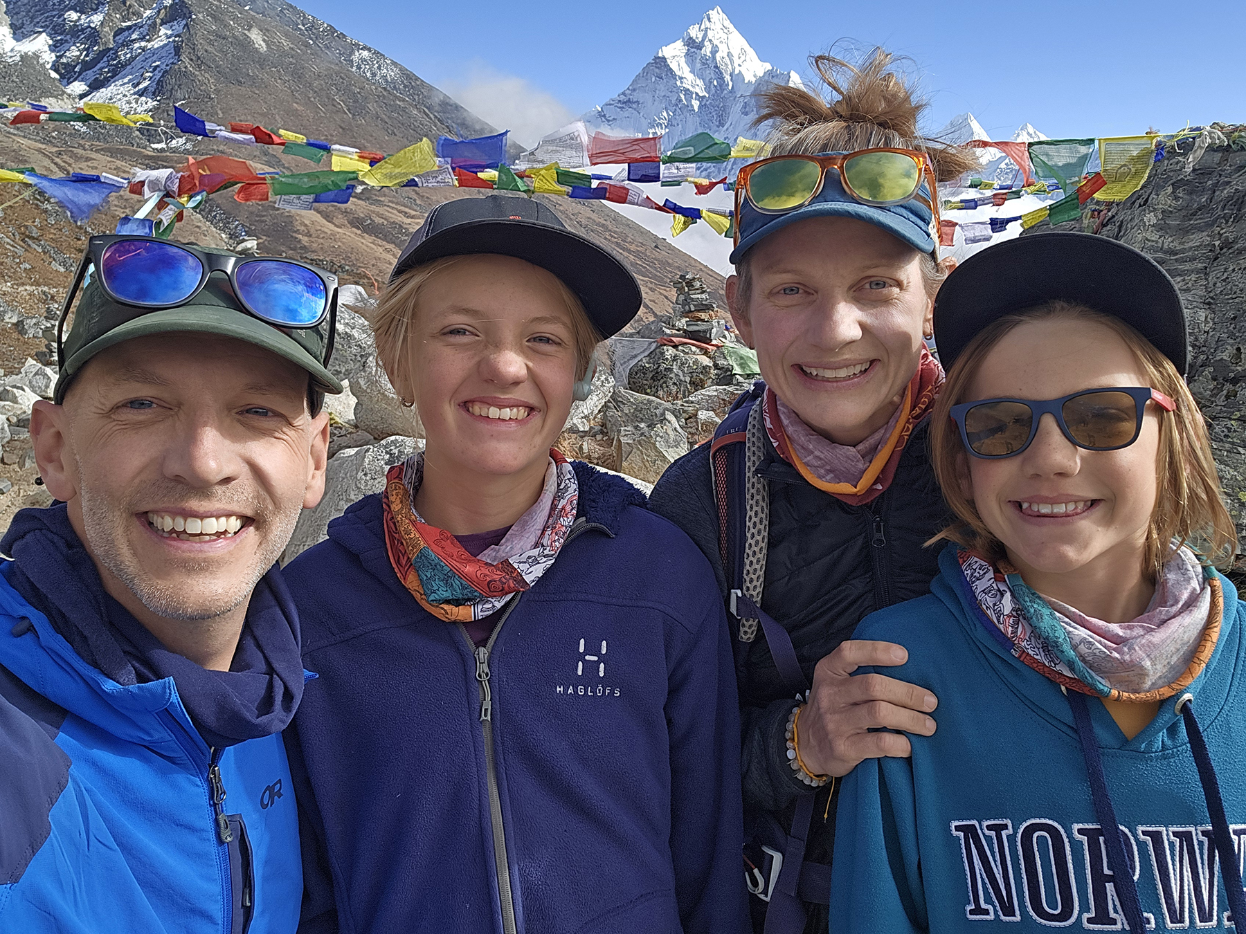
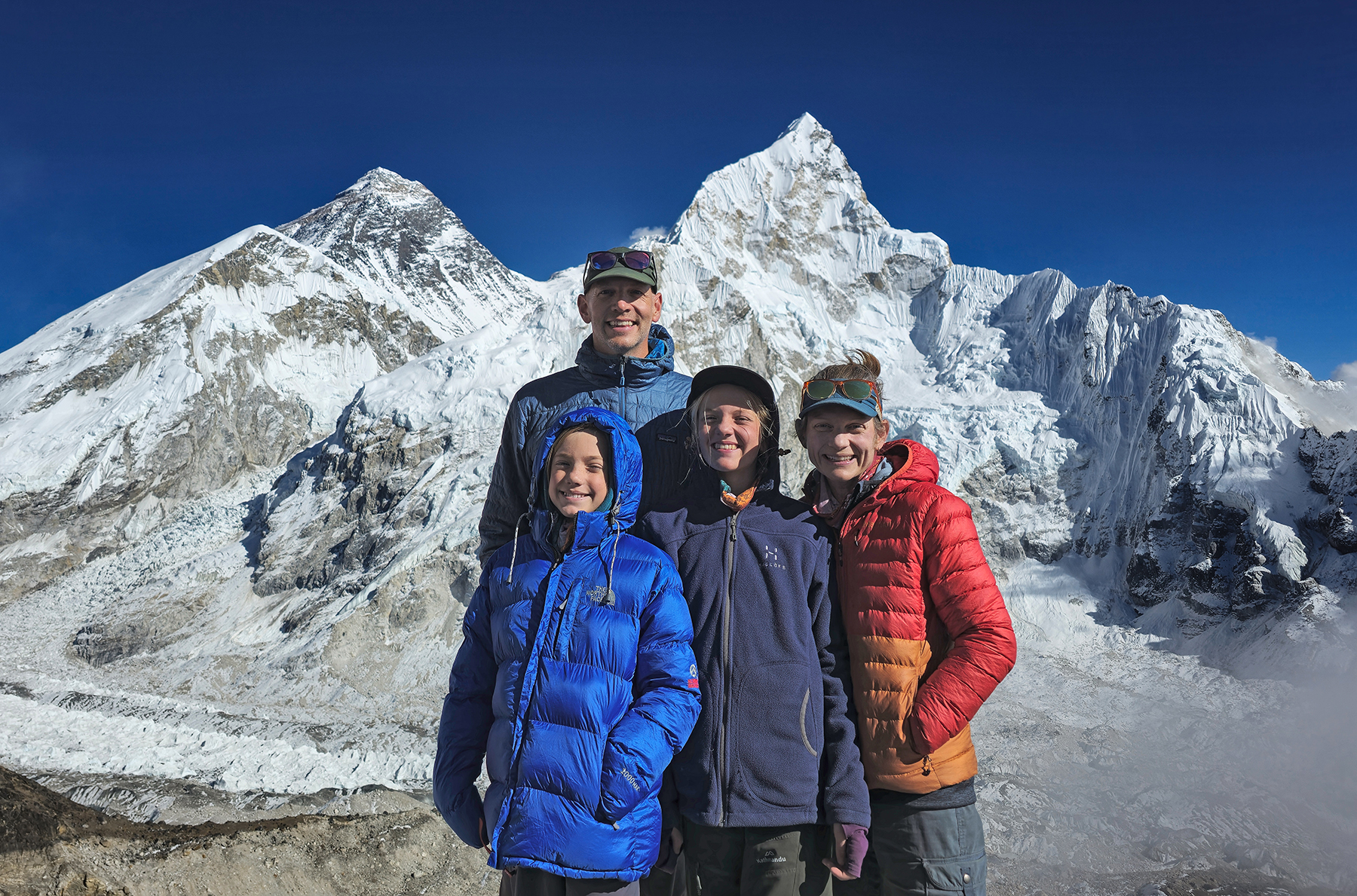
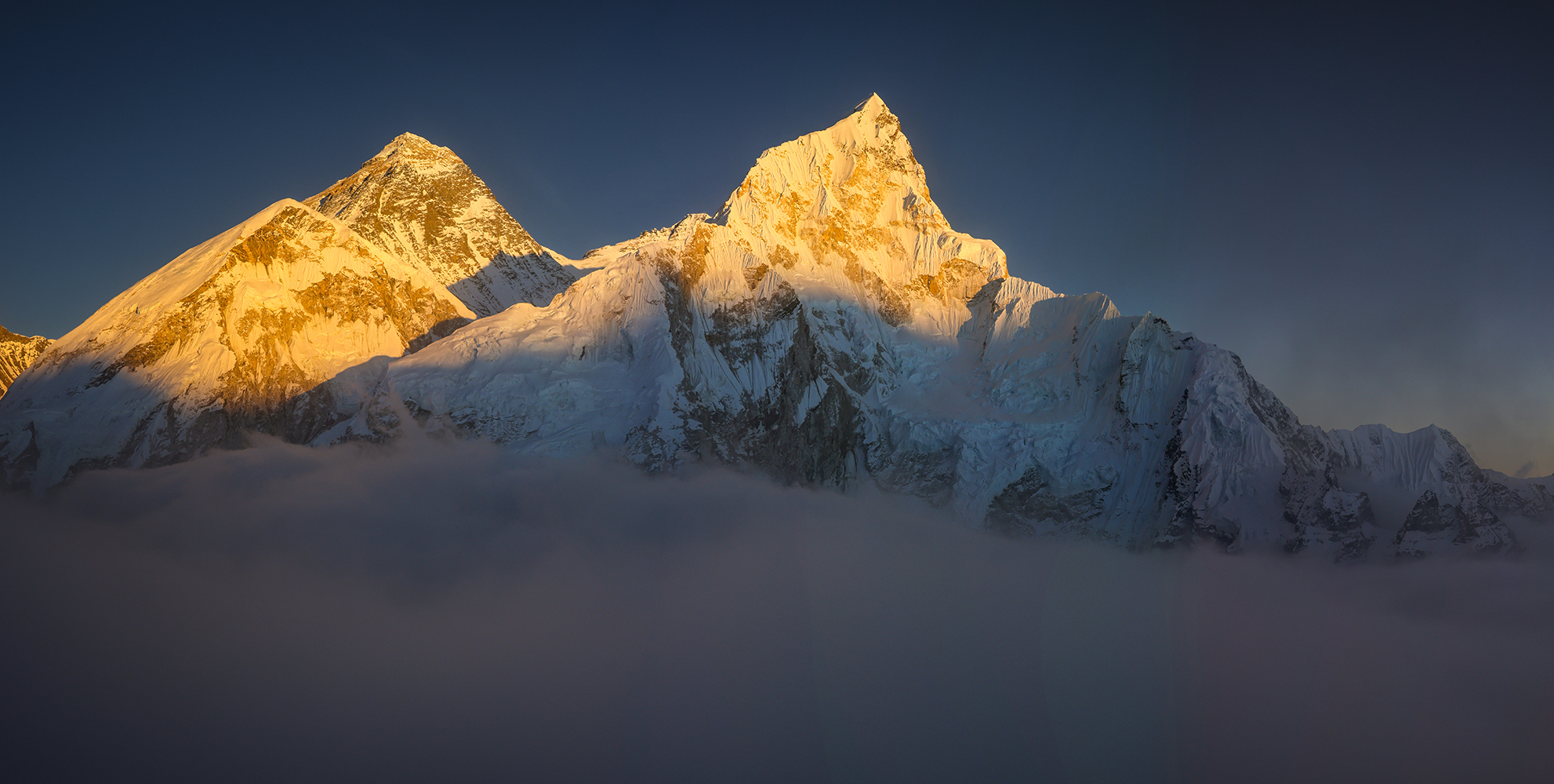
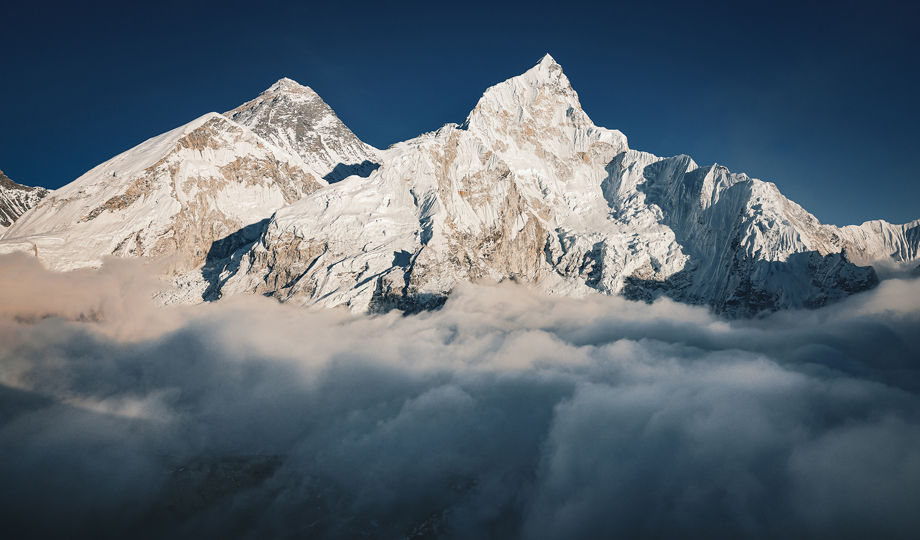
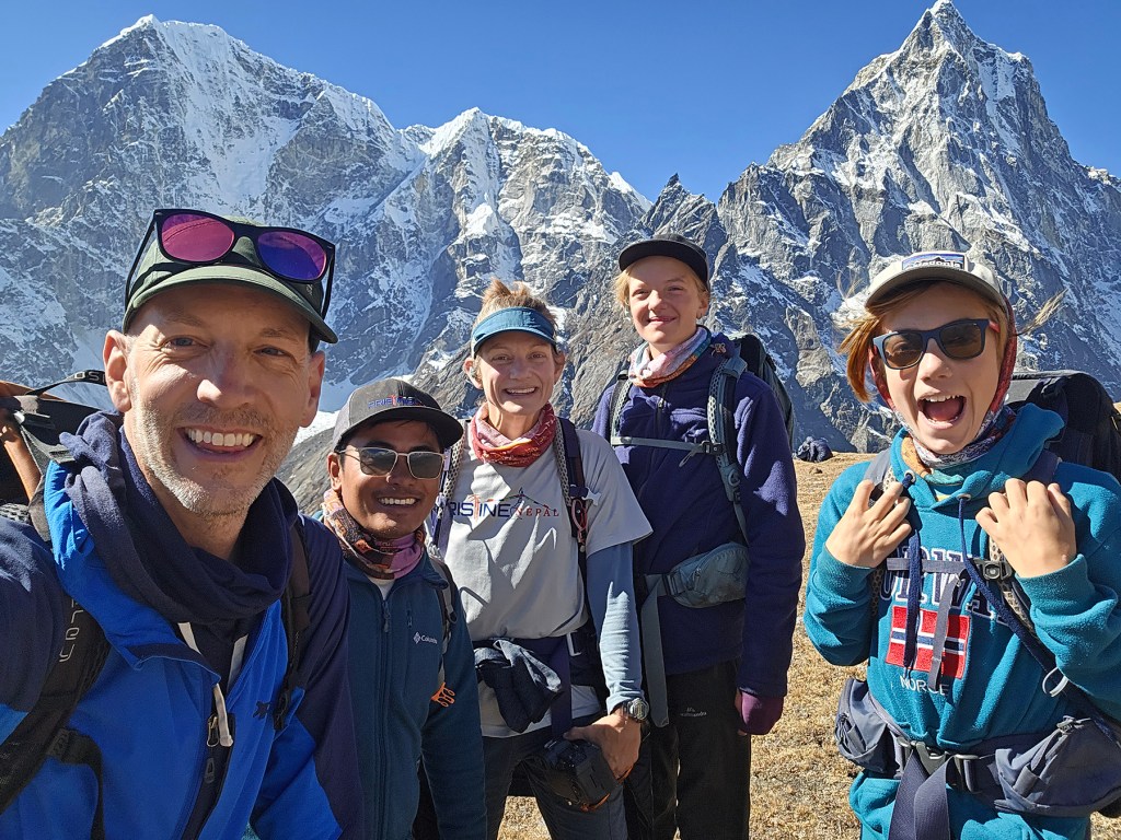
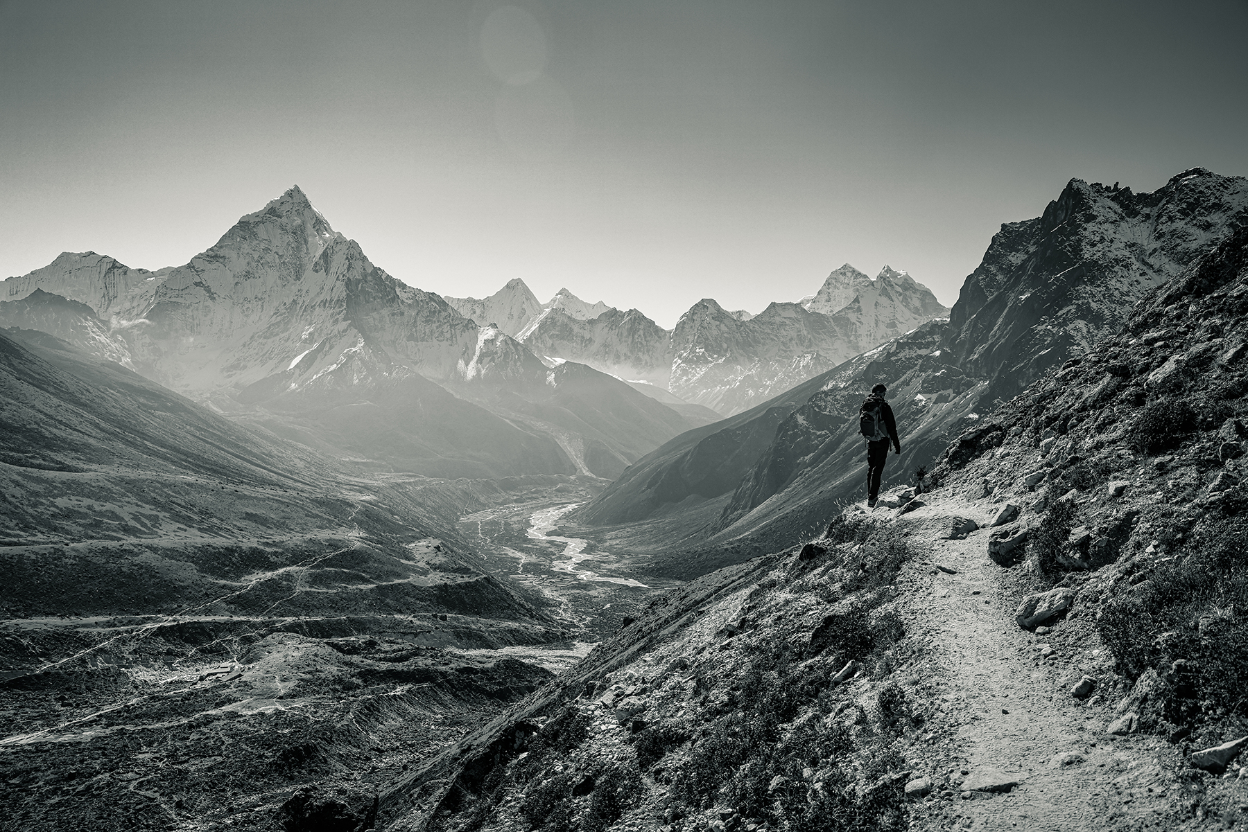
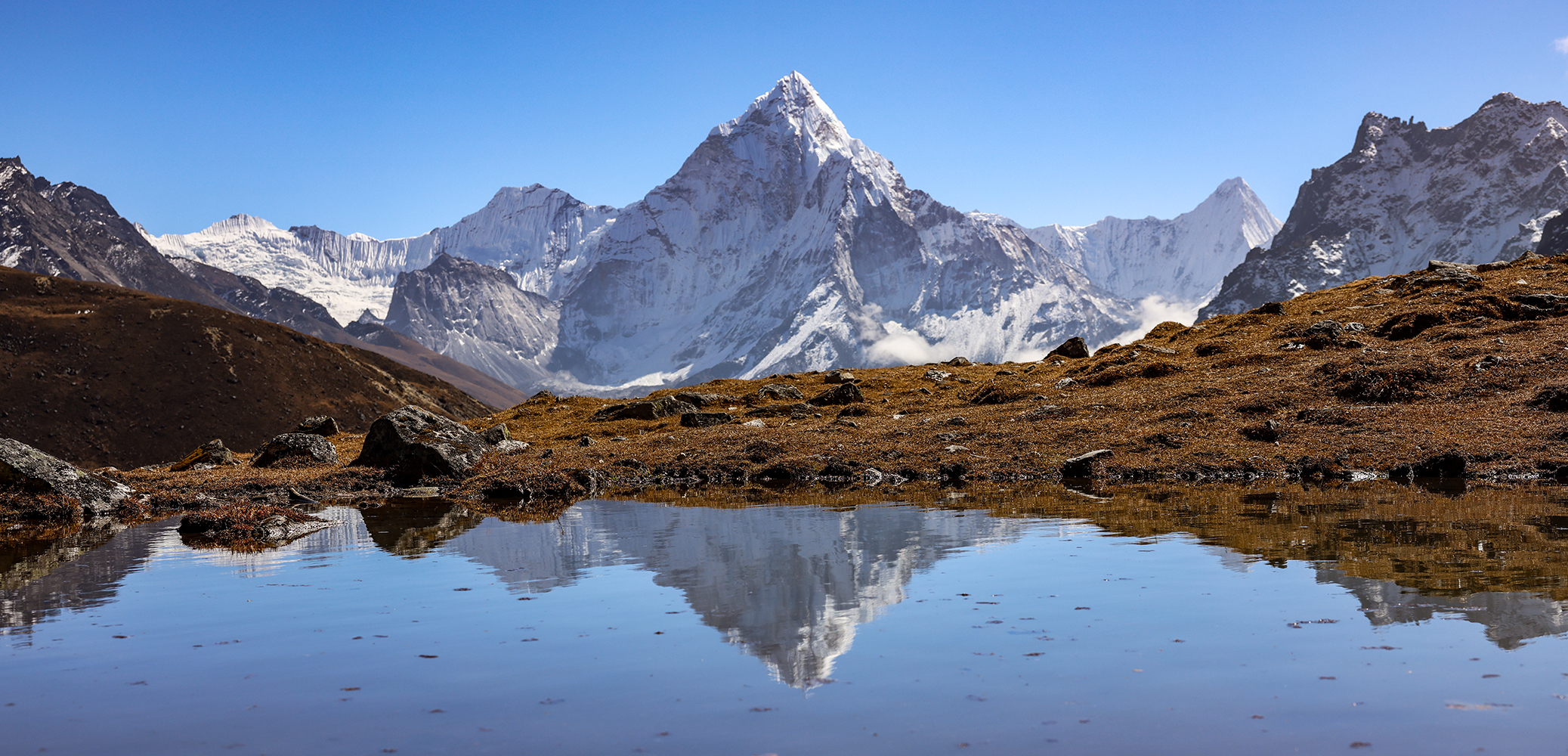
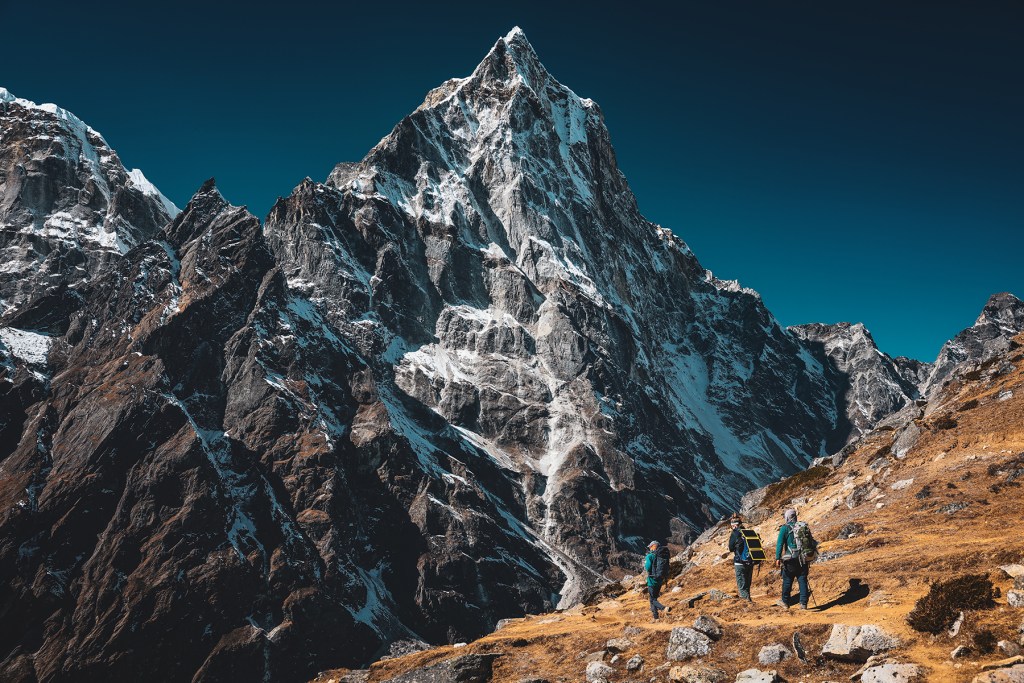
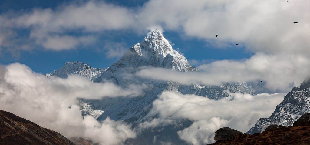
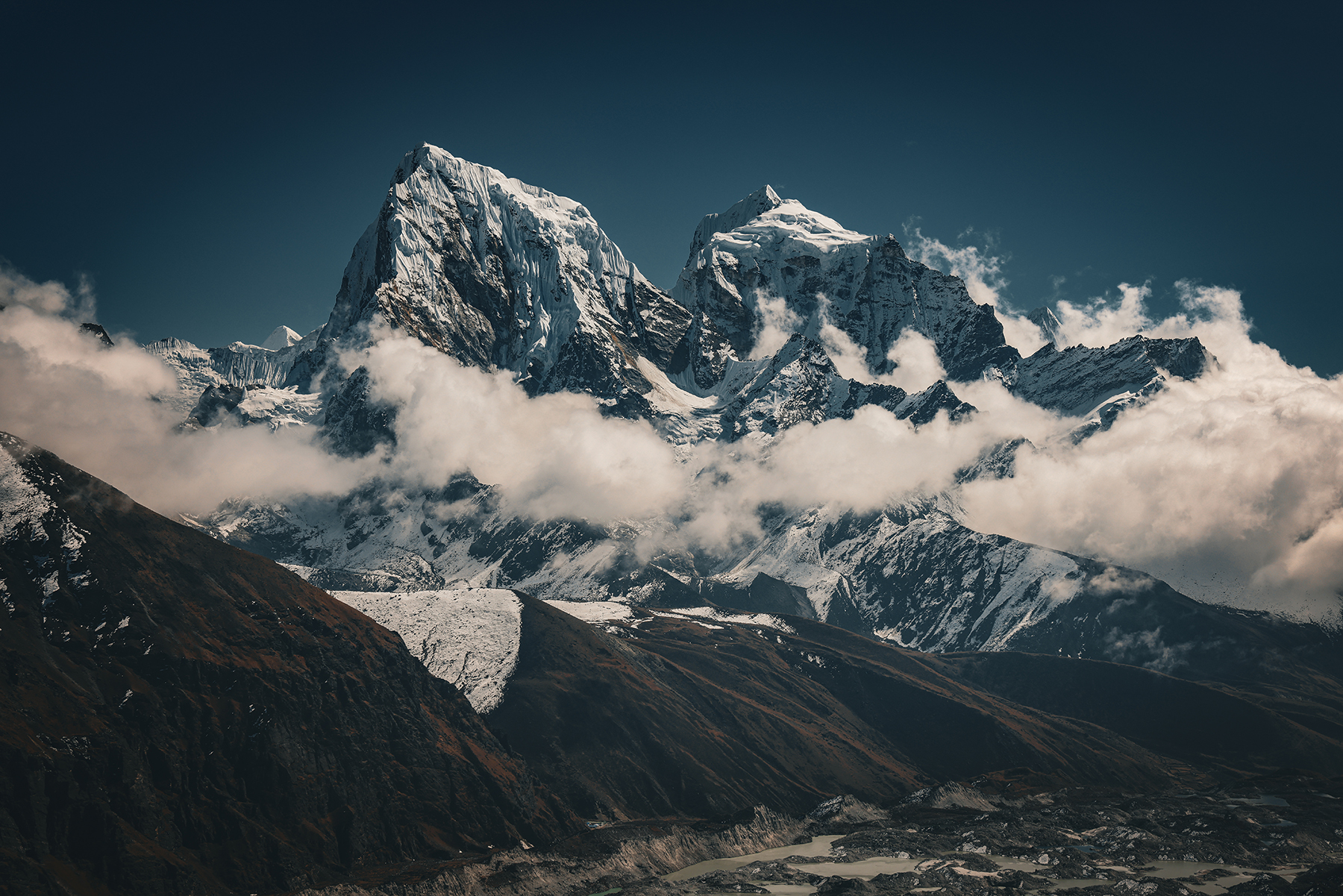
Part of our plan for approaching the trek with our kiddos had been to take extra time on the way up to avoid altitude related illness. With that goal in mind, we scheduled an extra day around Namche to complete some side trips while our bodies acclimatize to the thin air. Our first day was spent on a loop hike up the hill to the famously situated (and expensive!) Everest View Hotel. A steep ascent up the hill rewarded us with stunning panoramic views of not only Mt. Everest, but also Lhotse (the fourth highest mountain in the world) and the elegant summit of Ama Dablam, which I have always considered to be among the most beautiful mountains in the world. We will happily be trekking in the shadow of this peak for much of the next week as our route heads slowly up-valley.


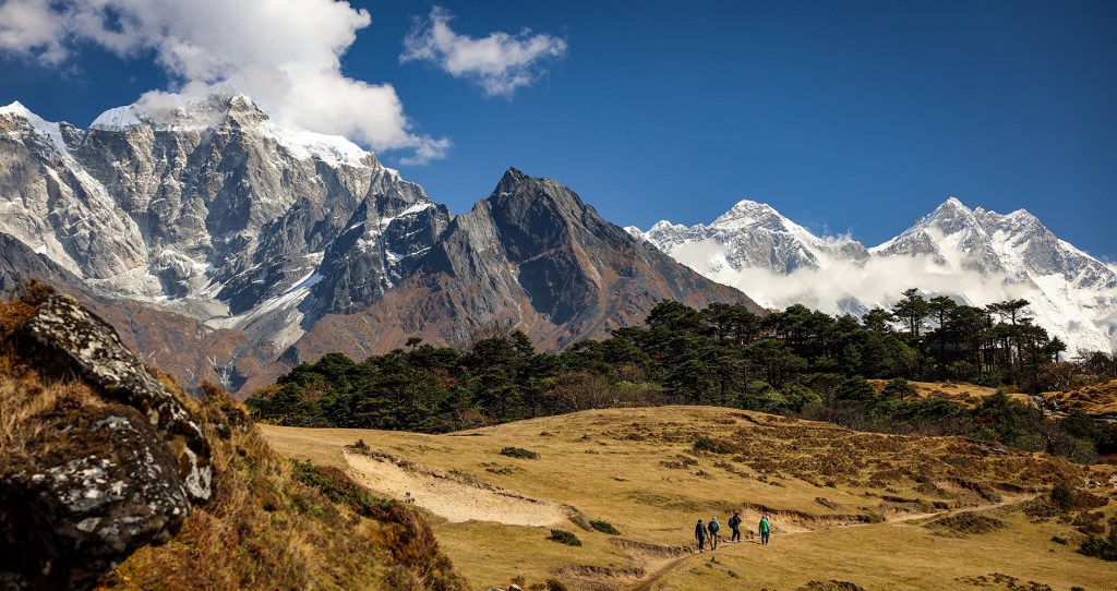

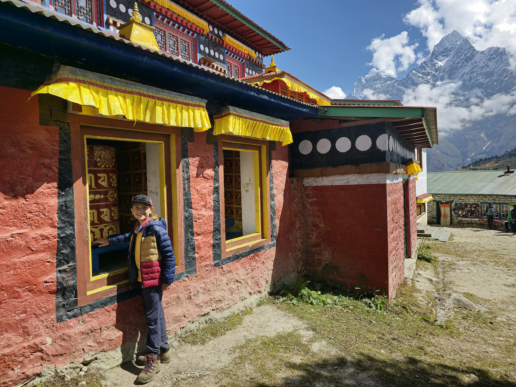
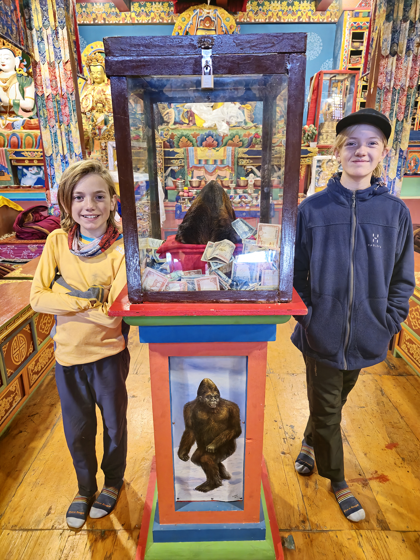
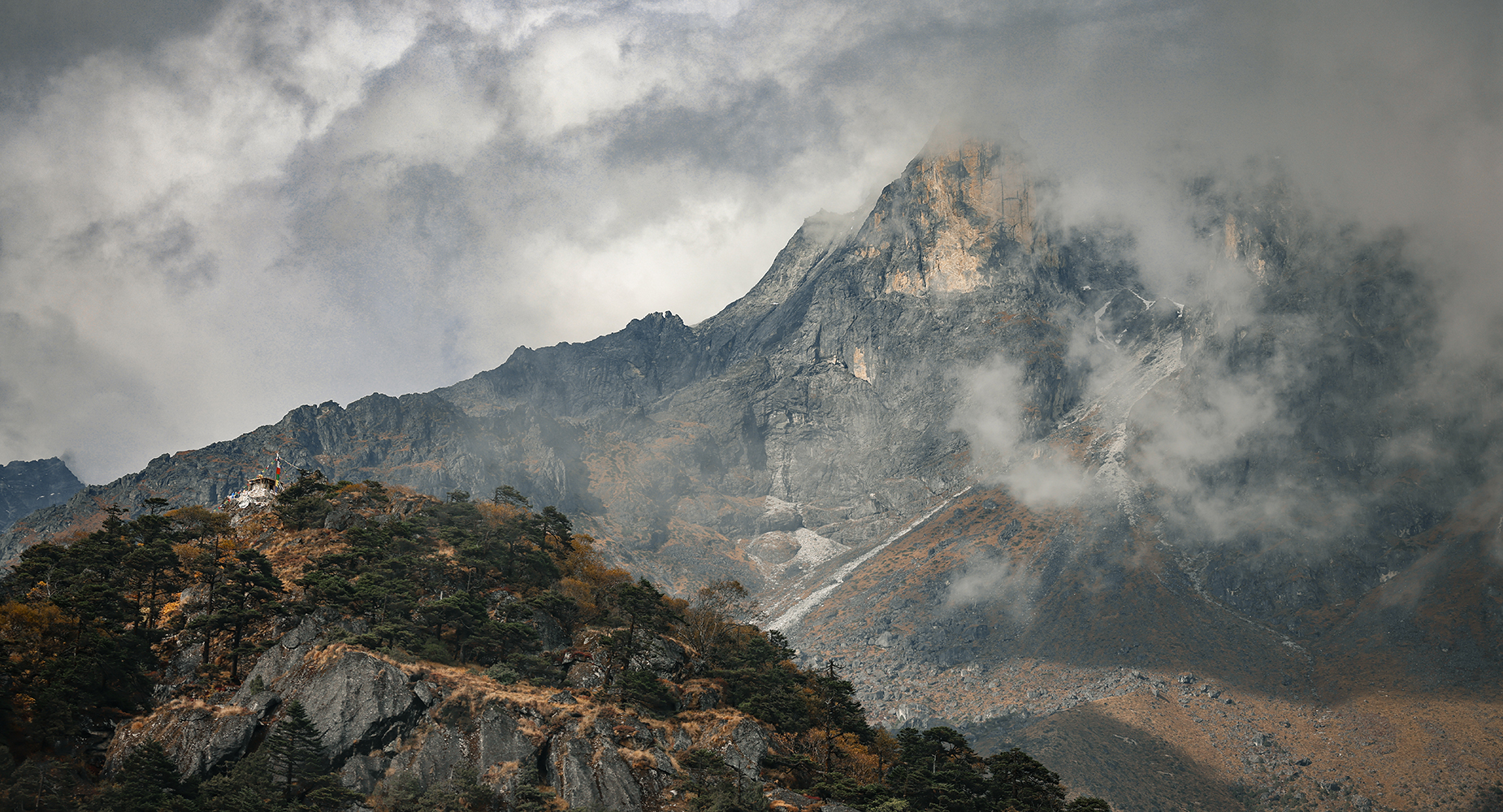
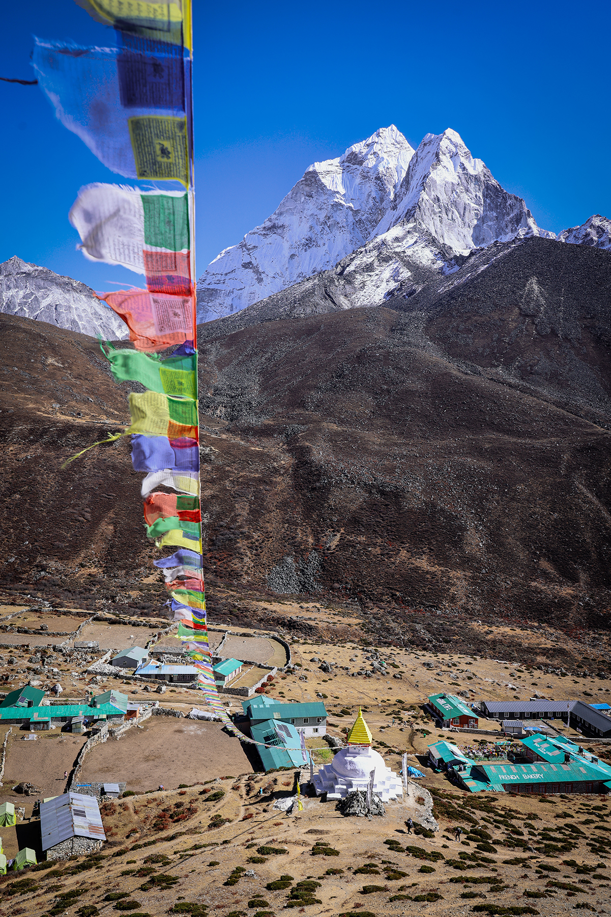
Following a quick break for hot chocolate at the cafe in the Everest View Hotel, we continued along a ridge down towards the quiet village of Khumjung. Khumjung lies away from the main path taken by most trekkers on the way to Everest Base Camp, and as such has better retained its traditional character than other sites along the main trekking route. The village sits at the foot of the sacred mountain Khumbi Yul Lha, an enigmatic rocky peak often embraced by misty layers of cloud that is completely off-limits to climbers. Khumjung is home not only to the Hillary School, established with the help of the legendary Sir Edmund Hillary, but also the famous Khumjung Monastery, a Buddhist site that houses a moderately suspicious Yeti scalp. The views from this area of the lush rhododendron forests contrasting with the towering snowy Himalayan peaks were nothing short of spectacular. On the way back to Namche we stopped by the Sagarmatha Next museum, a site that is focused on environmental impacts to the Khumbu from both tourism and climate change. The innovative museum has helped to implement a waste removal system for the Everest Base Camp trekking route, installing trash collection sites along the path and providing trekkers with filled bags of waste to carry out as they exit the Khumbu.


Our second acclimatization day was spent on a longer hike to the Sherpa village of Thame. Thame has long been famous as the childhood home of Tenzing Norgay, who along with Sir Edmund Hillary was the first to climb Mt. Everest. The village is also the home of the famous climber Apa Sherpa, who once held the world record for summiting Mt. Everest an unbelievable 21 times! Sonya and the kiddos were ready for a shorter rest day, so they planned to turn around at the halfway point to return to Namche for hot chocolates with our friendly porter BBC.

Thame village sits along an ancient salt trading route between Tibet and India, and sadly was devastated by flooding released by a glacial dam break this August. During the flood, the river rerouted itself through the center of the town and left behind a trail of boulders and debris as it washed away around 15 buildings. I continued on upwards with Indra and Naresh until we reached a picturesque collection of stupas overlooking Thame, featuring the snowy peaks of Kusum Kangaru and Thamserku as a dramatic backdrop.
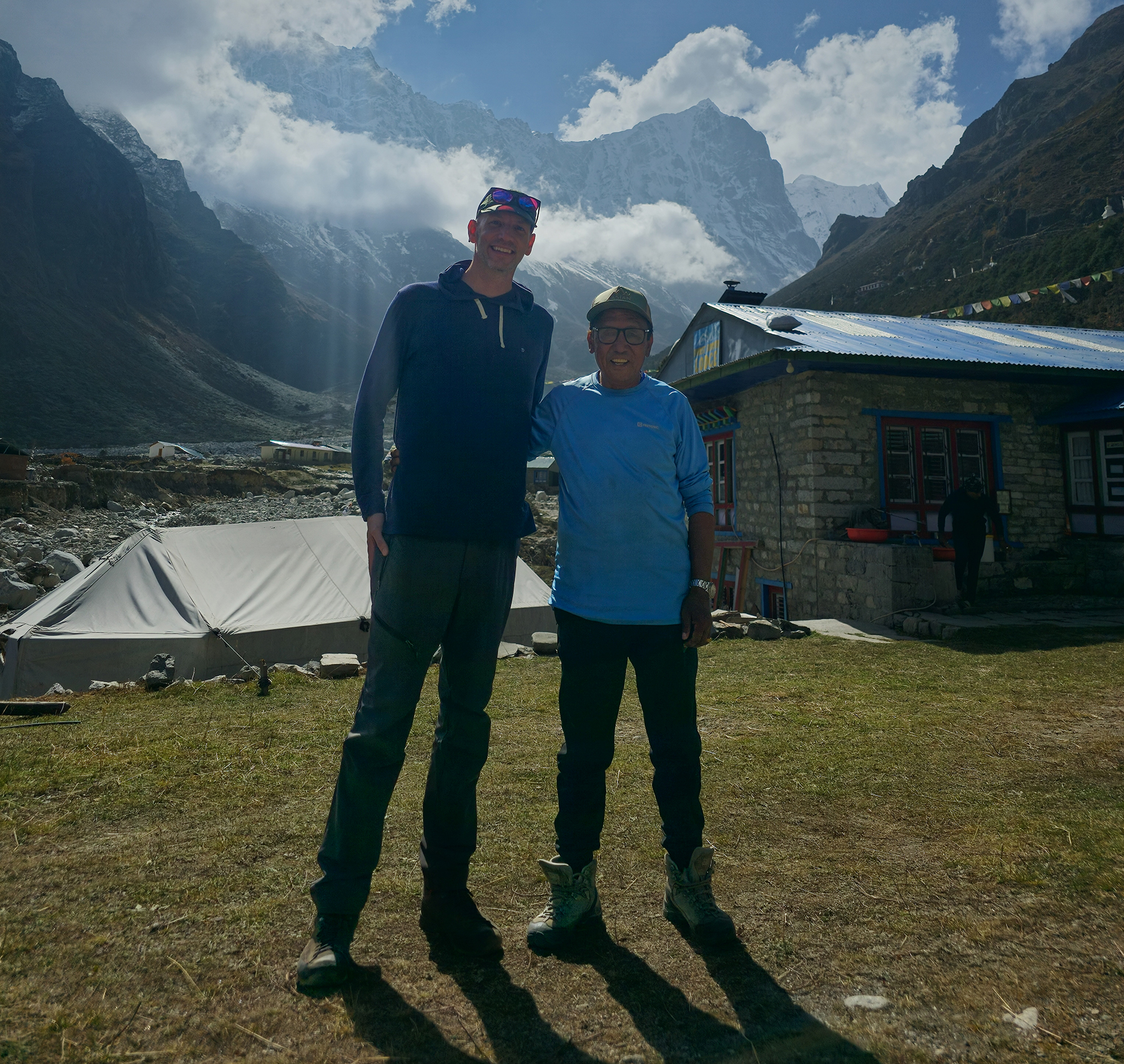
We enjoyed a fantastic lunch of dal bhat in a teahouse in Thame, where I was incredibly fortunate to have met none other than Apa Sherpa himself! The famous climber was spending time in his hometown to oversee work being done to construct a helicopter landing pad, with the goal of providing emergency medical transportation to the local population. I found Apa to be very kind and humble, and I enjoyed speaking with him about his work rebuilding his teahouse in Thame following the flood. Unfortunately, Apa is concerned that with the warming climate, similar glacial dam breaks will likely occur with greater frequency across the Himalaya in coming years. I wish that the kiddos had been along to meet Apa as well, but I suspect they were quite content drinking their hot chocolates and resting their legs back at our teahouse. Along the hike back to Namche I enjoyed the late afternoon light on the peaceful, nearly empty trail, and we even spotted a small herd of wild blue sheep. It was a long day of hiking, but worth every step!


Day 5! Namche Bazaar (11,286 feet) to Tengboche (12,687 feet)
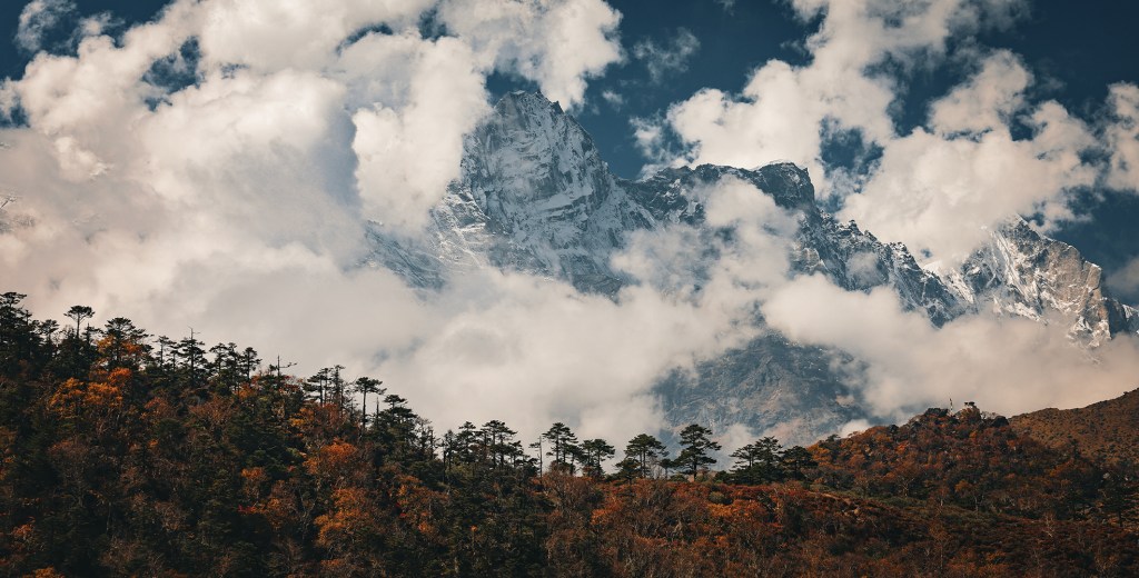
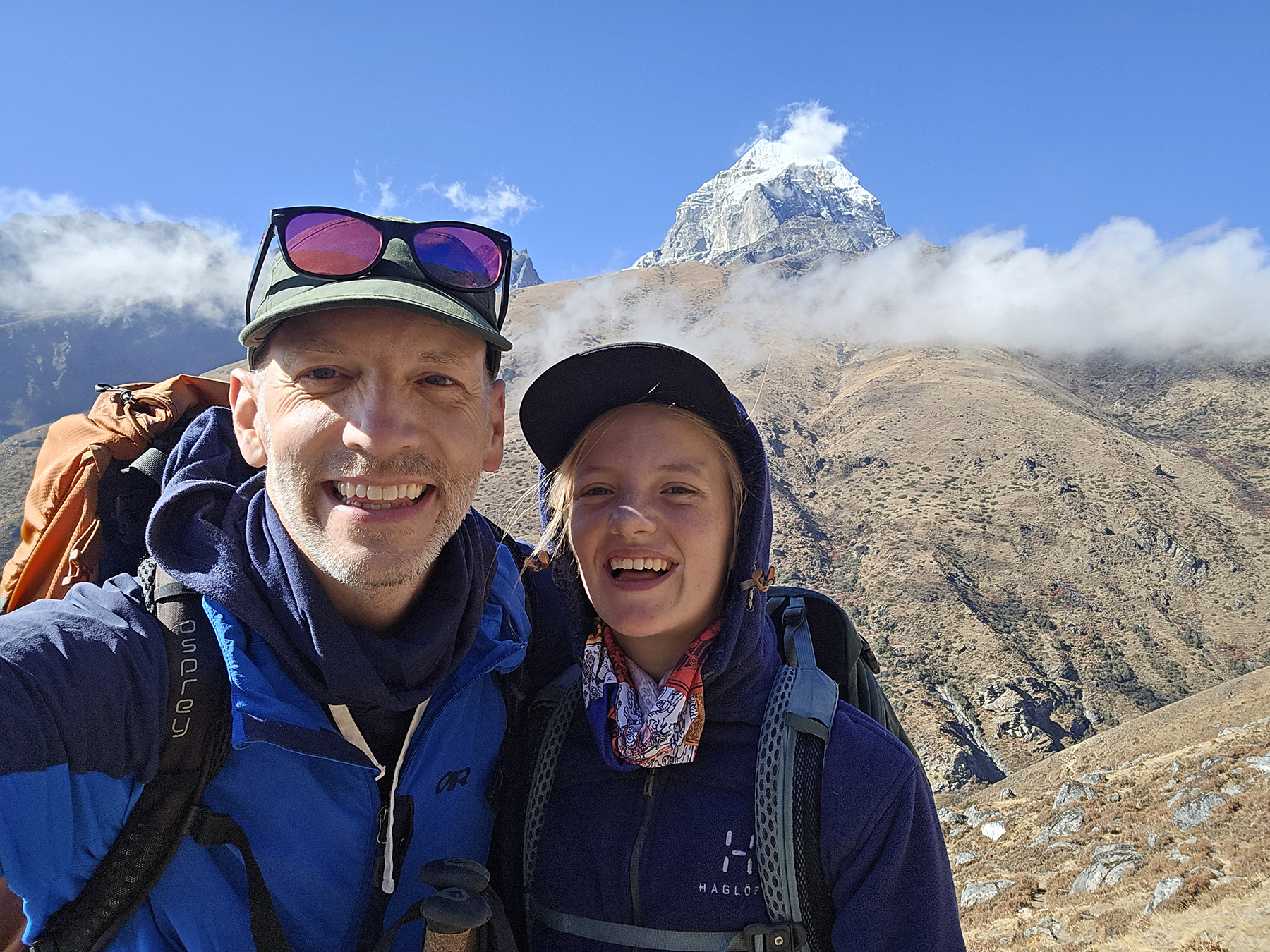
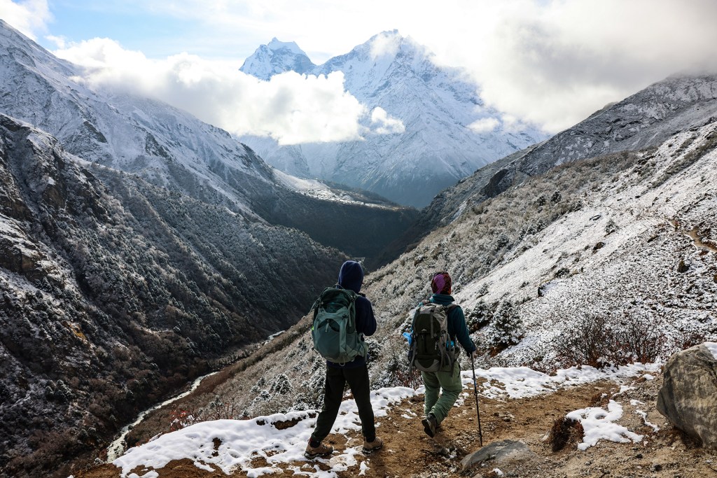
After our acclimatization days, we were all feeling mostly healthy and ready to make forward progress on the path to EBC! Our next stop was Tengboche, site of the most famous Buddhist monastery in the Khumbu region. The hiking for the day was for the most part easy and flat, ending with a relatively painless ascent leading into Tengboche. Most notably, soaring Ama Dablam dominated the views along this section of trail, with photo opportunities around every corner.


After arriving in Tengboche and getting settled in our teahouse, we visited the monastery and were fortunate to observe the monks chanting mantras and completing their afternoon rituals. It was both a fascinating and freezing cold way to spend the afternoon – several more layers of clothing would have been welcome! The evening featured a spectacular sunset, with soft alpenglow illuminating the enormous south faces of Lhotse and Nuptse.


Day 6! Tengboche (12,664 feet) to Pangboche (12,960 feet)
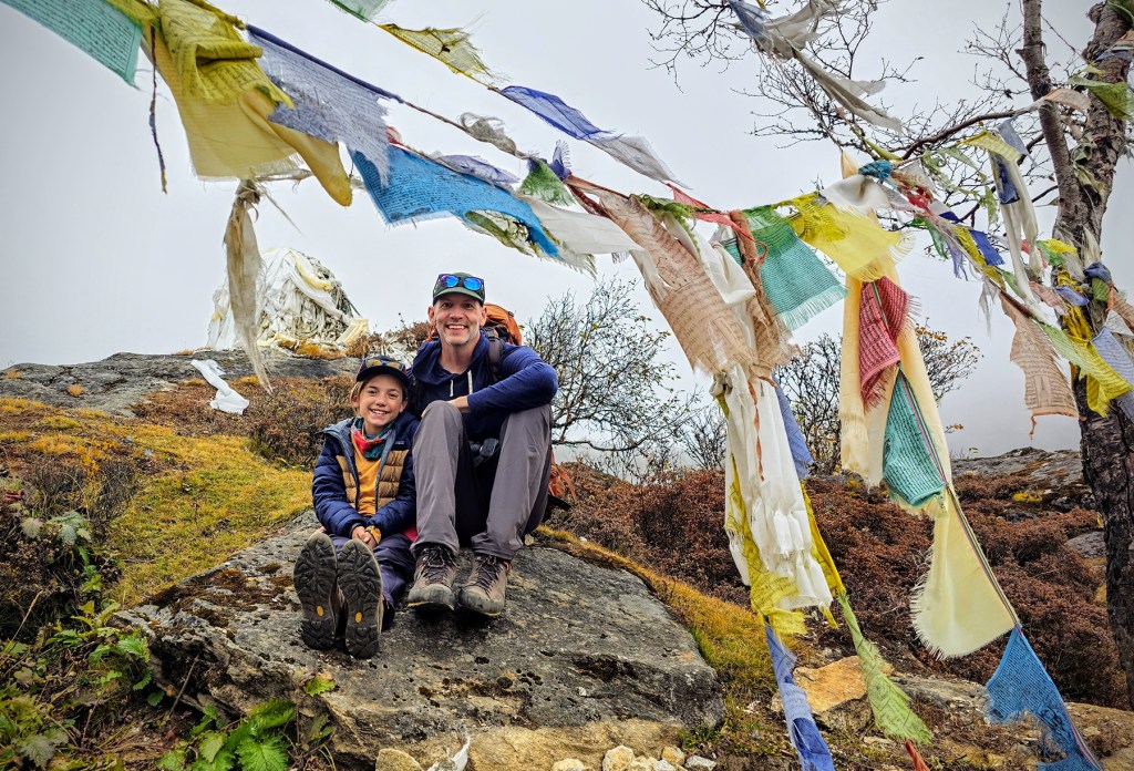
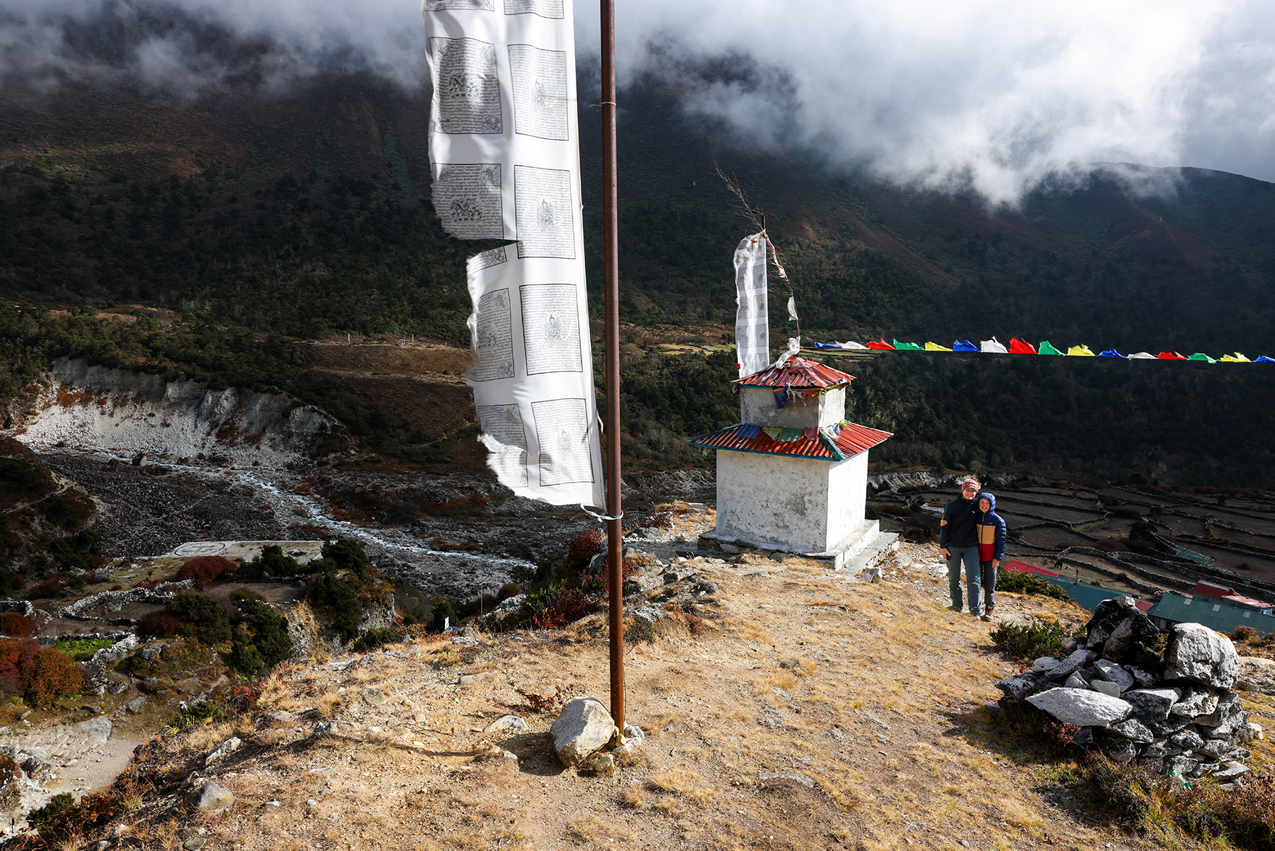
A short morning’s walk brought us quickly to our next destination, the small village of Pangboche. Most trekkers on the Everest Base Camp route pass through Pangboche without stopping for a night, but we had planned an additional side trip starting from this point to visit Ama Dablam Base Camp. The trek to Pangboche was scenic and uneventful, passing through some beautiful rhododendron forest. Later we spent a pleasant evening walking up a small hill above town to an overlook lined with numerous tall prayer flags, where we watched another glorious sunset on the peaks above.


Day 7! Pangboche (12,960 feet) to Ama Dablam Base Camp (15,026 feet) and back
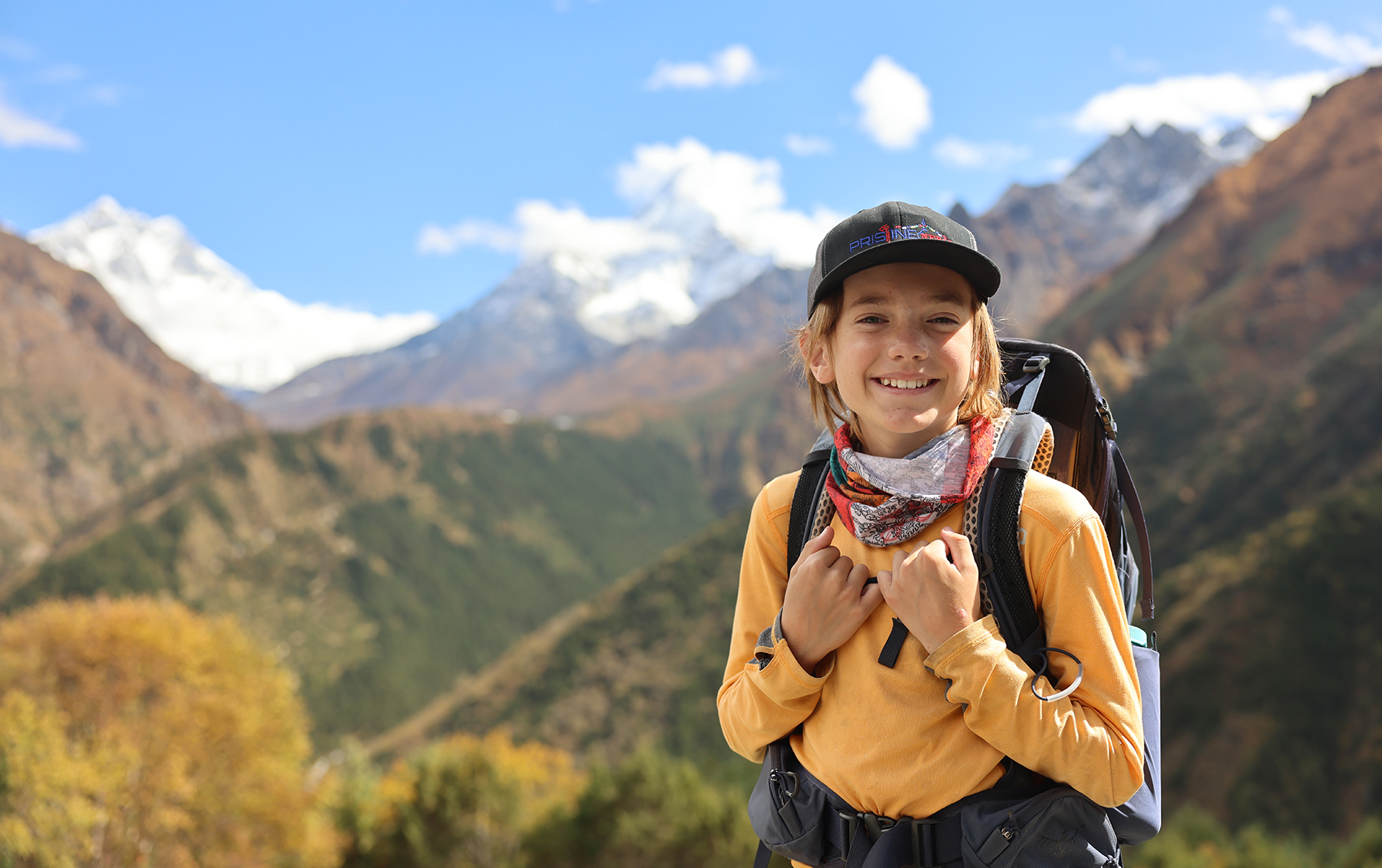
Today brought a new altitude record for the kiddos, and a spectacular day of trekking to the foot of Ama Dablam! Leaving Pangboche, we crossed a small bridge and began working our way steadily up the barren hillside. As we climbed upwards, views of new peaks slowly revealed themselves under a pristine blue sky. We even spotted the distinctive shape of Pumori off in the distance, a close neighbor of Mt. Everest in the upper Khumbu that hinted at views to come later along our route.


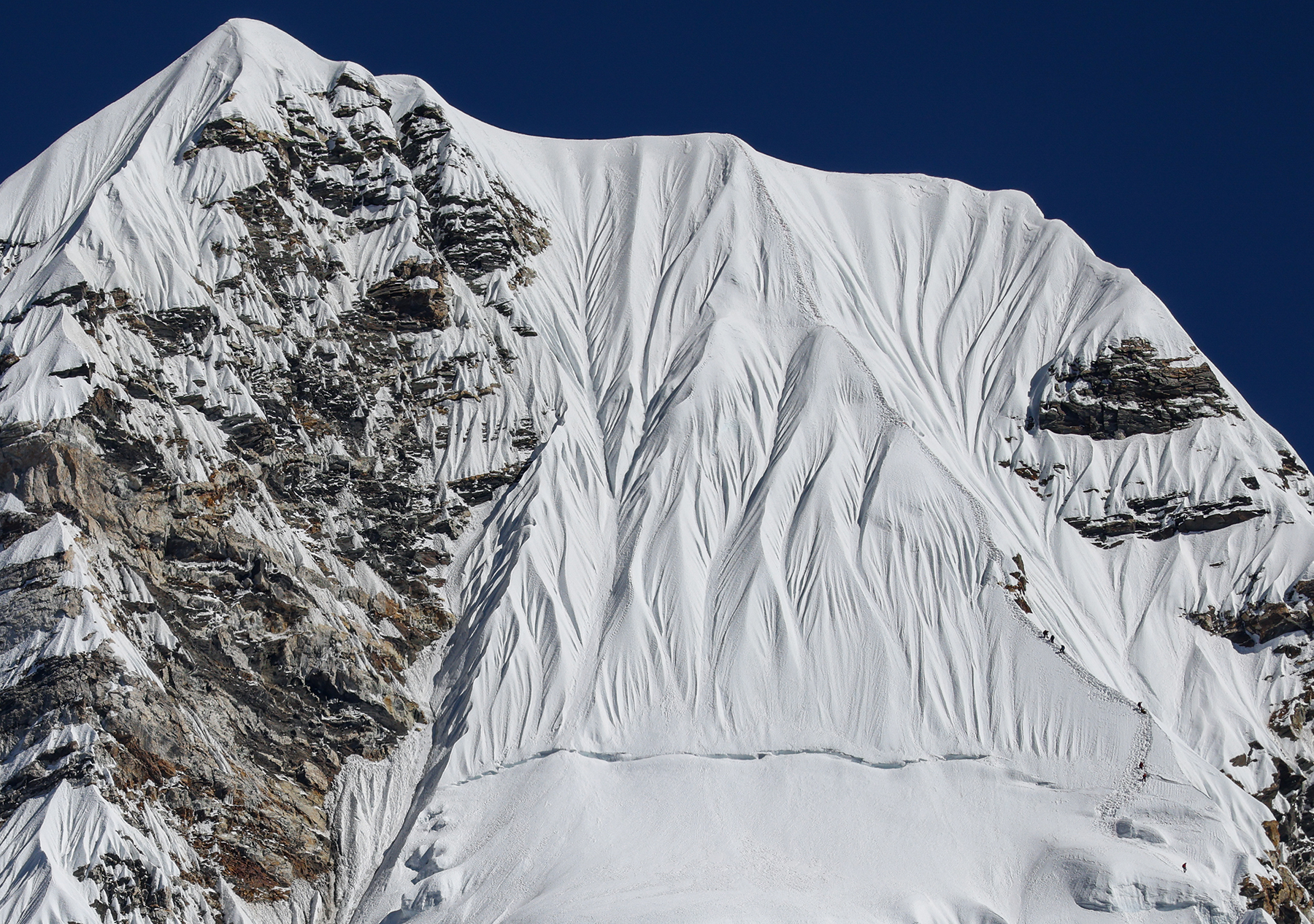
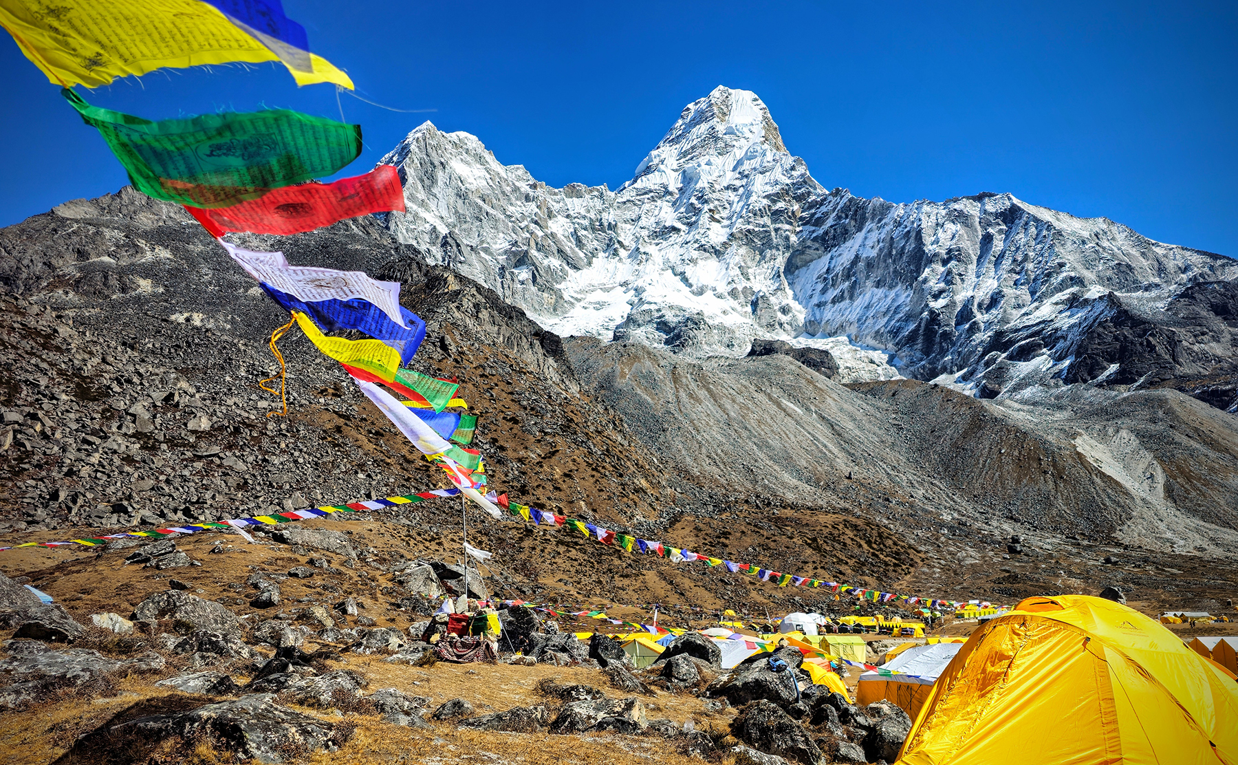

We made it to Ama Dablam Base Camp after a few hours of work, where we were excited to see dozens of bright yellow tents set up by the numerous expeditions working their way up the mountain. Being significantly lower in elevation, Ama Dablam has a different climbing season than Mt. Everest, which is climbed almost exclusively in the spring season. As such, Ama Dablam Base Camp is a much more active site than EBC this time of year. We spotted a number of tiny climbers on the steep upper snow slopes – it would be a dream to climb, but our sense of self-preservation means that this particular peak falls under the look but don’t touch rule for the Sillecks! A brilliant day trekking – we are feeling strong and having a grand adventure!
Day 8! Pangboche (12,960 feet) to Dingboche (14,470 feet)
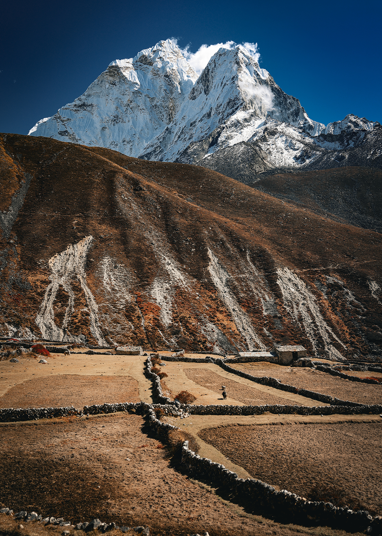
Our next day of trekking was a short walk up the valley to Dingboche, historically the last permanent settlement along the route to Everest Base Camp. These days several higher villages exist in the area, but these are only present to service the trekking industry in areas that were traditionally used only as yak pastures. I vividly remember passing through Dingboche back in 2001, and I marvel at the changes that have taken place since my last visit. The upper part of the village remains as it once was – agricultural plots separated by rough stone walls, and the occasional traditional house with slate roofs and low (4-foot?) doorways. The lower village, however, is now a bustling trekker mini-town, complete with clinics, a pharmacy, bakeries, cafes, and perhaps two dozen teahouses. It’s hard to balance in my mind my desire to see places like Dingboche frozen in time, retaining the charm and allure of their traditional appearance, with the recognition that increasing tourism and infrastructure development are an economic boon to the people who live in these communities.
We will be in Dingboche for a three-day stay, again planning side trips to aid in acclimatization. On arrival, we noted that the accommodations are getting a little rough around the edges (or as H would say, there’s some rust in the corners!) as we reach these higher altitudes – the rooms in Dingboche are getting very cold at night, and the plumbing in the bathrooms is getting suspicious, to say the least. We are a long way from the posh sunroom and suite we enjoyed in Namche Bazaar!
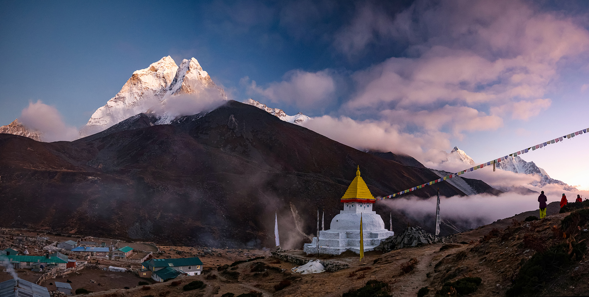
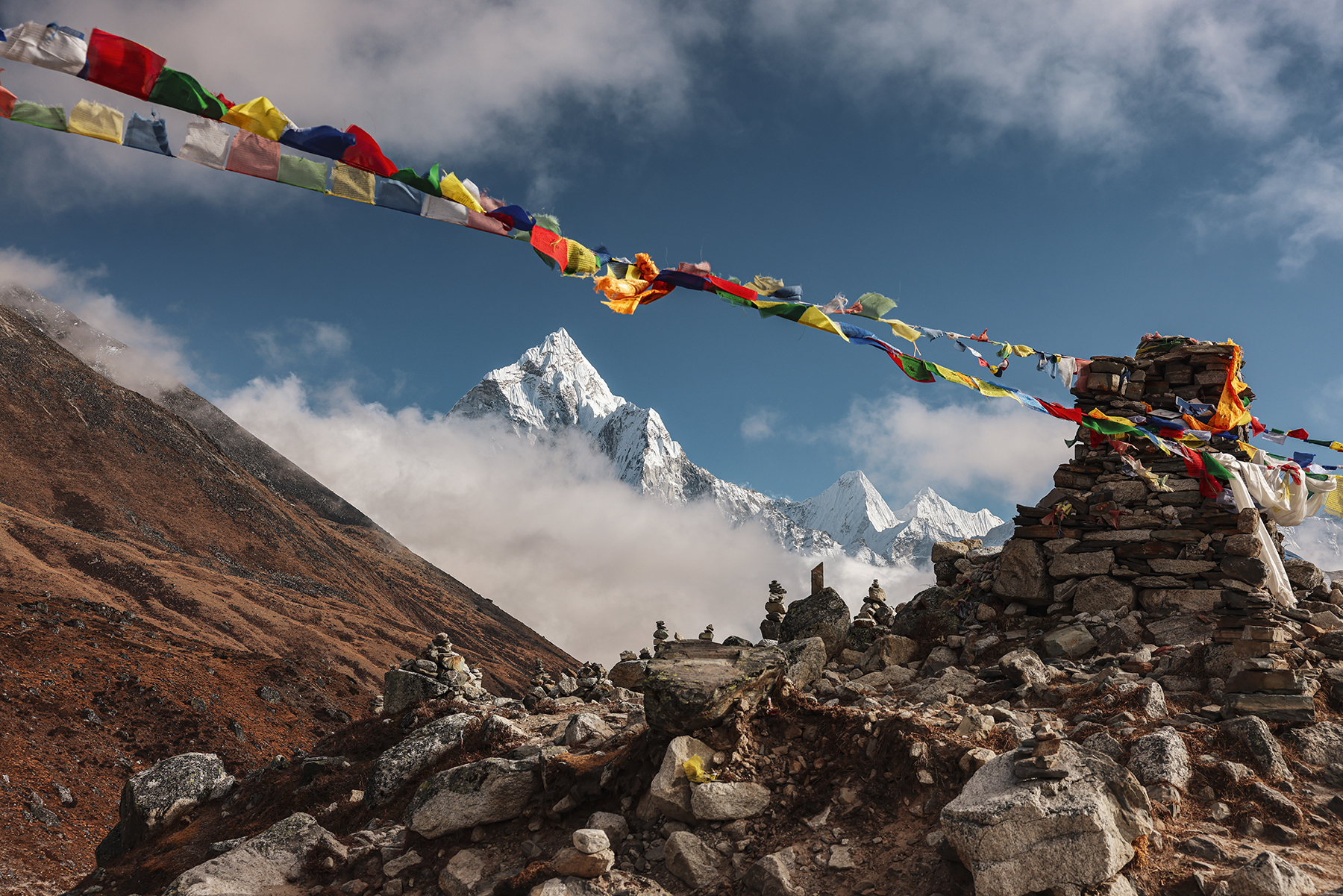
Highlight of the day was definitely a late afternoon walk up the hill behind our teahouse to check out an incredibly long string of prayer flags, arching gracefully between two beautifully situated stupas. Watching the sunset on Ama Dablam as the prayer flags fluttered in the breeze felt like we were in exactly the right place for this moment in time.


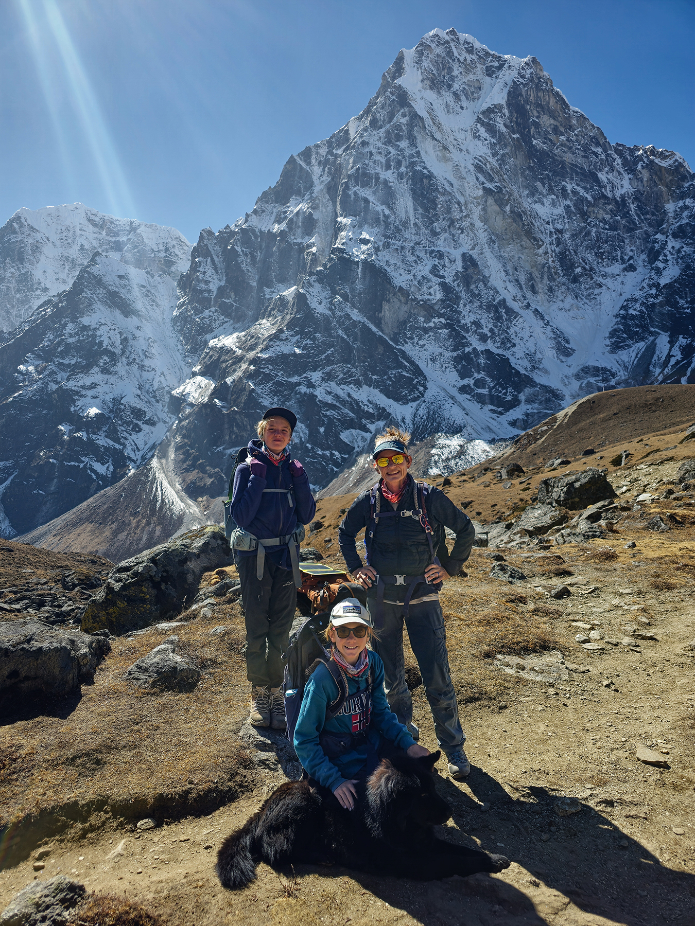
Day 9! Dingboche (14,470 feet) to Chukhung Village (15,518 feet) and back
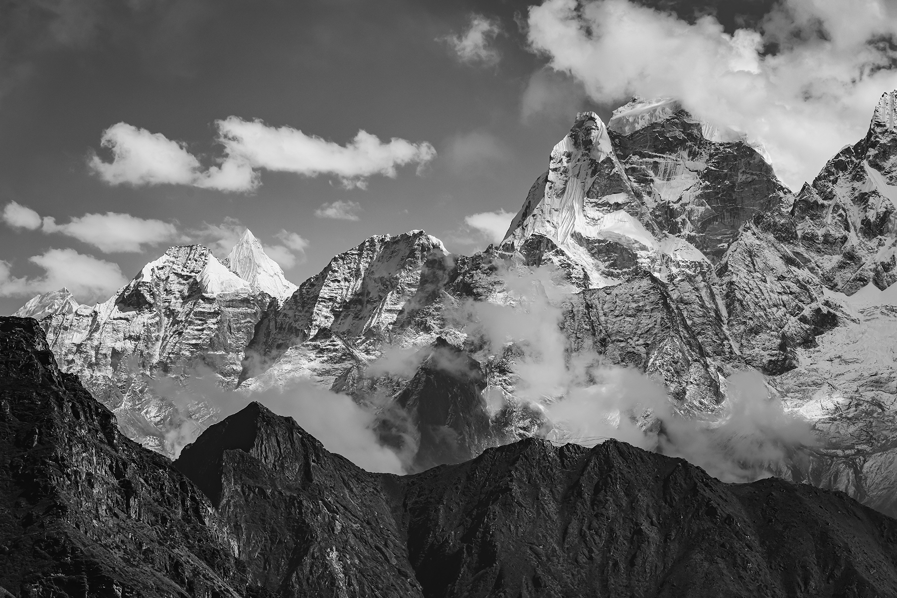
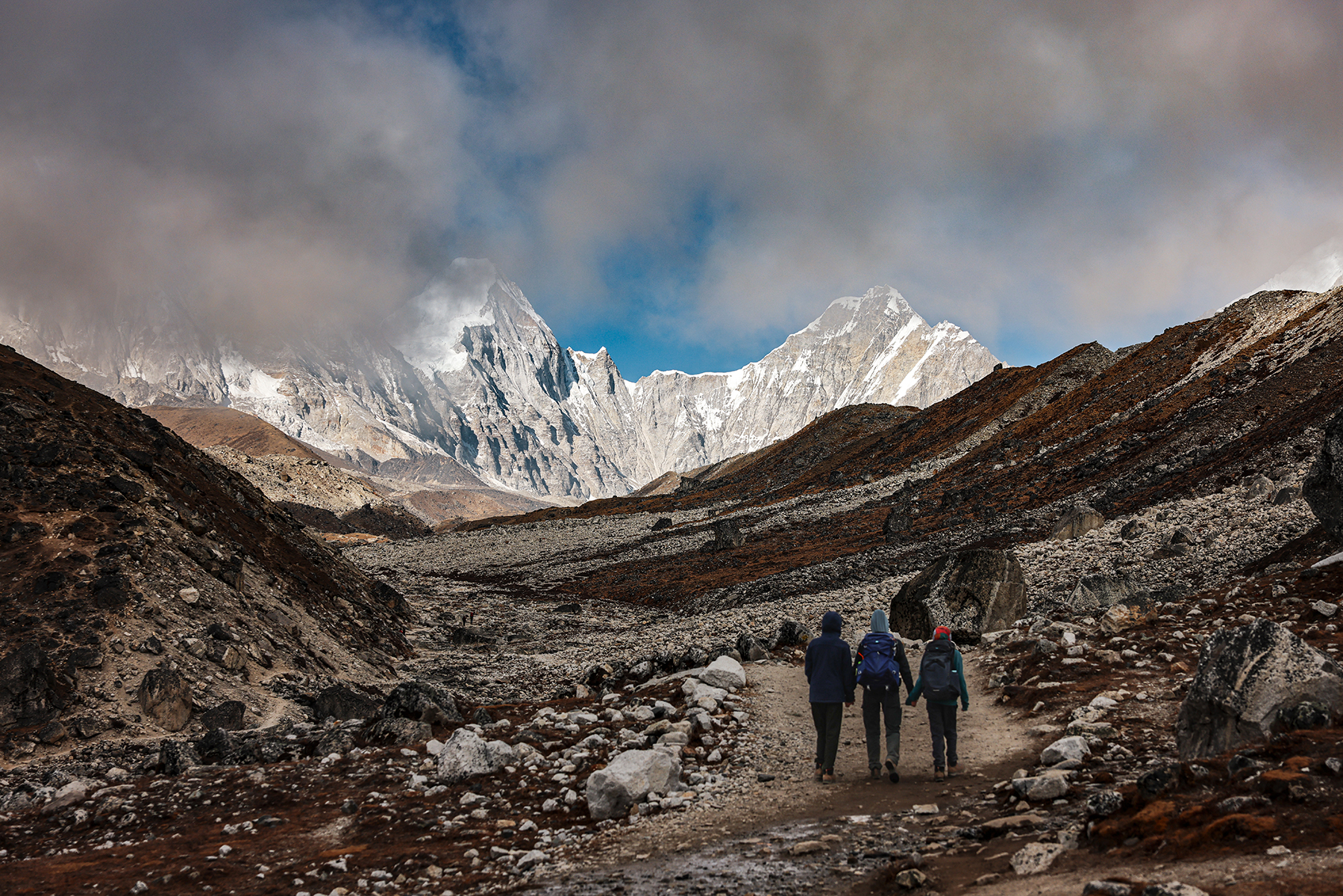
Another day, another altitude record for the kiddos! Our next steps took us briefly off the main EBC trekking route, following the Imja Khola river up the easy terrain leading to Chukhung Village. I had walked this section of trail after descending from the Amphu Lapscha Pass in 2001, and I was again surprised to see how much more established the outpost of Chukhung has become over the past twenty years. Easy hiking both up and down the valley, with stunning views of the imposing south faces of Lhotse and Nuptse.


In the evening, we encountered our first big concern of the trek. Each night at dinner we had been regularly monitoring our heart rates and oxygen saturation to make sure everyone was acclimatizing to the altitude effectively. Concerningly, tonight H’s heart rate was elevated at 150 beats per minute resting, and stubbornly refused to go back down. We resolved to visit the high-altitude clinic in the morning if things were not improved by then, and have the kiddos rest in Dingboche for the next day, skipping the planned hike. Up until this point we had been feeling quite confident in our ability to make it up to Everest Base Camp, but now for the first time we are worried that we might not reach our goal. We went to sleep feeling quite uneasy, hoping to wake up to good news.
Day 10! Dingboche (14,470 feet) to Nangkartshang Peak (16,644 feet) and back
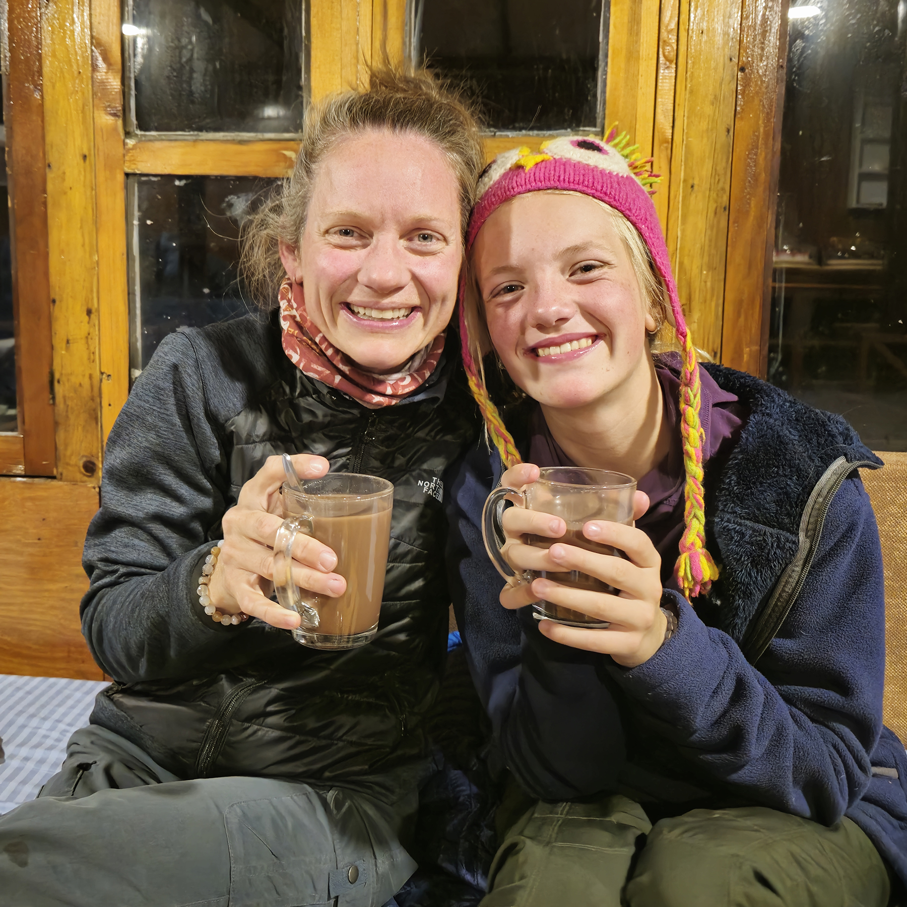
We woke to a wonderful discovery – H’s heart rate had returned back to normal levels, and the kiddo was feeling much improved! Even with this great news, a day of rest was still in order. After briefly stopping by the high altitude clinic to discover they unfortunately didn’t have any more resources available that might be of use, we dropped the kiddos (and a walkie talkie) off for their day of rest at Cafe 4410, which in their words was “a complete vibe”. The cozy cafe served decadent hot chocolates and pastries, played a daily Everest-themed movie, and even had a chess board to keep them busy – kiddos were delighted!

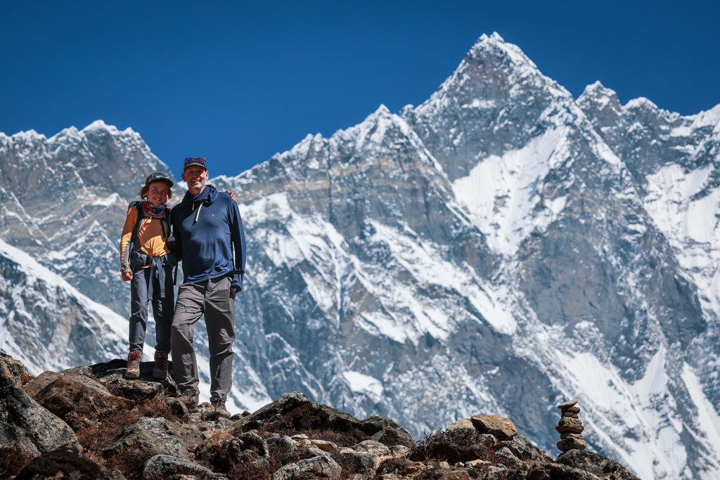
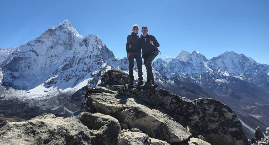
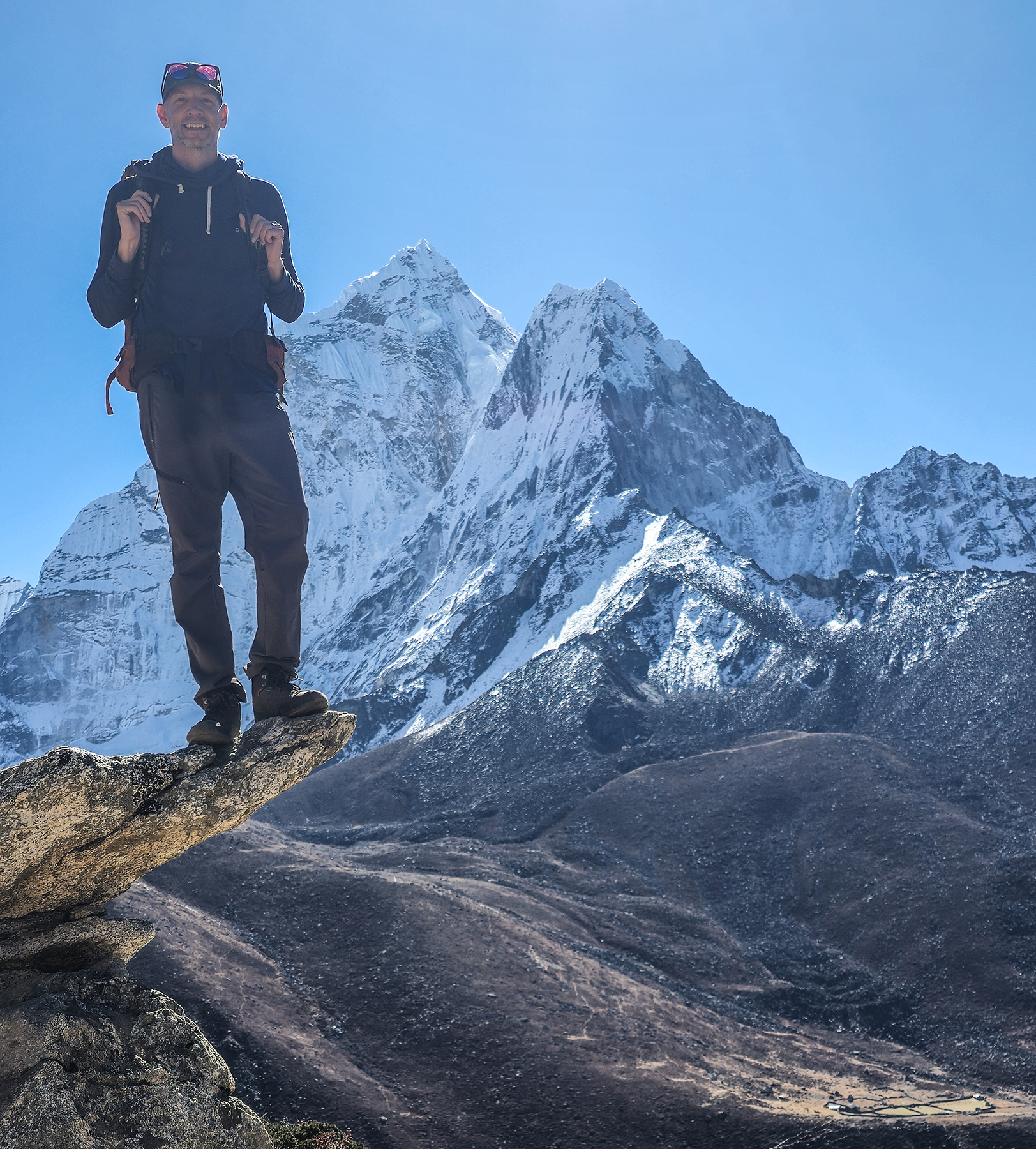
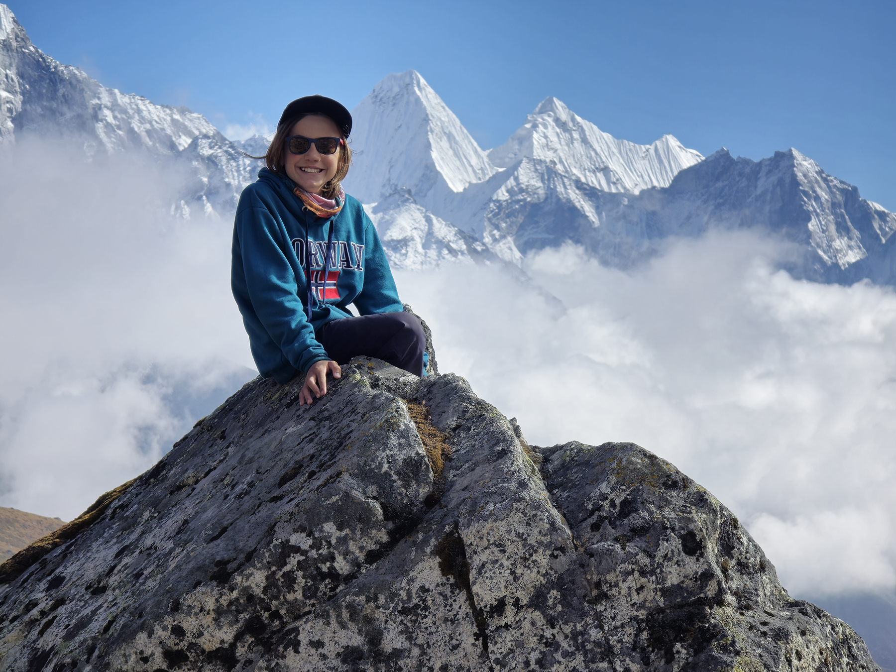
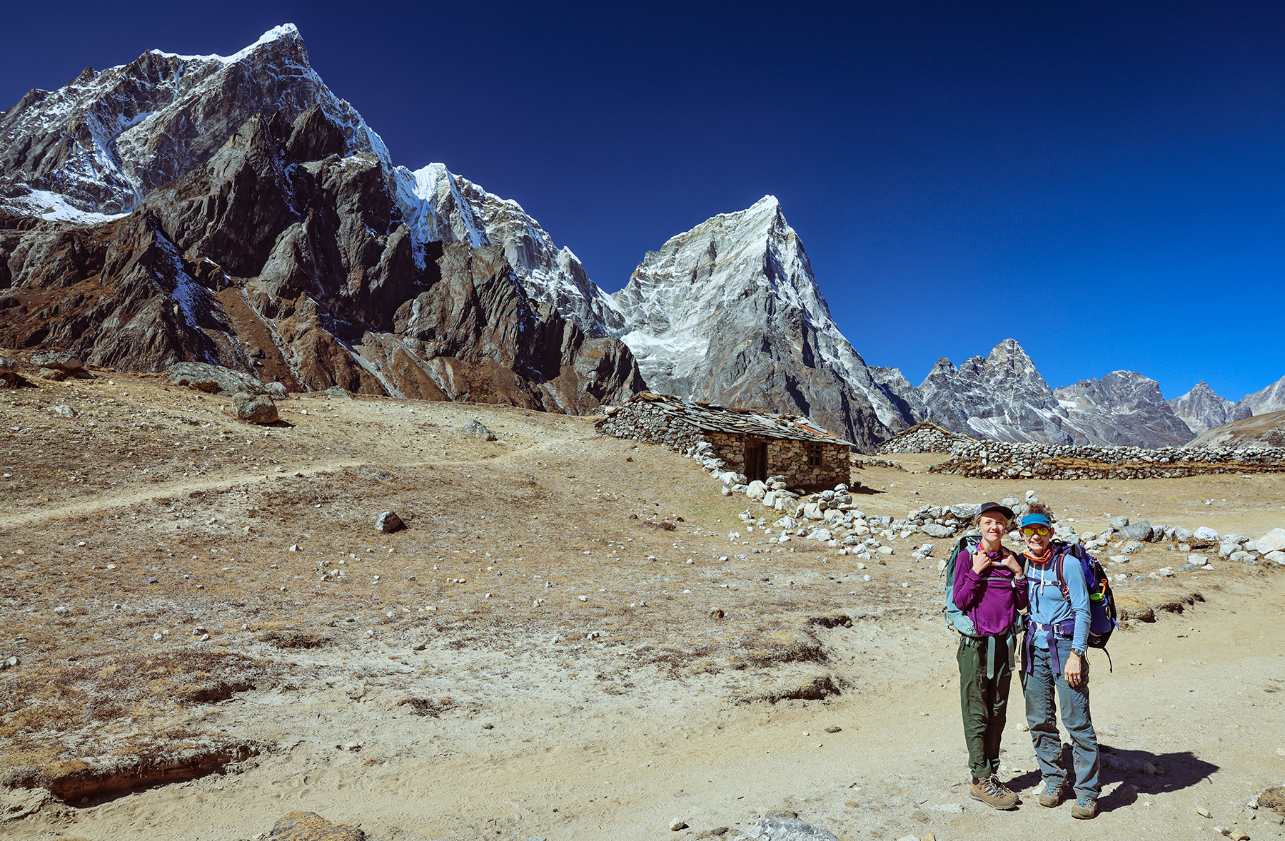
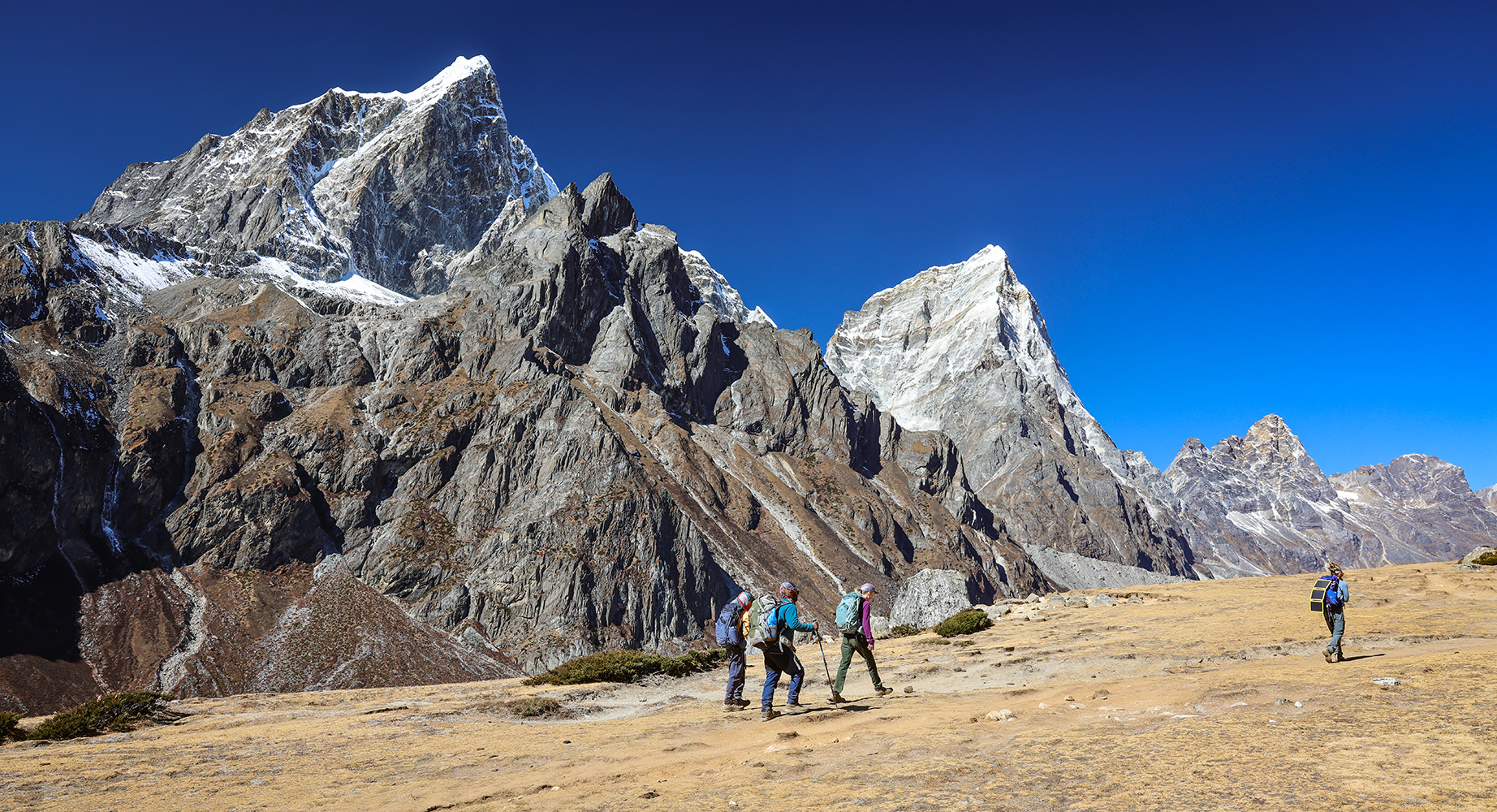
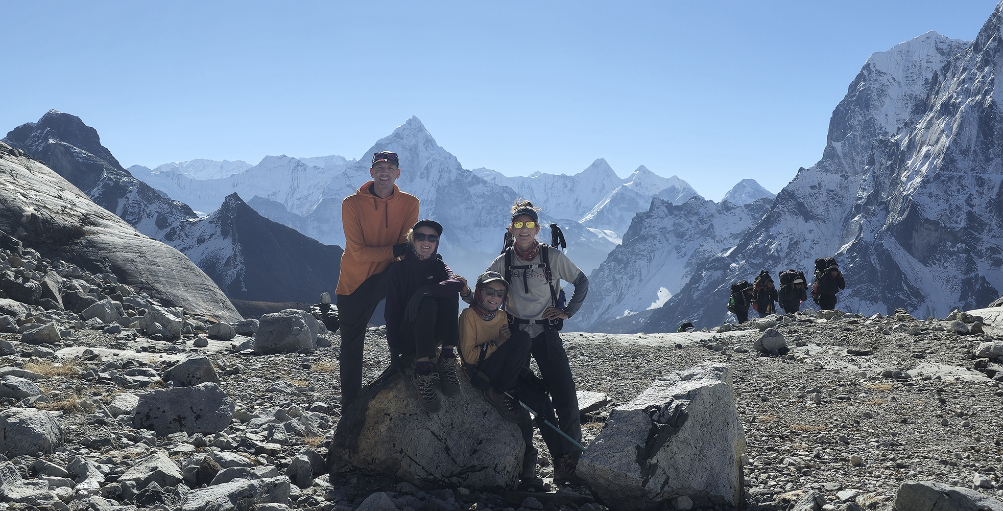
Sonya and I then headed off with Indra and BBC rather directly upwards to ascend Dingboche’s local hill, a rocky summit called Nangkartshang Peak. Almost anywhere else in the world a peak easily clearing 16,000 feet would be considered a major mountain, but here in the Himalaya our day’s objective looked like a small bump on a low ridge below the towering giants surrounding us. As we headed up the switchbacks, I was delighted to feel my breathing at ease as we gained altitude. We stopped by an iconic rocky platform to take some obligatory photos before continuing upwards towards the diminutive summit.
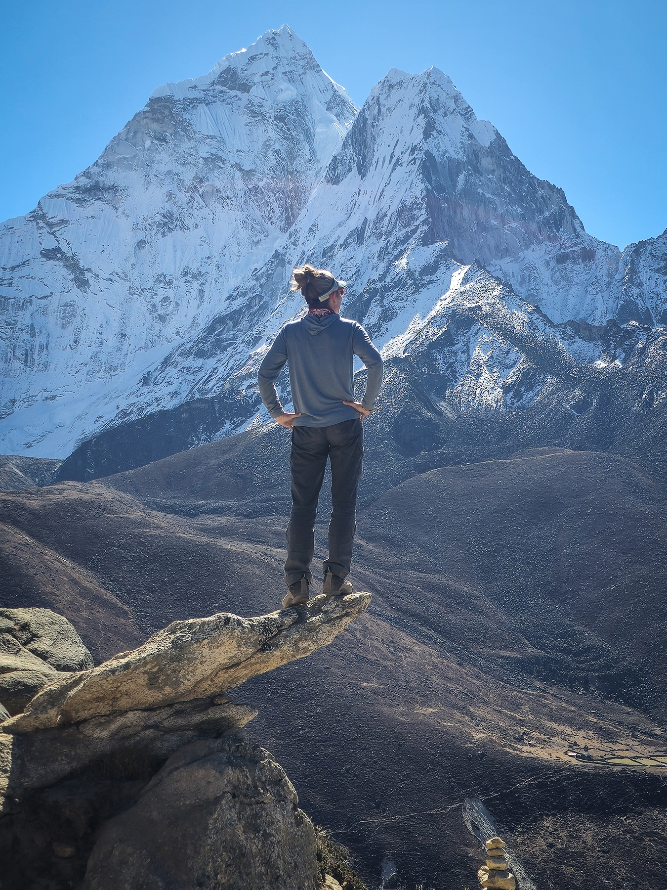

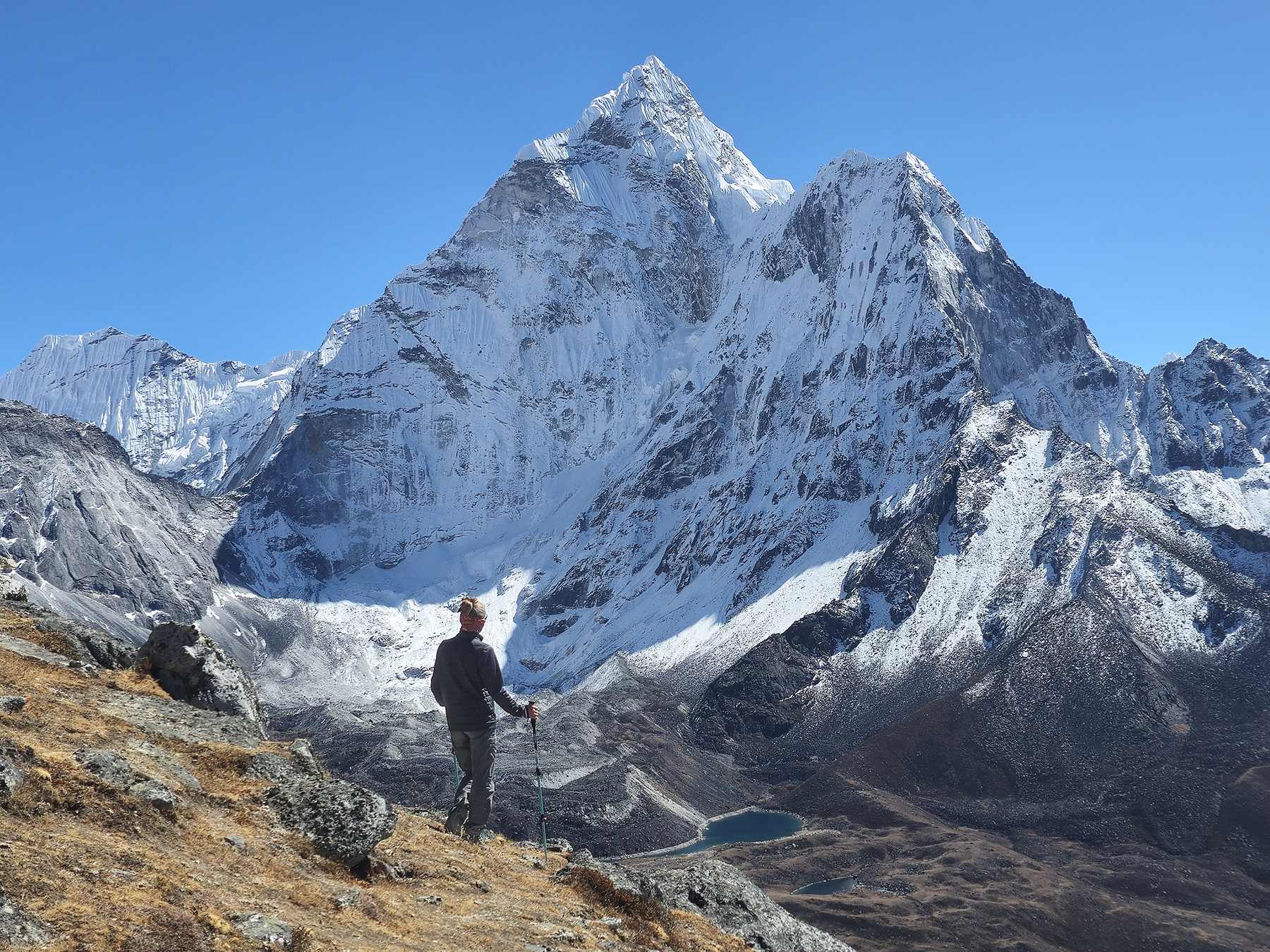
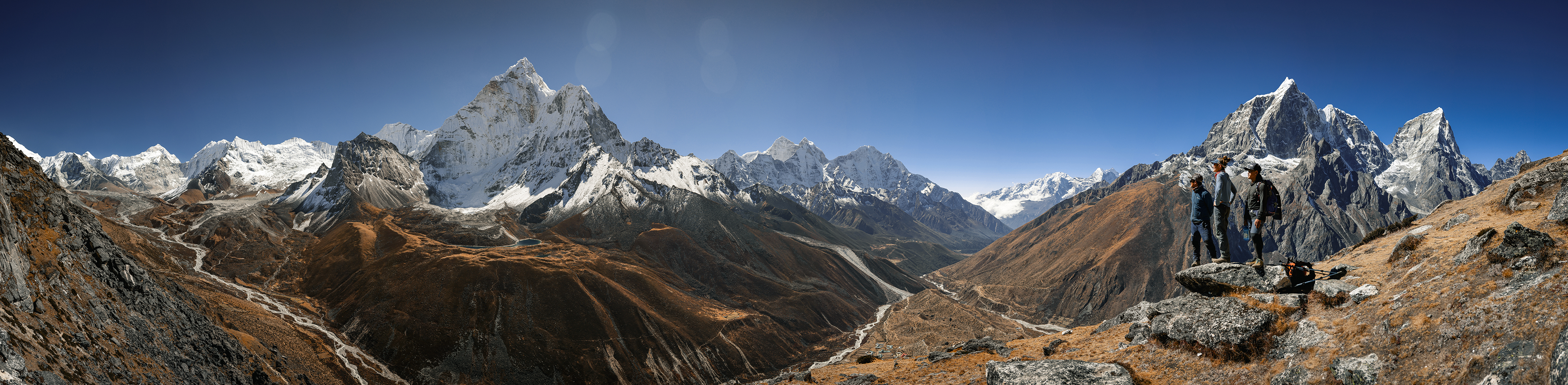
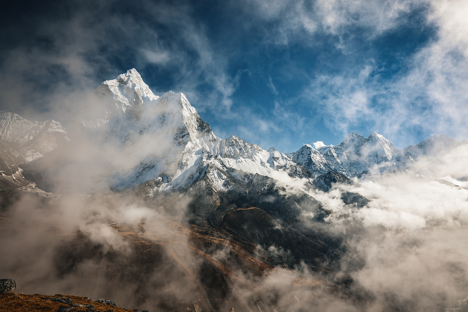

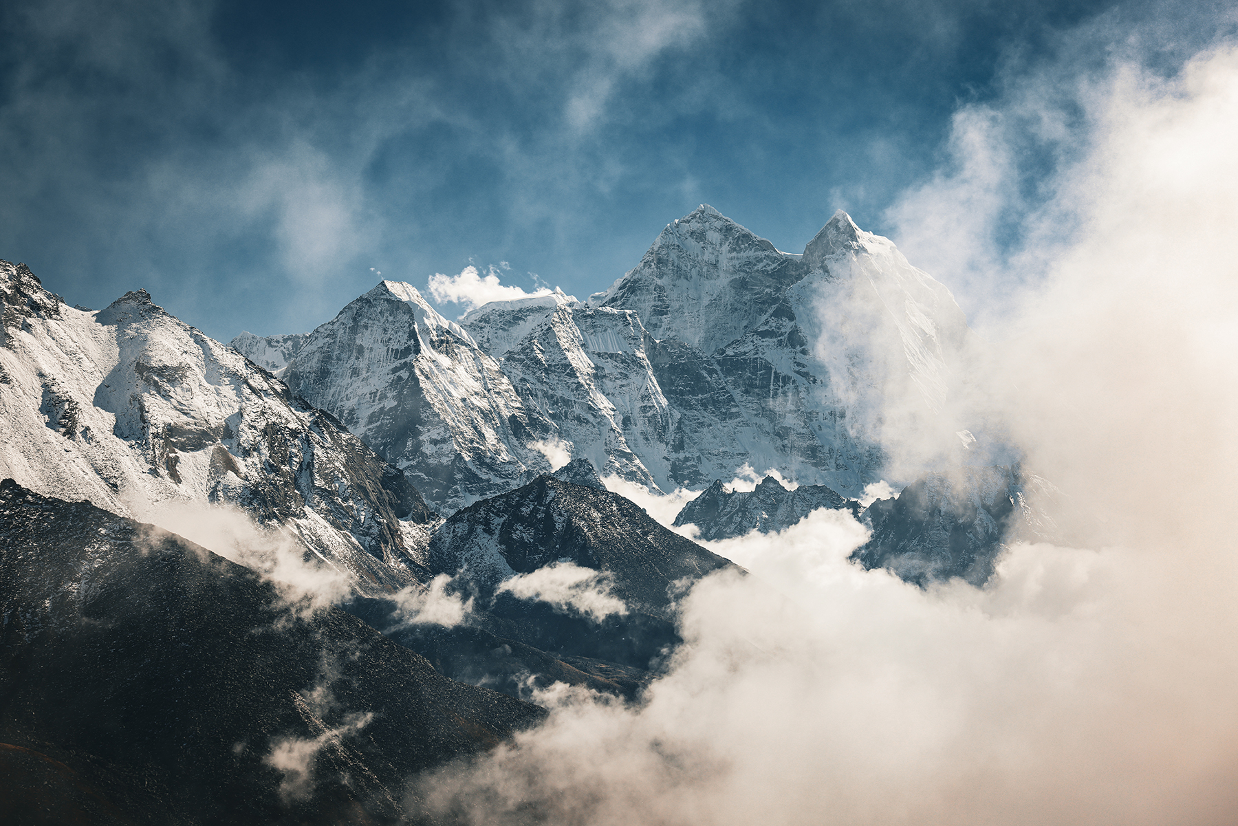

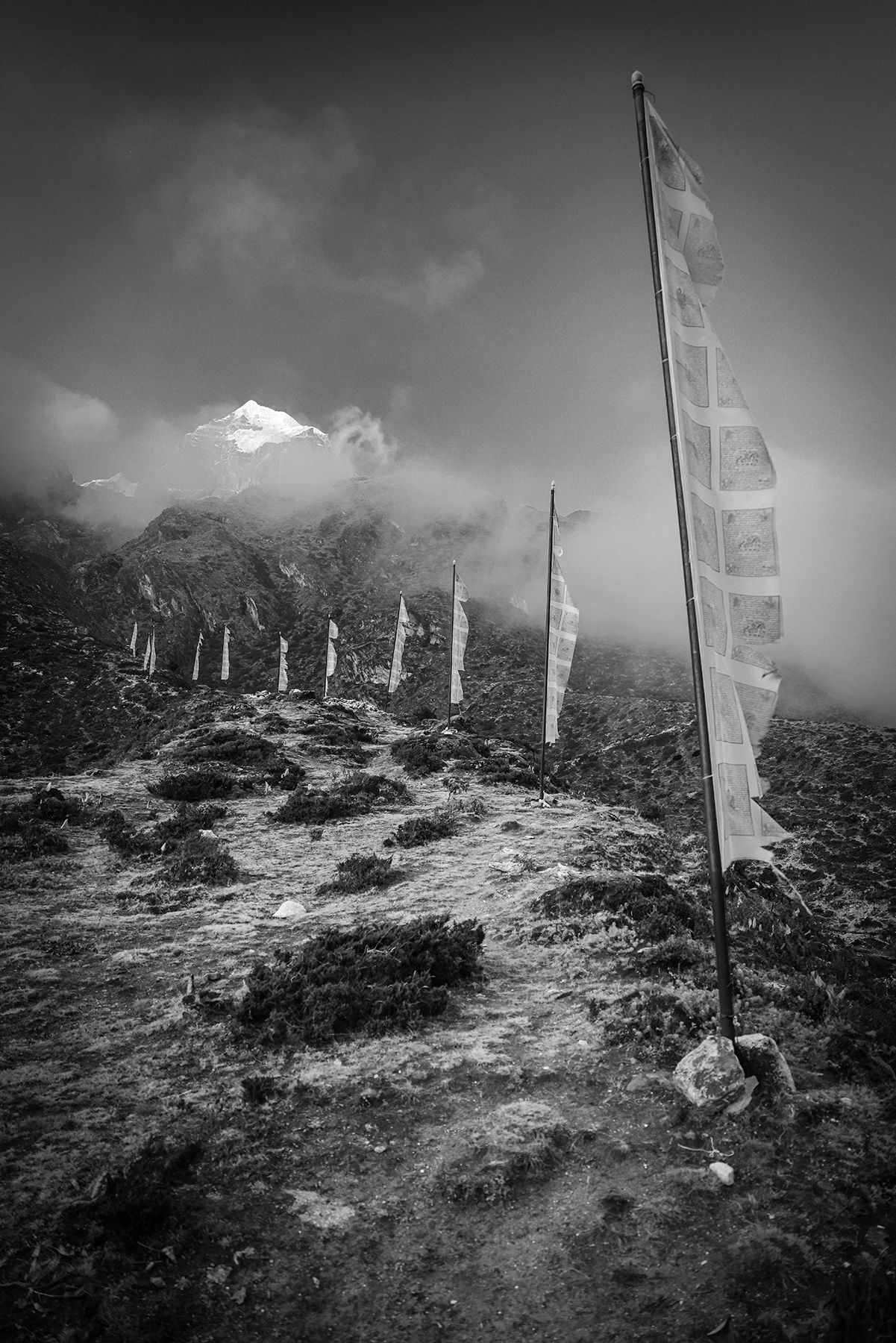
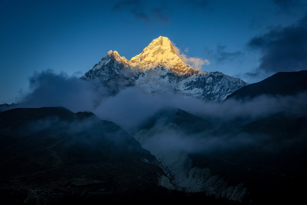
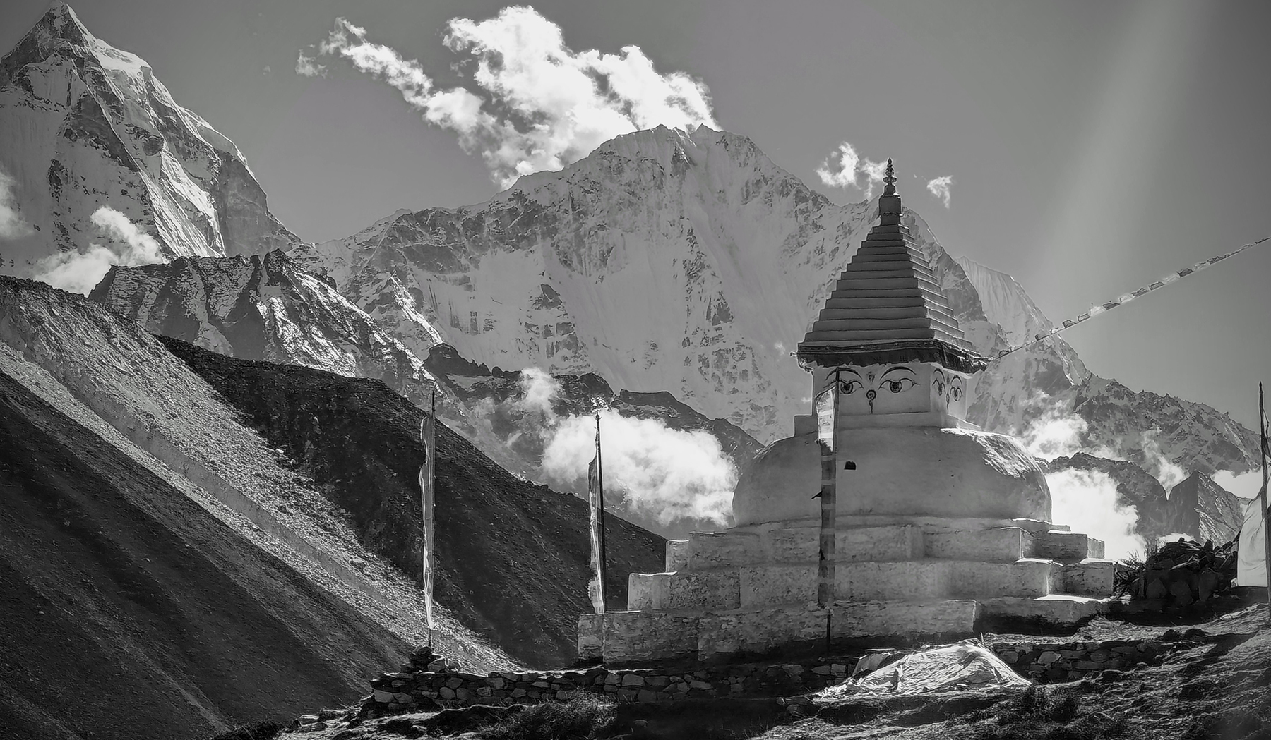
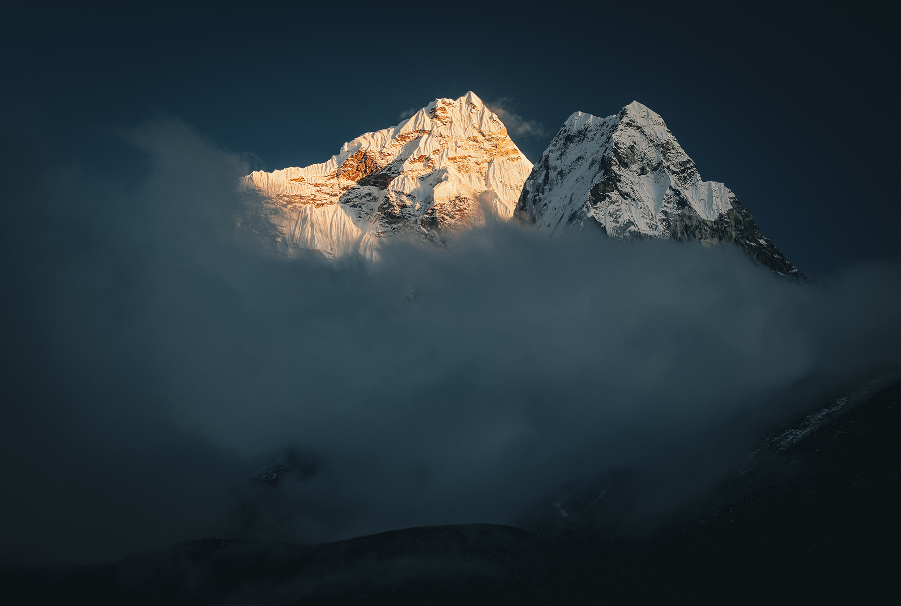
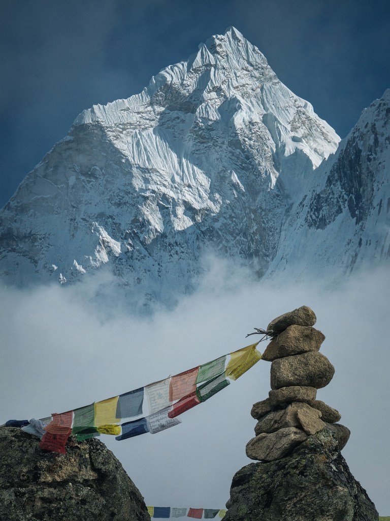
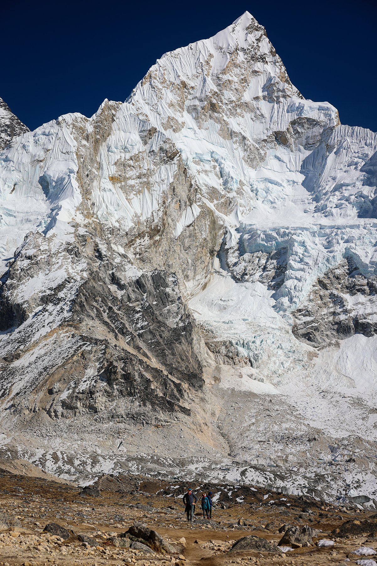
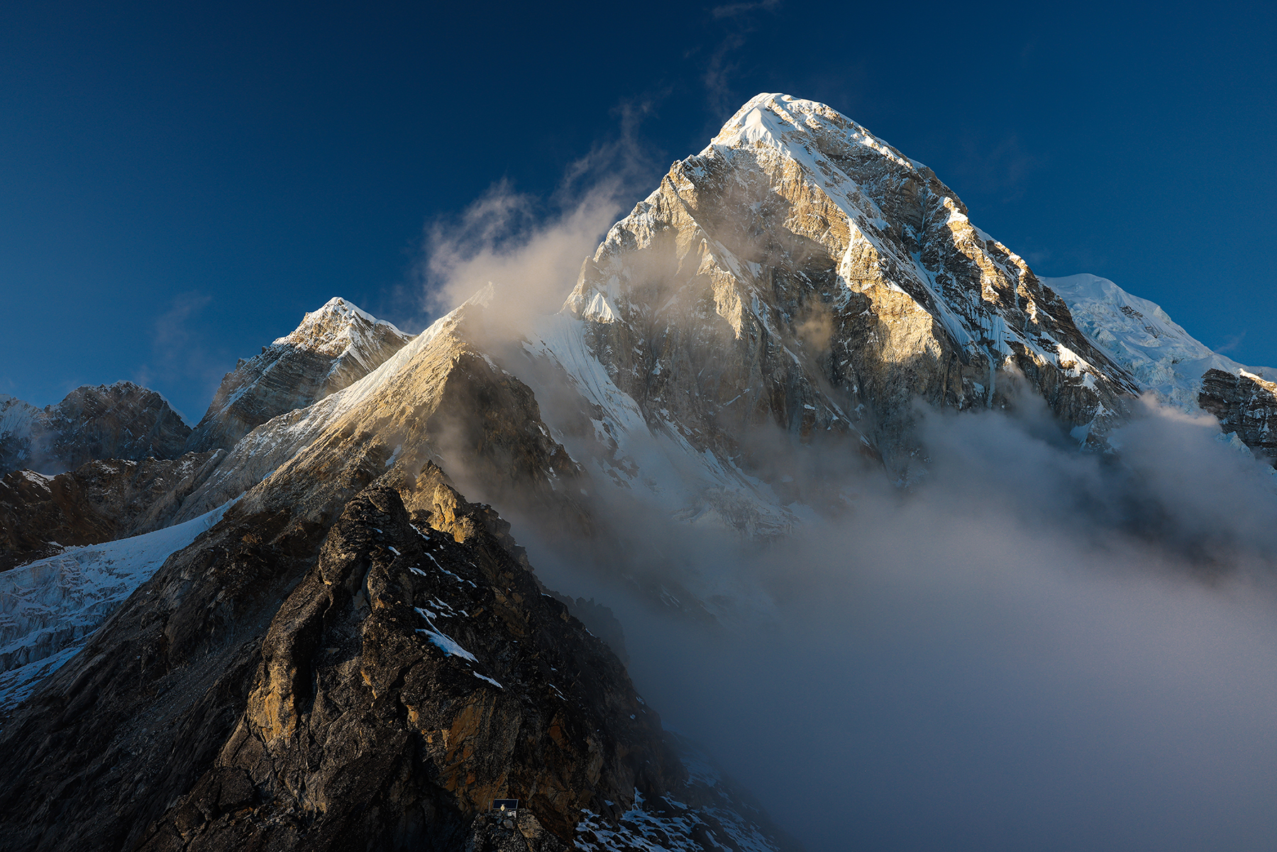
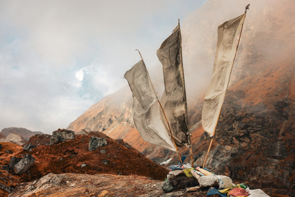
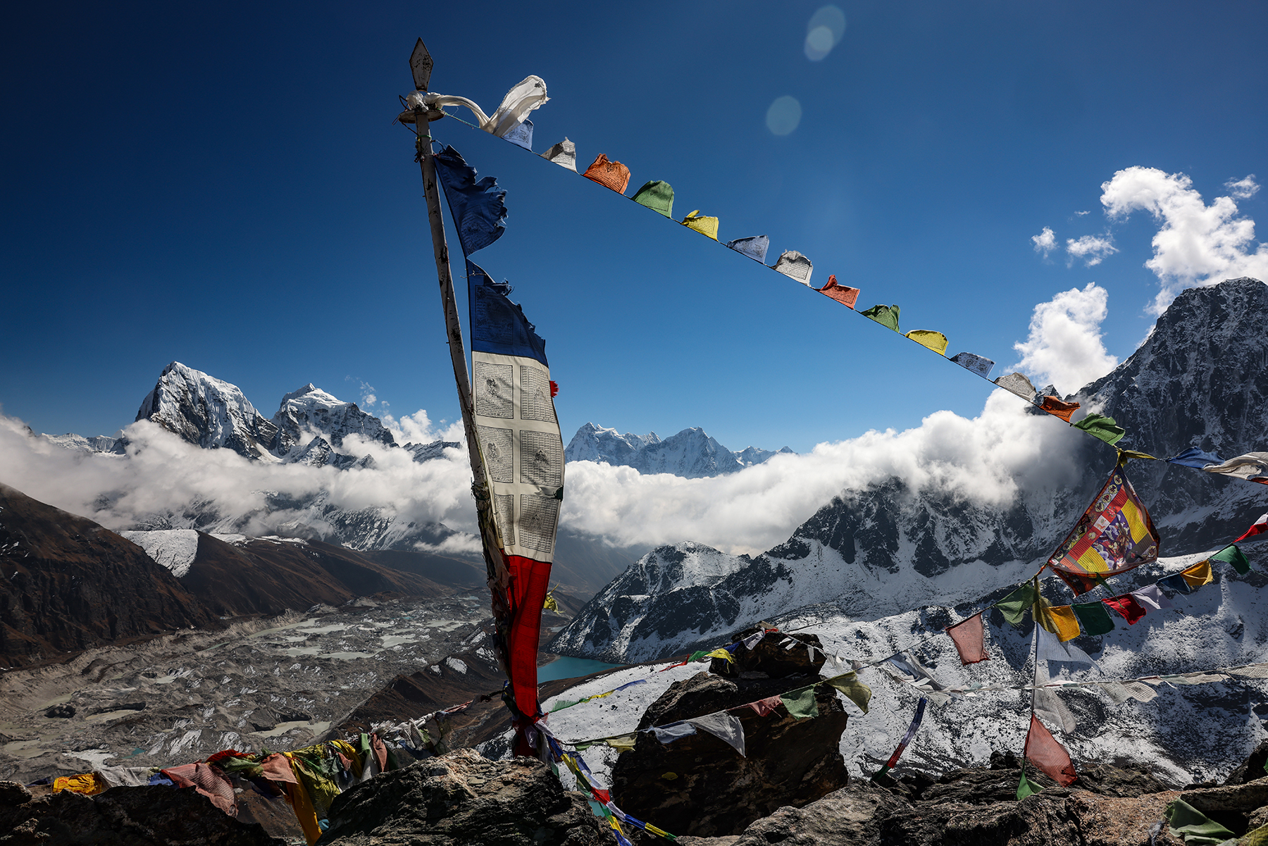
Views of Ama Dablam from the top were nothing short of spectacular. On the way back down, I decided to stick around on the ridge for some photo taking while Sonya descended with BBC and Indra. I spent an incredible couple of hours watching the swirling clouds move up the valley, slowly swallowing up the peaks in a layer of mist. A peaceful afternoon, allowing me the chance to do nothing much but feel the warmth of the sun and listen to the breeze as I took in the views. As the sun was going down I headed back down into the clouds, and stopped briefly to photograph a stunning scene of Ama Dablam emerging from the mist behind a small cairn and some prayer flags – one of my favorite images of the trip thus far.
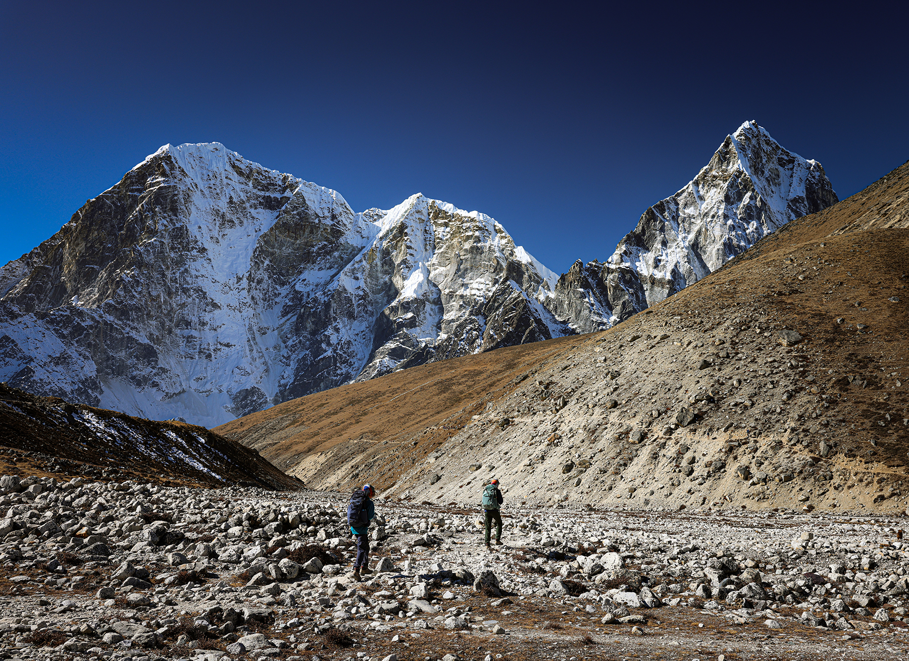
Day 11! Dingboche (14,470 feet) to Lobuche (16,210 feet)
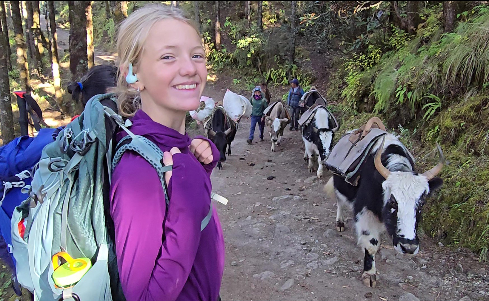
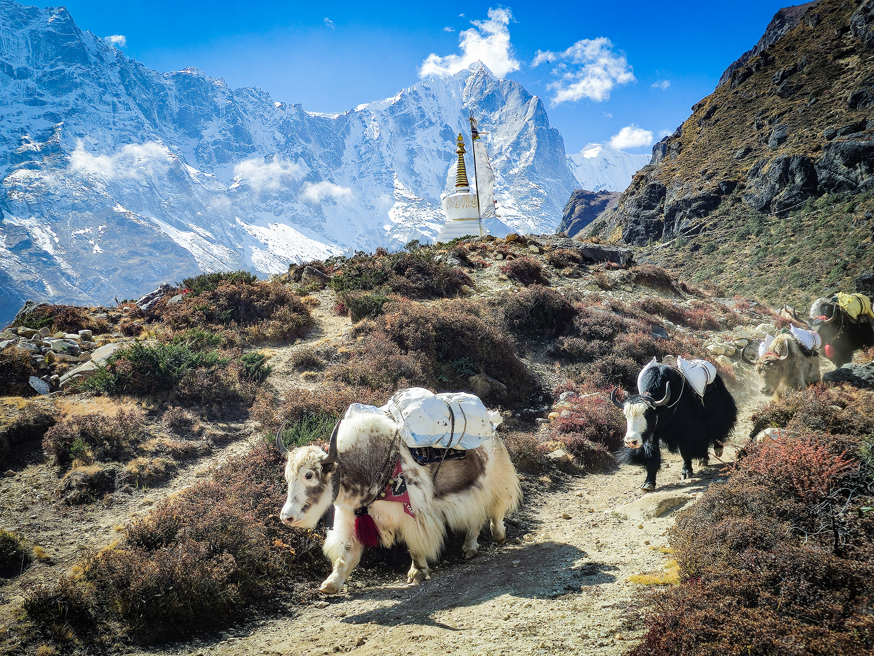
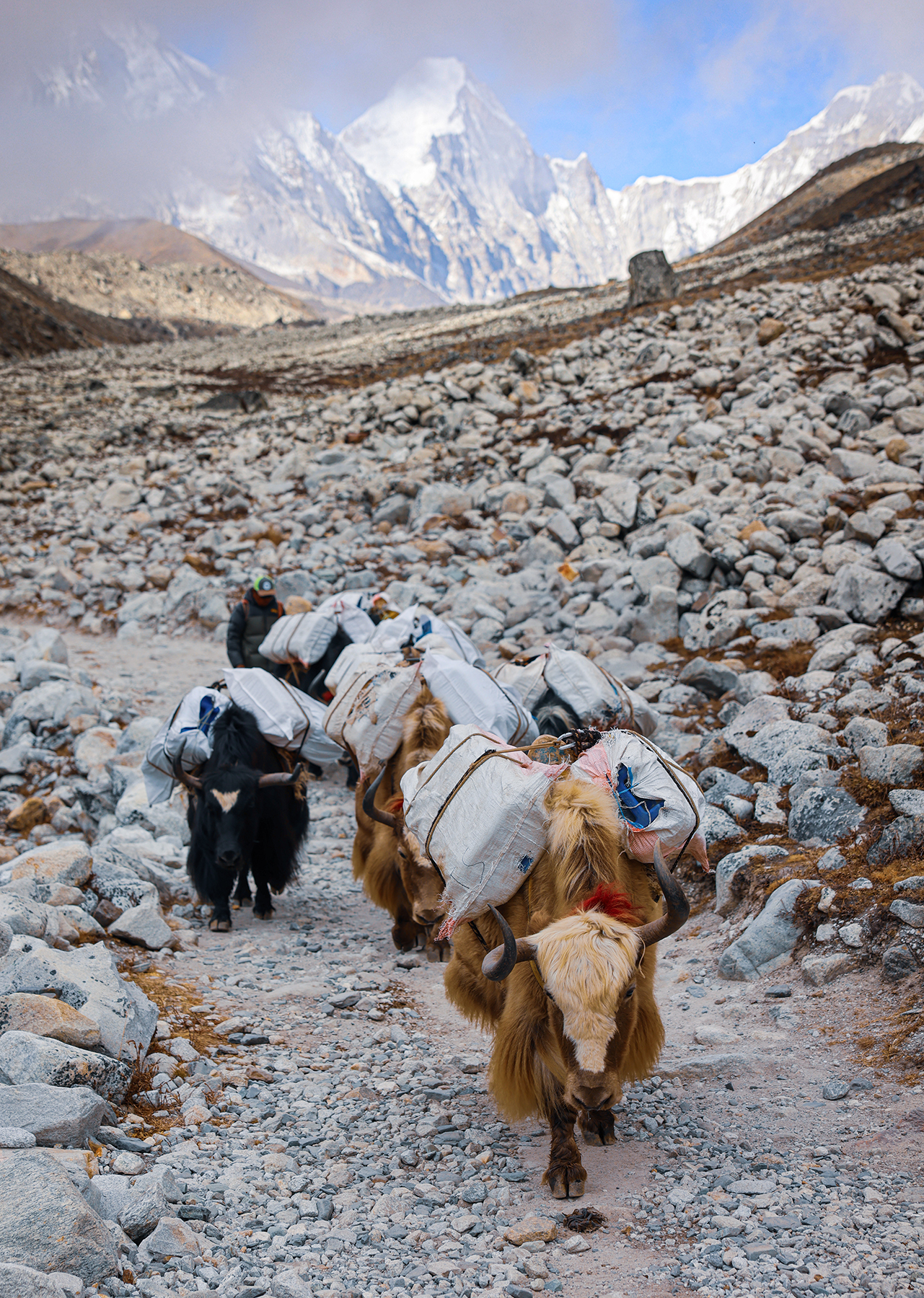
Disaster strikes! One challenge of the EBC trek is supplying the teahouses with food, fuel, and other necessities, as there is no road access to Lukla. Everything either needs to be flown in (incredibly expensive), or carried in by porters, horses, or yaks. This makes food safety very difficult, as most everything consumed has been unrefrigerated for at a minimum three days, but often much longer. This includes meat and poultry, as Nepal does not allow the slaughter of animals within the boundaries of Sagarmatha National Park. As such, many trekkers choose to follow a vegetarian diet while on the trek, as our family chose to do. That is, until poor MB saw the chicken sandwich offered in the cozy cafe in Dingboche. Sonya tried to warn her that just because the restaurant looks fancy and polished, it does not mean that the food is any safer to eat. Despite this warning, MB is thirteen and therefore periodically immune from parental advice.
This chicken sandwich nearly ended our trek. MB spent the night vomiting, and was feeling quite miserable by the time our morning got started. We considered waiting in Dingboche for another day, but MB decided she was willing to give the hike a try. We planned to shorten our hike for the day and stop in Thukla, a tiny village about halfway to our original destination at Lobuche.


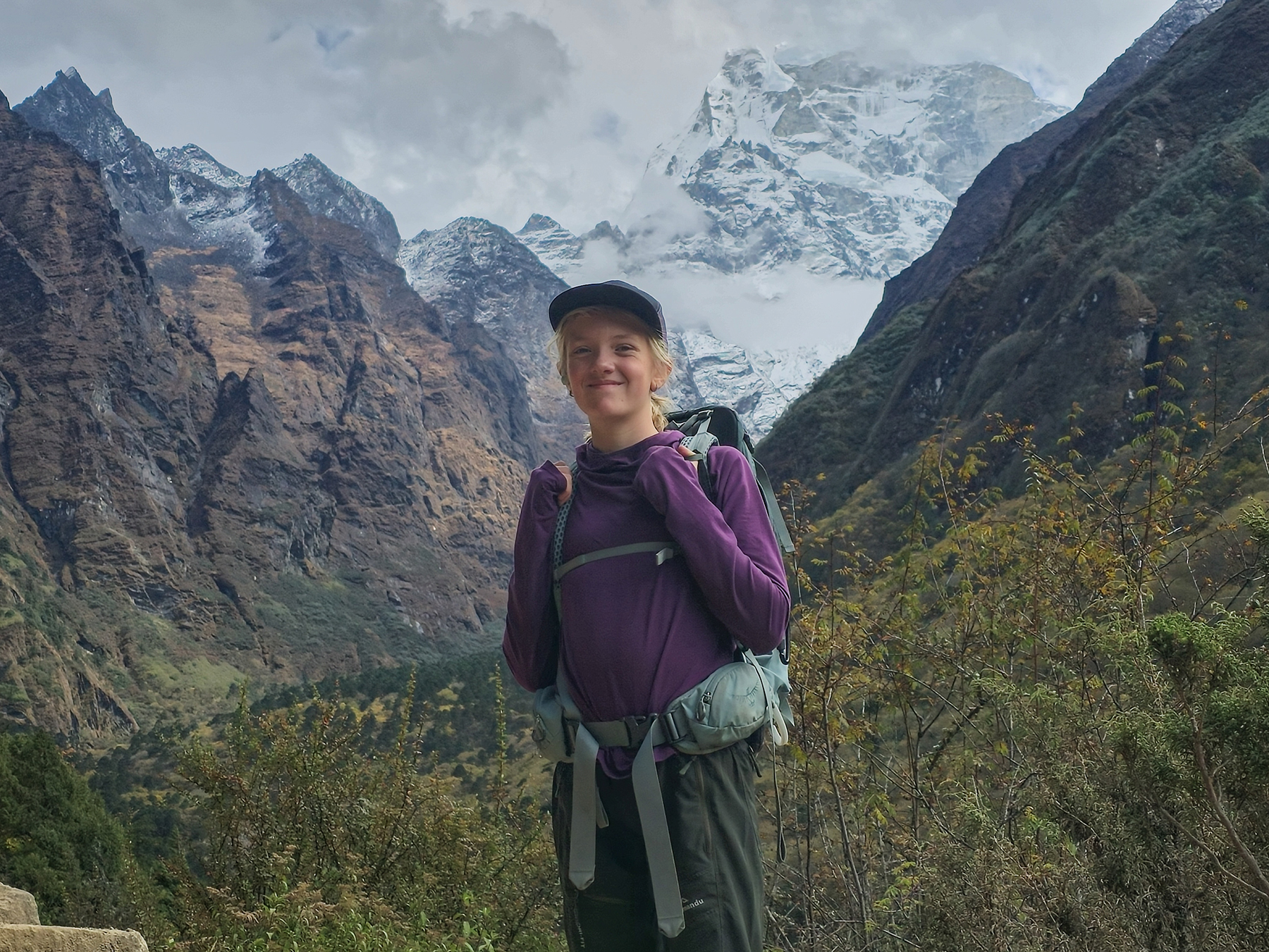
One of our goals for our sabbatical year is to teach our kiddos that with determination they can accomplish difficult goals. The Everest Base Camp trek is among the most difficult endeavors our kiddos have yet attempted, and we are so proud of the character building they have achieved through their hard work thus far. That being said, MB’s trek on this day will go down in Silleck history as the day she decided to build all of the character in one go. So much character. She felt good enough at lunch to press on, all the way to our planned goal of Lobuche, keeping the trek on pace and our dreams of reaching EBC as a family still intact. Hiking at 16,000 feet is a challenge even when you’re feeling good, so to do so when not feeling your best (and while 13, not the easiest age emotionally speaking) showed us MB’s truly amazing spirit. We held hands at times, set mini-goals of reaching the next interesting looking rock over and over, and in the end made it up over the stunningly beautiful Thuk La Pass and into Lobuche as dusk approached.

The trek for the day passed through some of the most stunningly beautiful terrain I’ve ever seen, across open yak pastures in the shadow of the Himalayan giants Taboche and Cholatse, with Ama Dablam passing into the distance at our backs. After a long look back towards Ama Dablam among dozens of memorial cairns to fallen climbers at the top of Thuk La, we made the turn towards the final stages of the route to Mt. Everest / Sagarmatha at the edge of the Khumbu glacier.


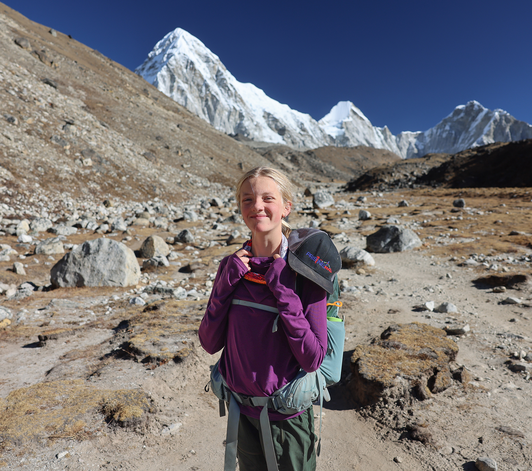
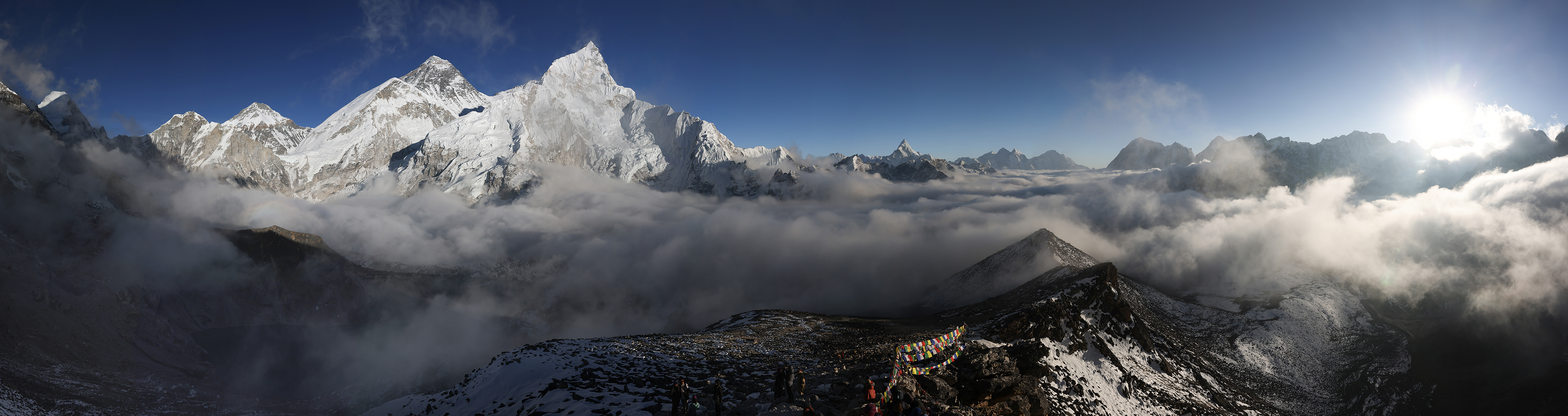
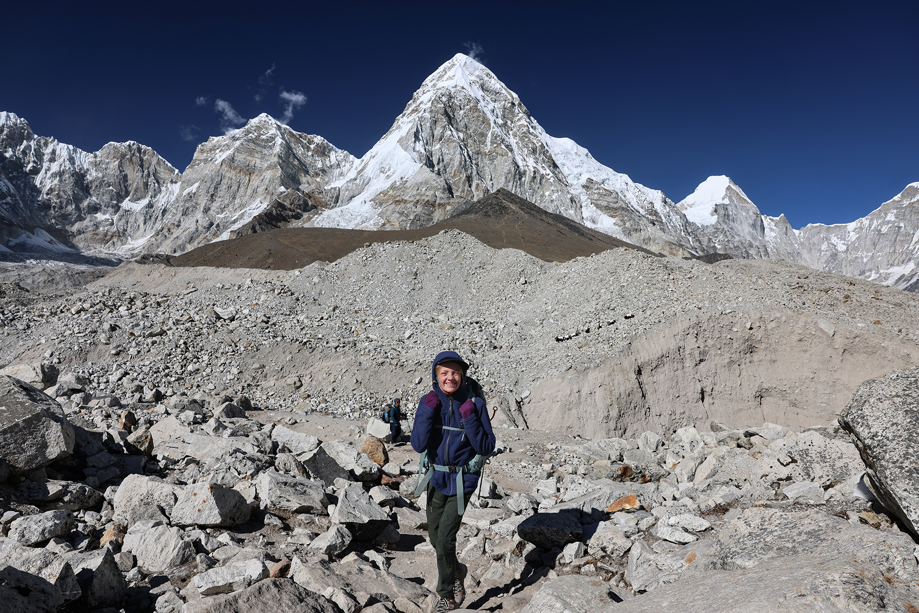
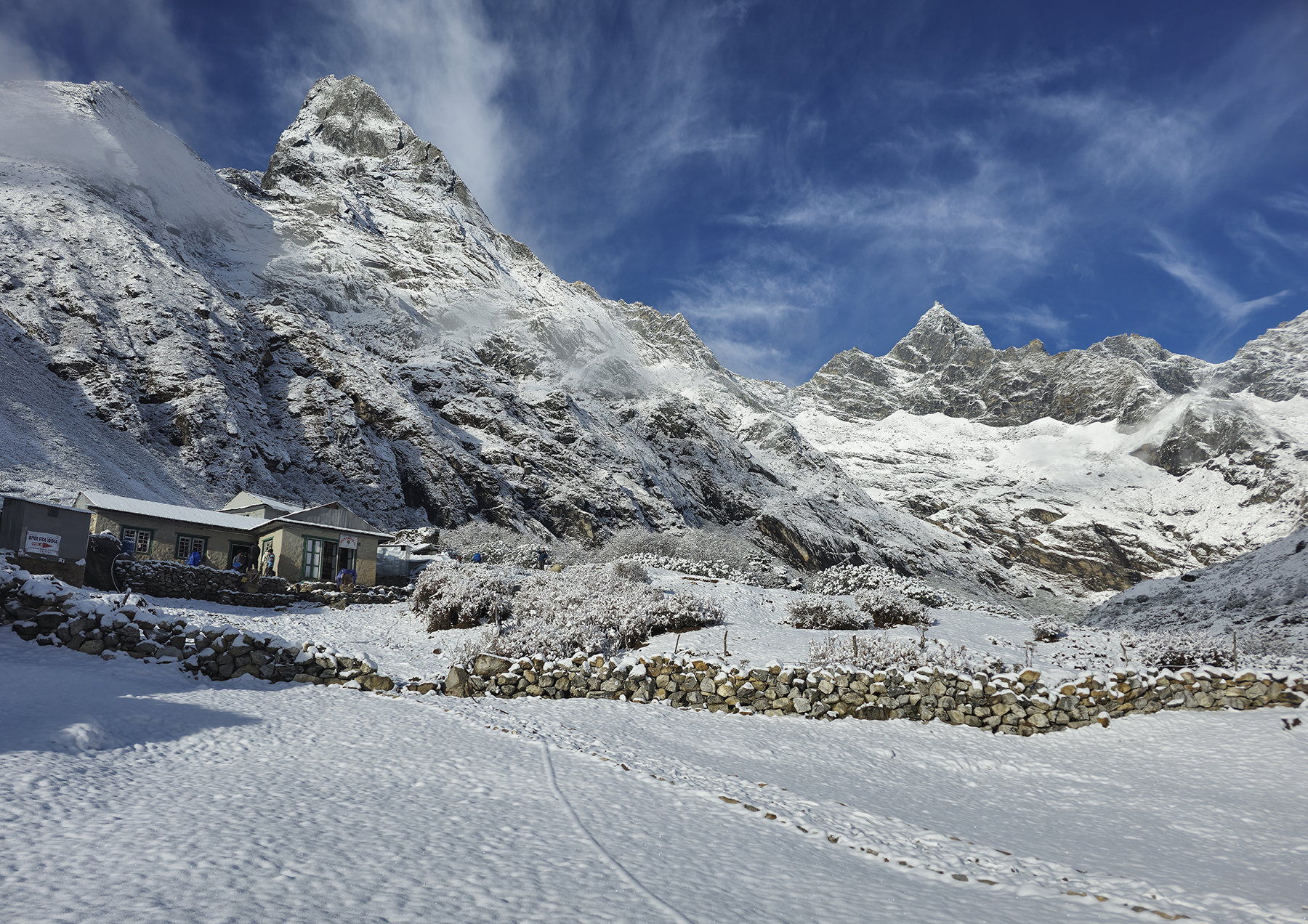
Day 12! Lobuche (16,210 feet) to Gorak Shep (16,864 feet) to Kala Patthar (18,519 feet) and back to Gorak Shep
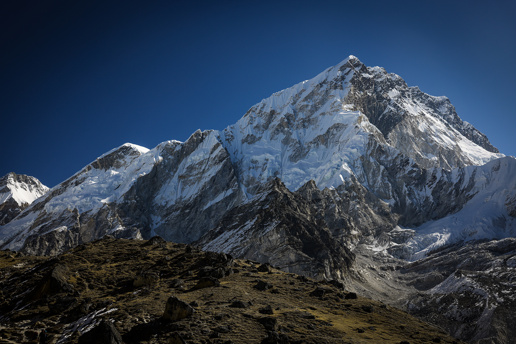
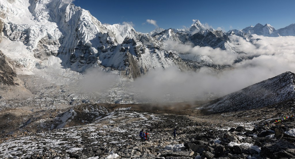
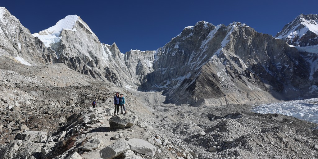
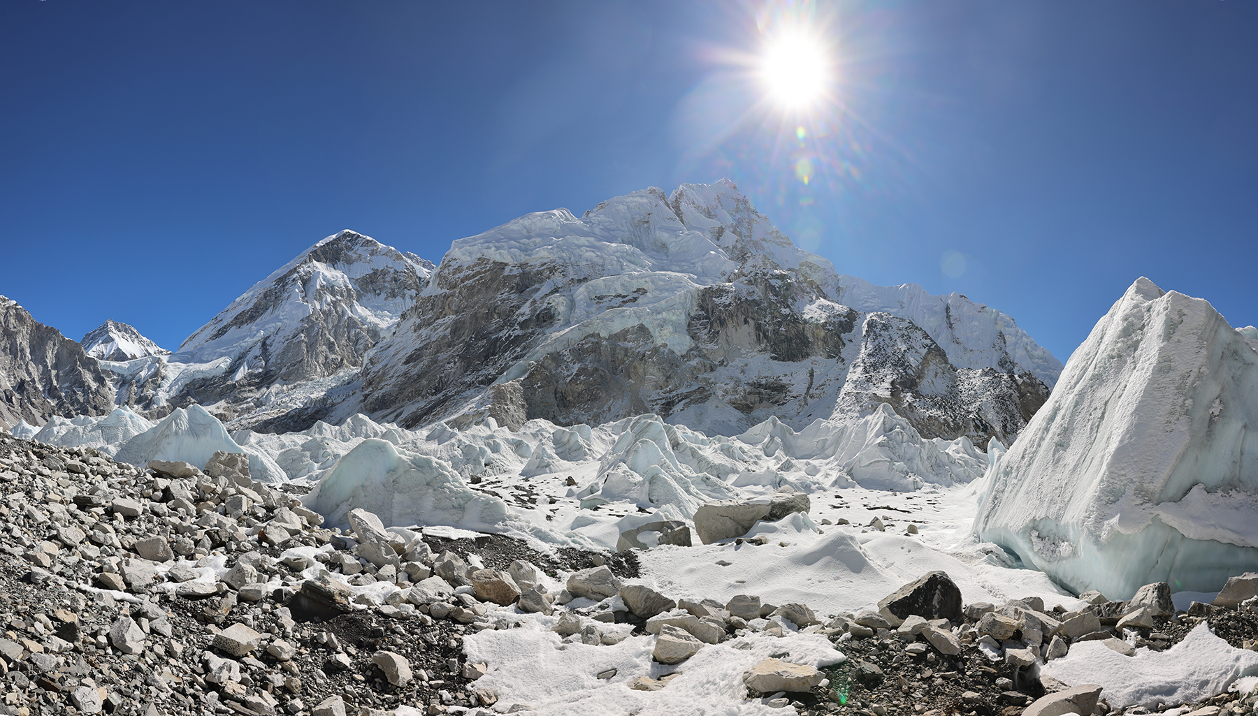
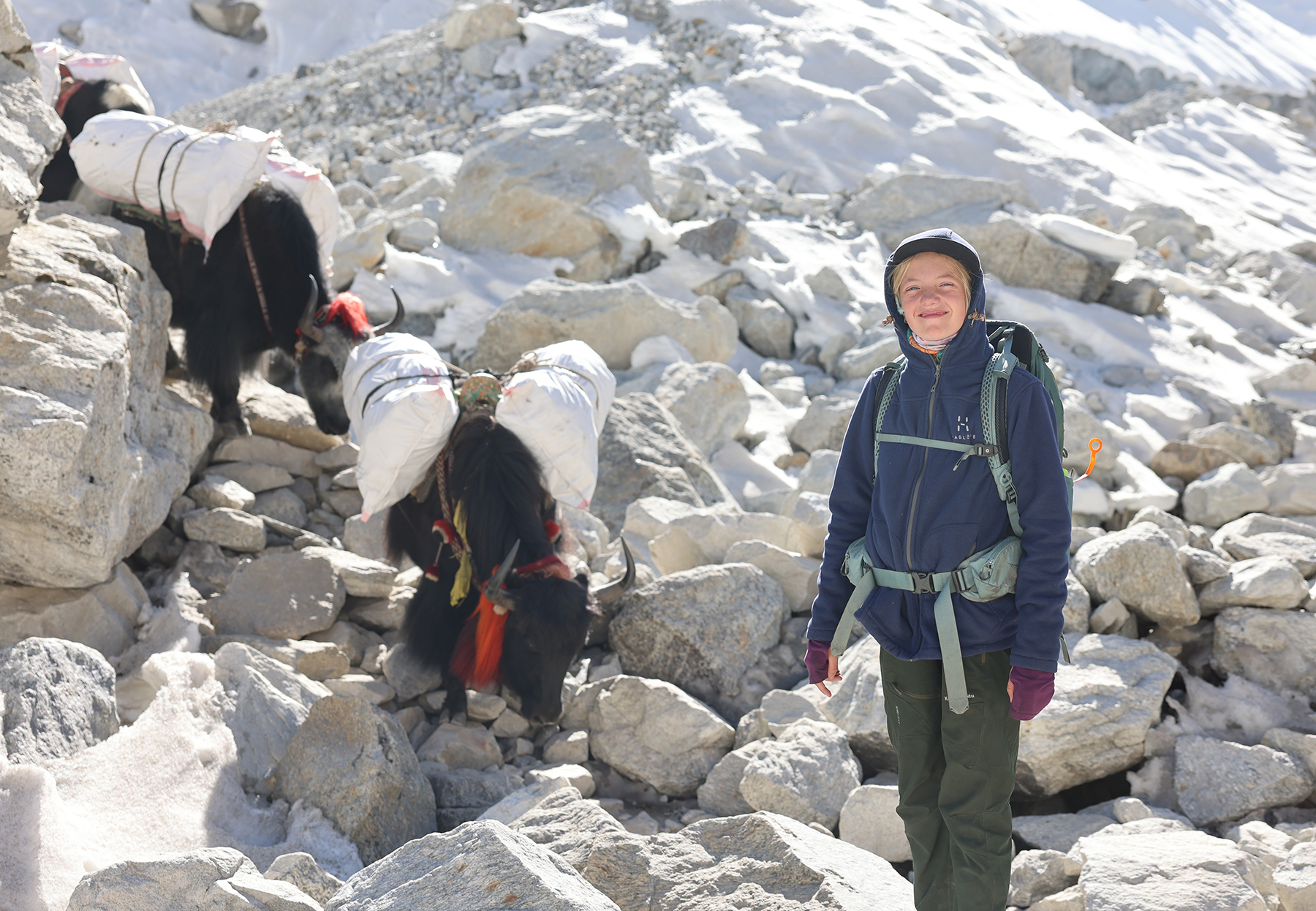
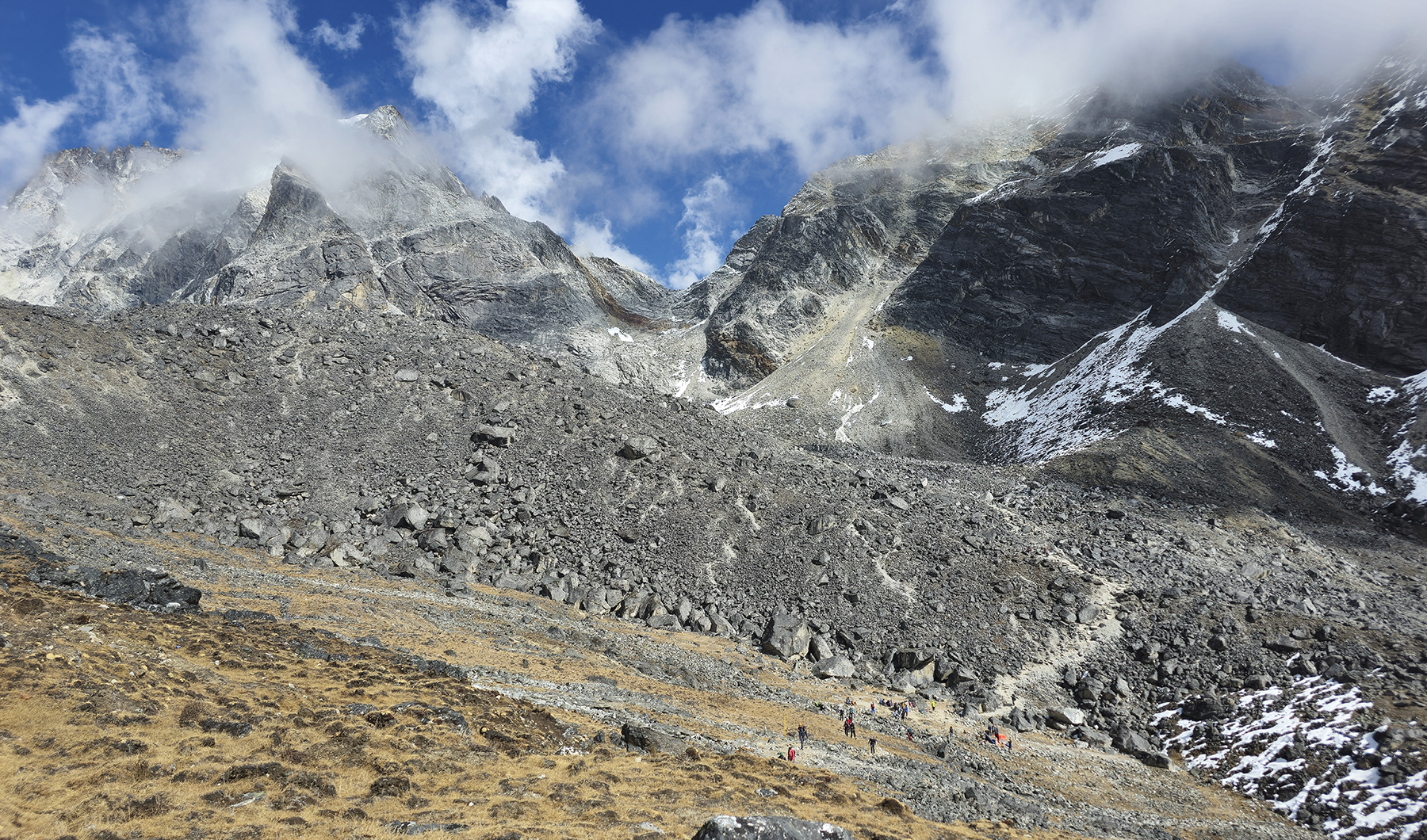
We had arrived at the day of our planned high point of the trek! MB was doing somewhat better with her food poisoning overnight, but poor H spit up last night’s dinner as well. The kiddos were otherwise in good spirits as we left Lobuche and continued on the mostly gentle path towards Gorak Shep, the final outpost on the EBC route. Making our way up beside the lateral moraine of the Khumbu glacier, we marveled at the stunning peaks around us, with icy Nuptse and the great pyramid of Pumori dominating the views. As we made our way onto the rocky snout of the Changri Shar glacier we ran into a traffic jam of trekkers along the narrow path, with yak trains passing in both directions adding to the general chaos of the trail. Despite the crowd, we made it easily into Gorak Shep before lunchtime.

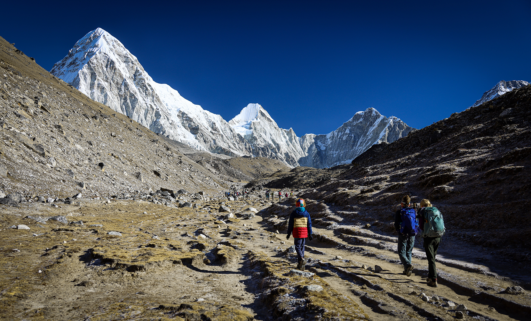


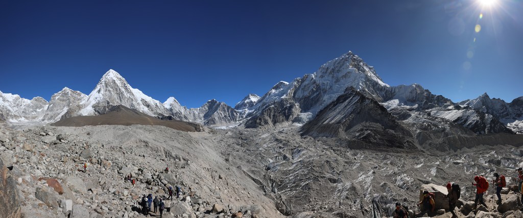
The village of Gorak Shep is situated in one of the most beautiful places on the planet, but the village itself is not at all a comfortable place to exist. High, cold, lacking running water and rudimentary in terms of sanitation, the teahouses here are in no way luxurious. What they do offer is a final rest stop before heading on to both Everest Base Camp and Kala Patthar, a high point offering a stunning panoramic view situated on a rocky ridge leading down from the upper reaches of Pumori.

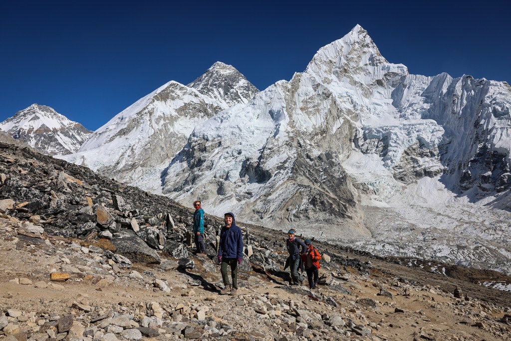
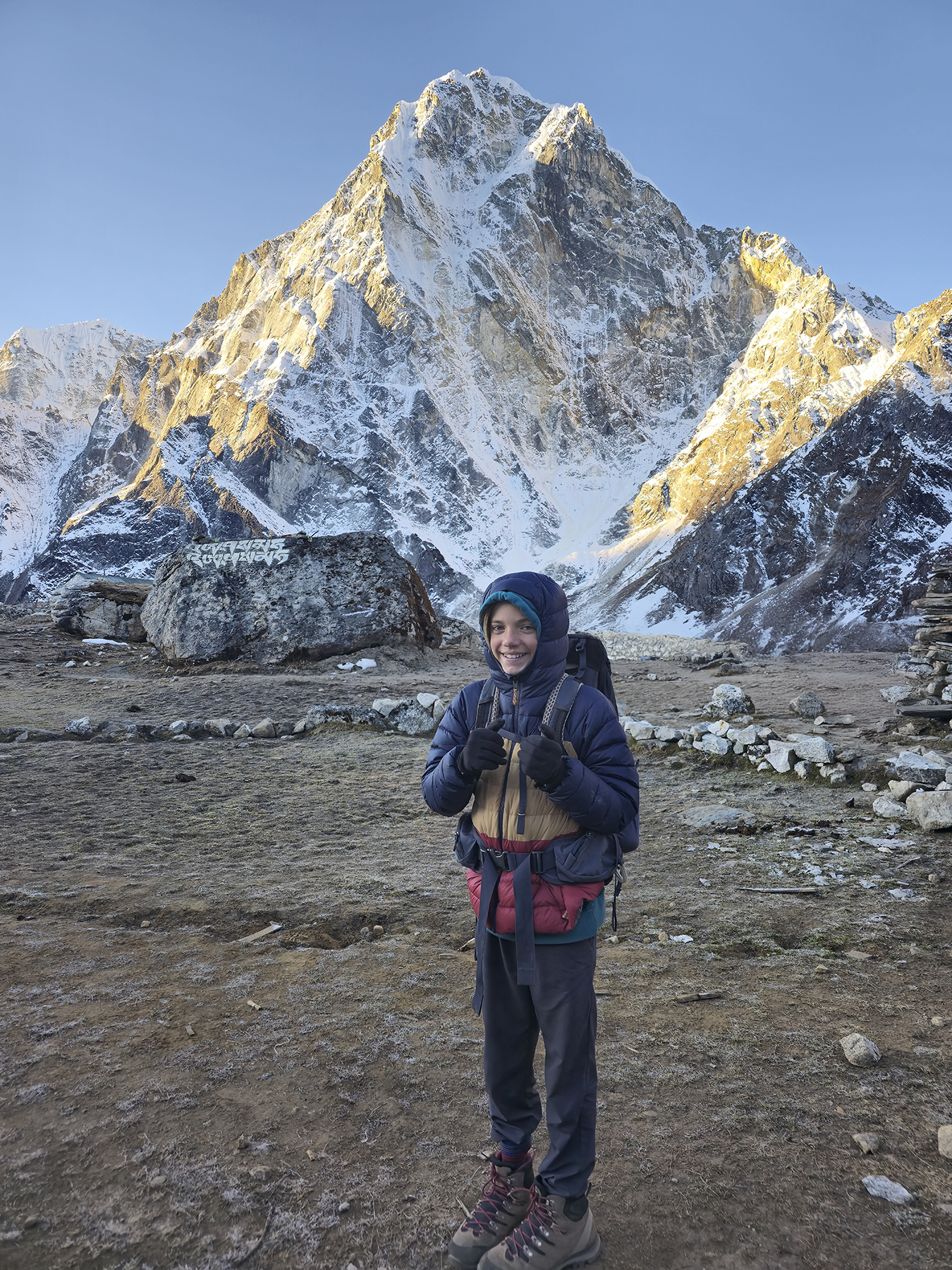
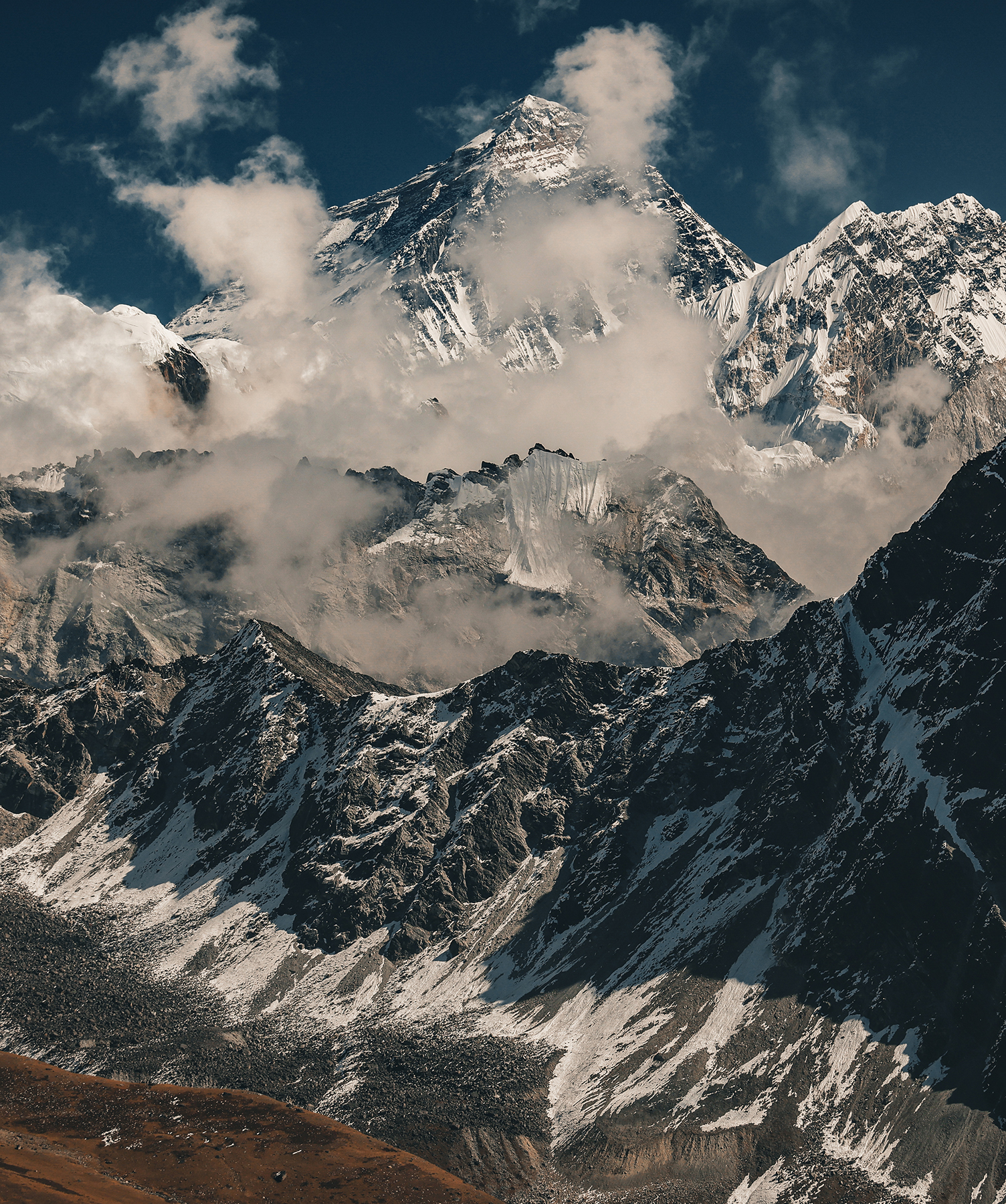
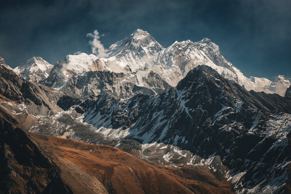
After lunch, having successfully evaded consumption of any additional chicken sandwiches, we set out with Indra and Naresh across a flat sandy expanse towards the Kala Patthar trail. After this brief introduction we began the steep hike, taking care to move slowly and breath deeply in the thin air. In many ways the hike up Kala Patthar is like a number of Colorado 14ers the kiddos have hiked – it is not a difficult ascent apart from the effects of the altitude. After a short time hiking, Mt. Everest began to reveal itself, poking out from behind the jagged, icy ridges of Nuptse. With each step the view became more spectacular, and soon in the far off distance the snowy pyramid of Ama Dablam again became visible.


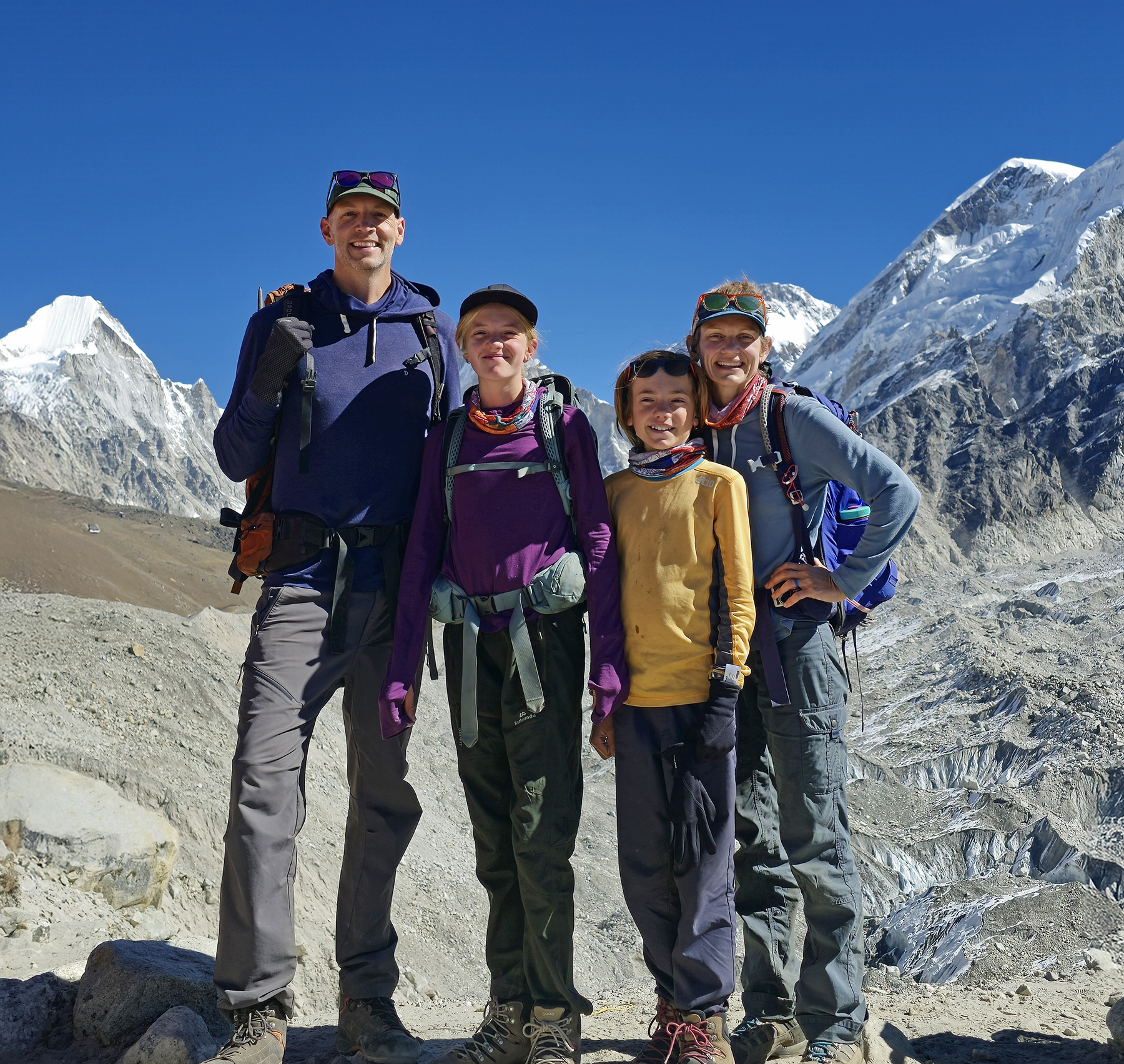
We made steady progress upwards, until at last we arrived at the high point of 18,519 feet, surrounded on all sides by the towering peaks of the Roof of the World! At this moment, among many others, we felt such joy at the determination our kiddos have shown to get here!
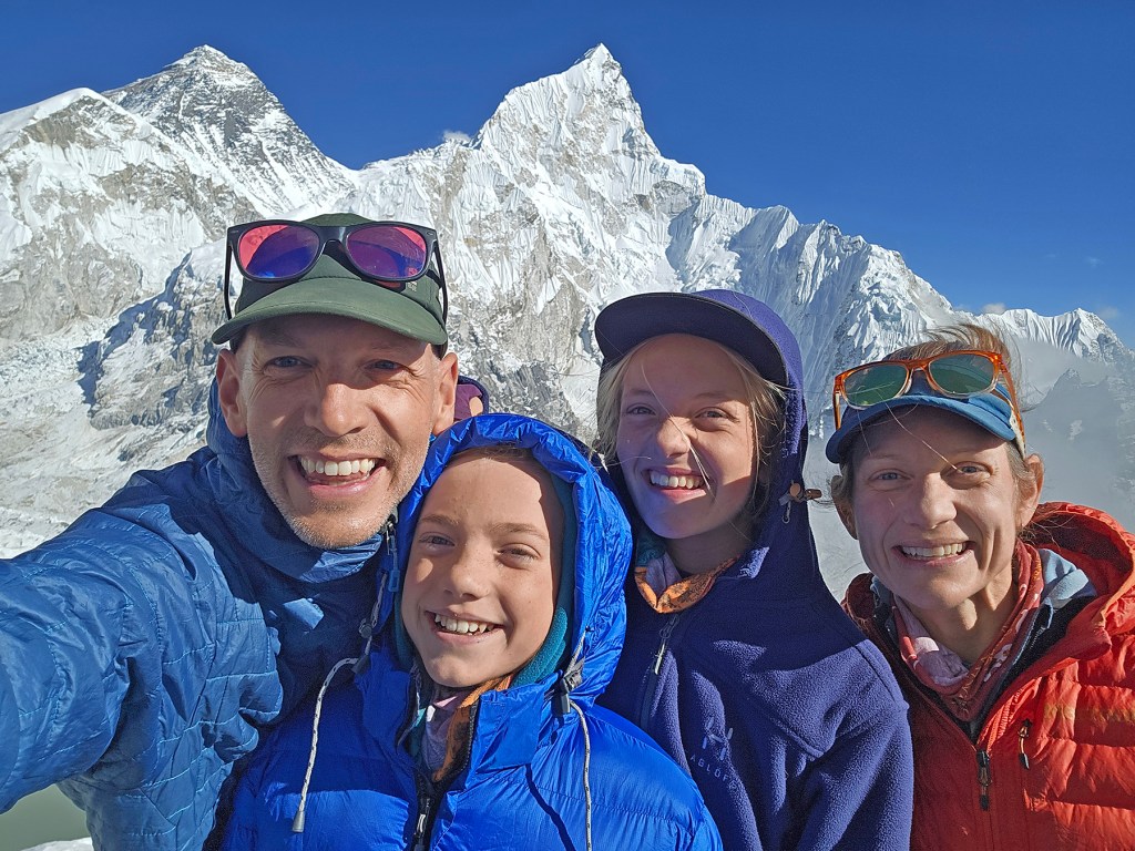


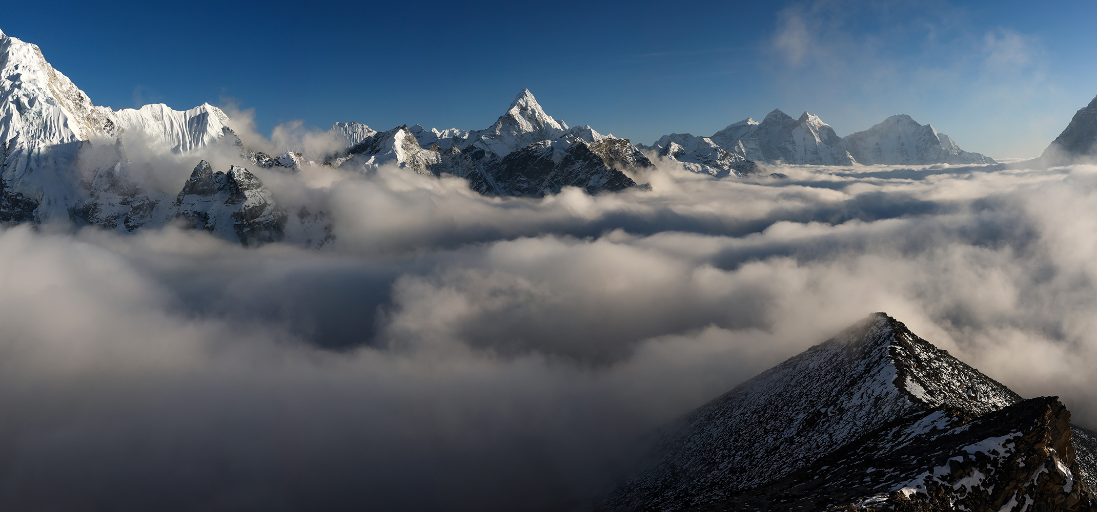
The afternoon and evening are not nearly as popular as sunrise for hiking up Kala Patthar, so we enjoyed the summit with just a small number of other trekkers. After Sonya and the kiddos had their fill of mountain vistas, they headed back down to Gorak Shep with Indra and Naresh, while I remained behind at the summit to wait for sunset. I thoroughly enjoyed the quiet opportunity to rest on the summit, gathering sunshine and listening to the rockfall and small avalanches from the face of Pumori above.
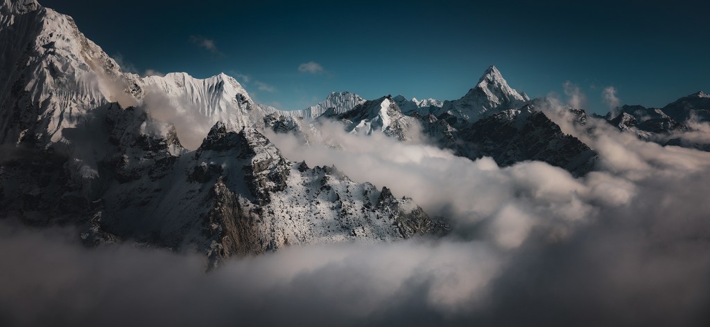
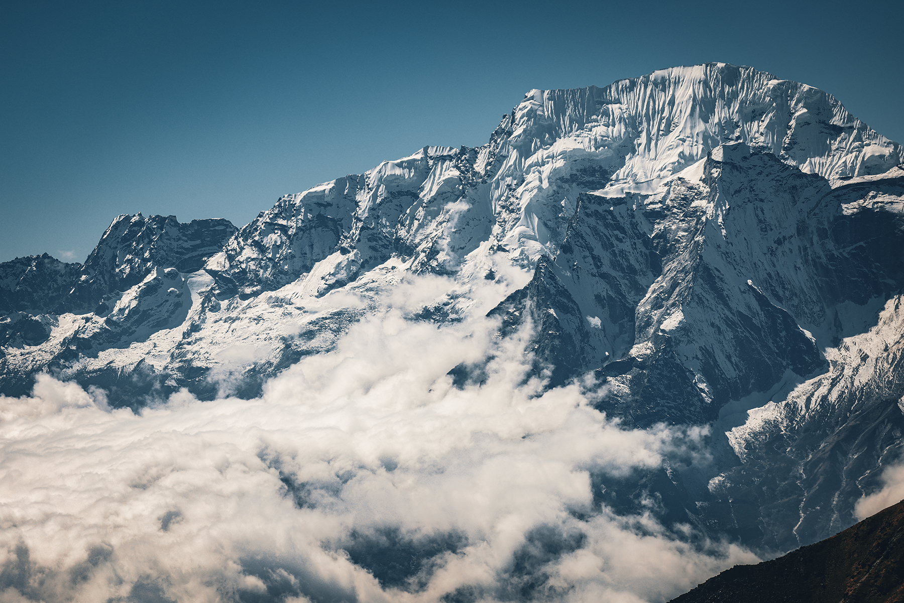
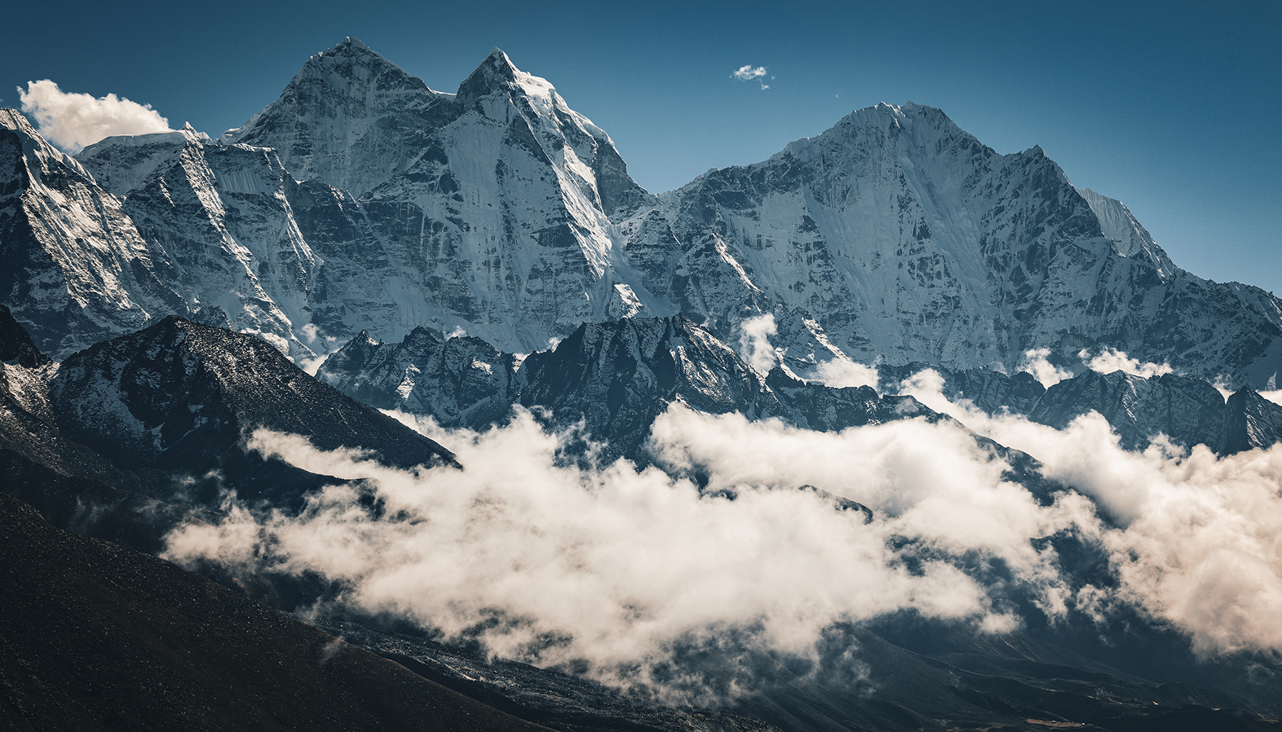
I was also thrilled to see once again the return of one of my favorite mountain phenomena – the arrival of a thick sea of clouds that slowly filled the Khumbu, leaving only the high summits poking out from below. I took roughly ten bazillion photos, only leaving the top to descend right after the last glow of light faded from the tip of Mt. Everest. I hurried back down the mountain as quickly as possible, racing the fading twilight to arrive back at Gorak Shep and rejoin my amazing wife and kiddos.


Day 13! Gorak Shep (16,864 feet) to Everest Base Camp (17,598 feet) to Lobuche (16,210 feet)
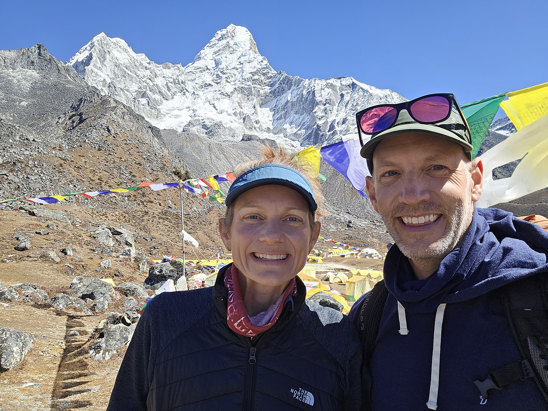
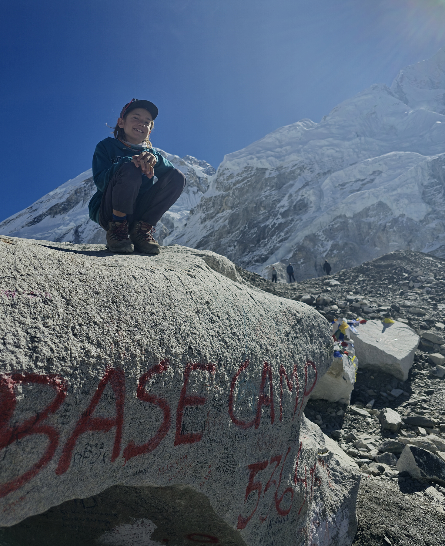
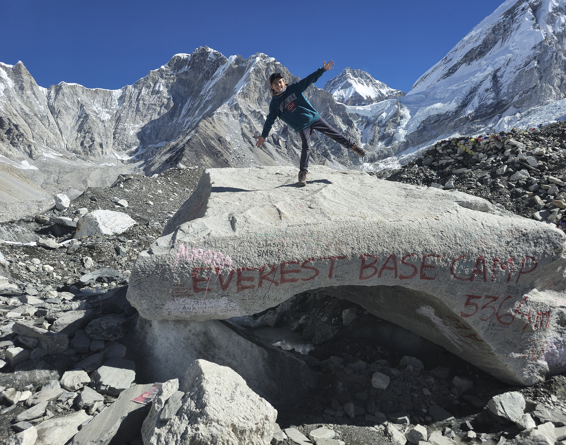
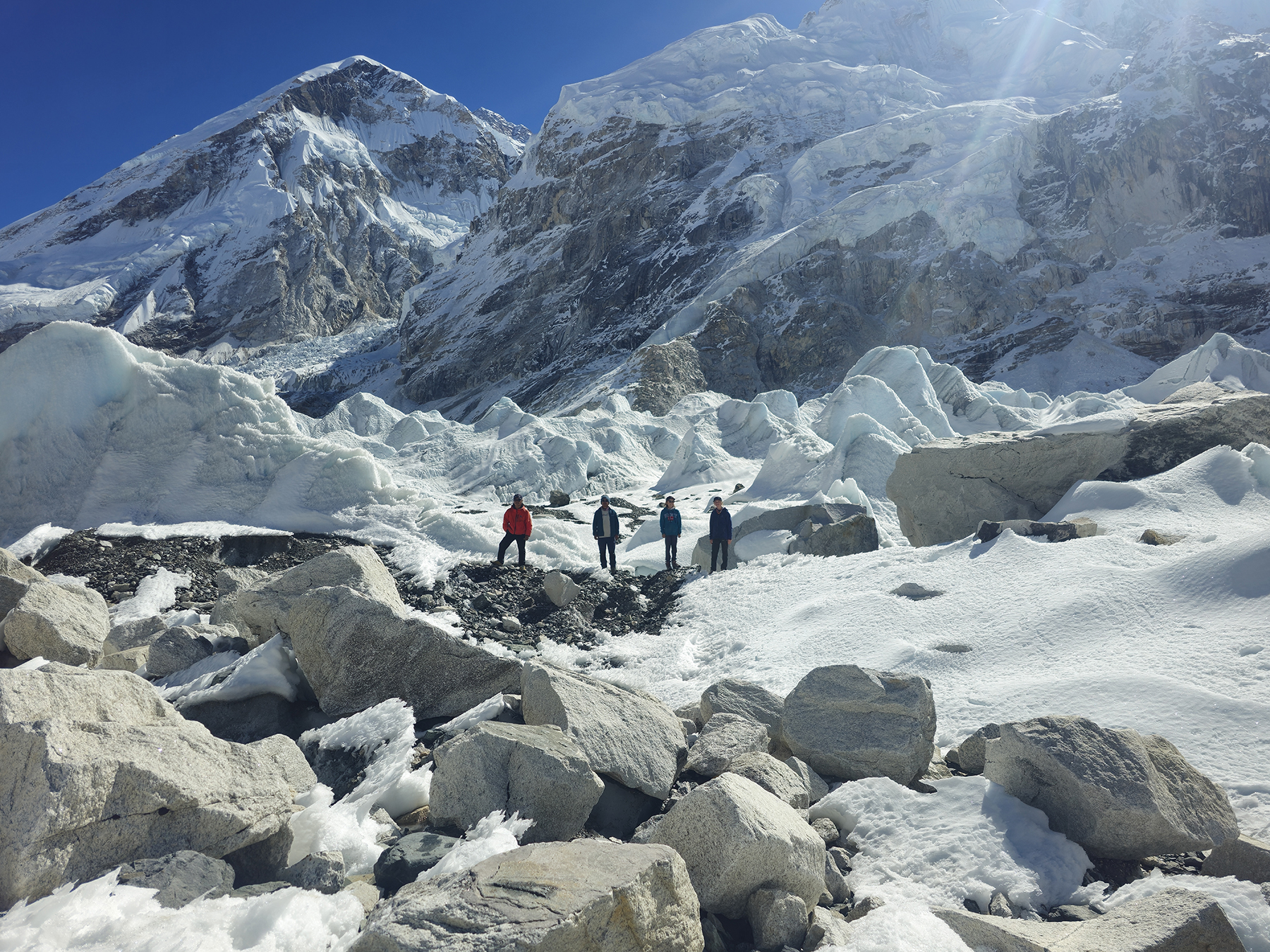
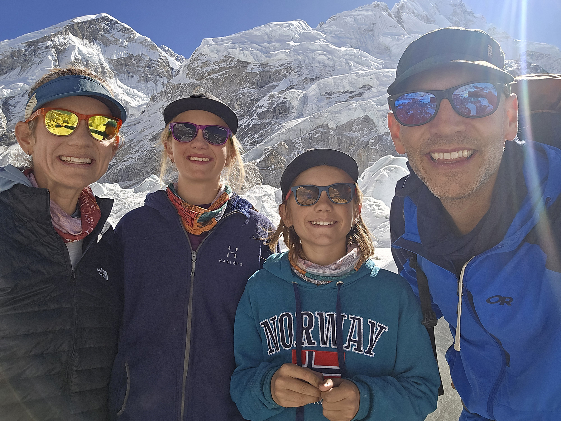
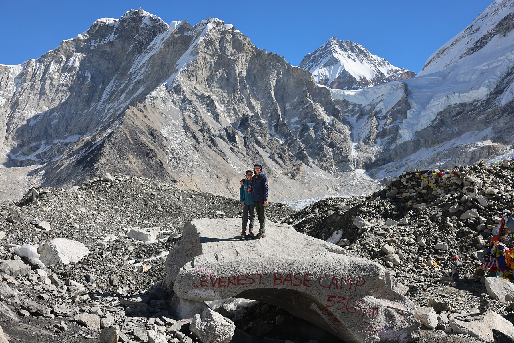
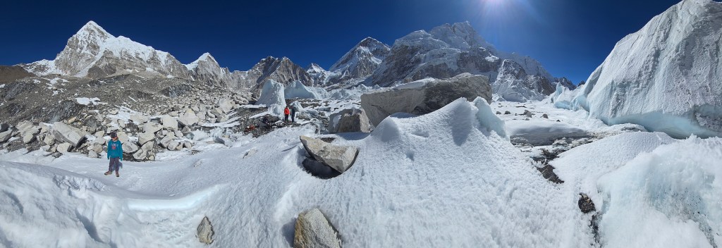
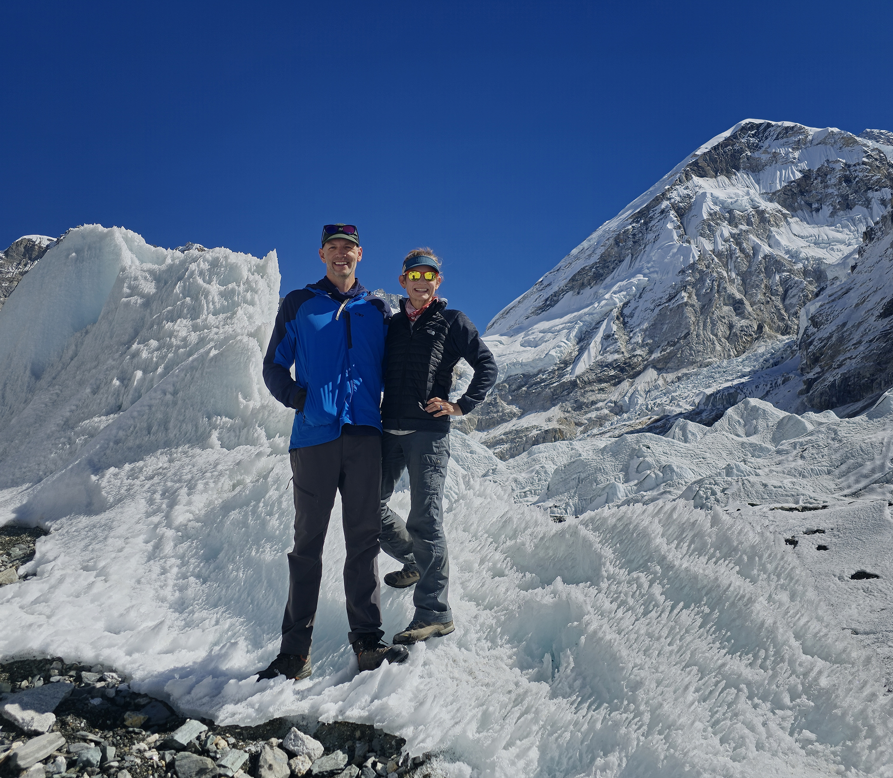
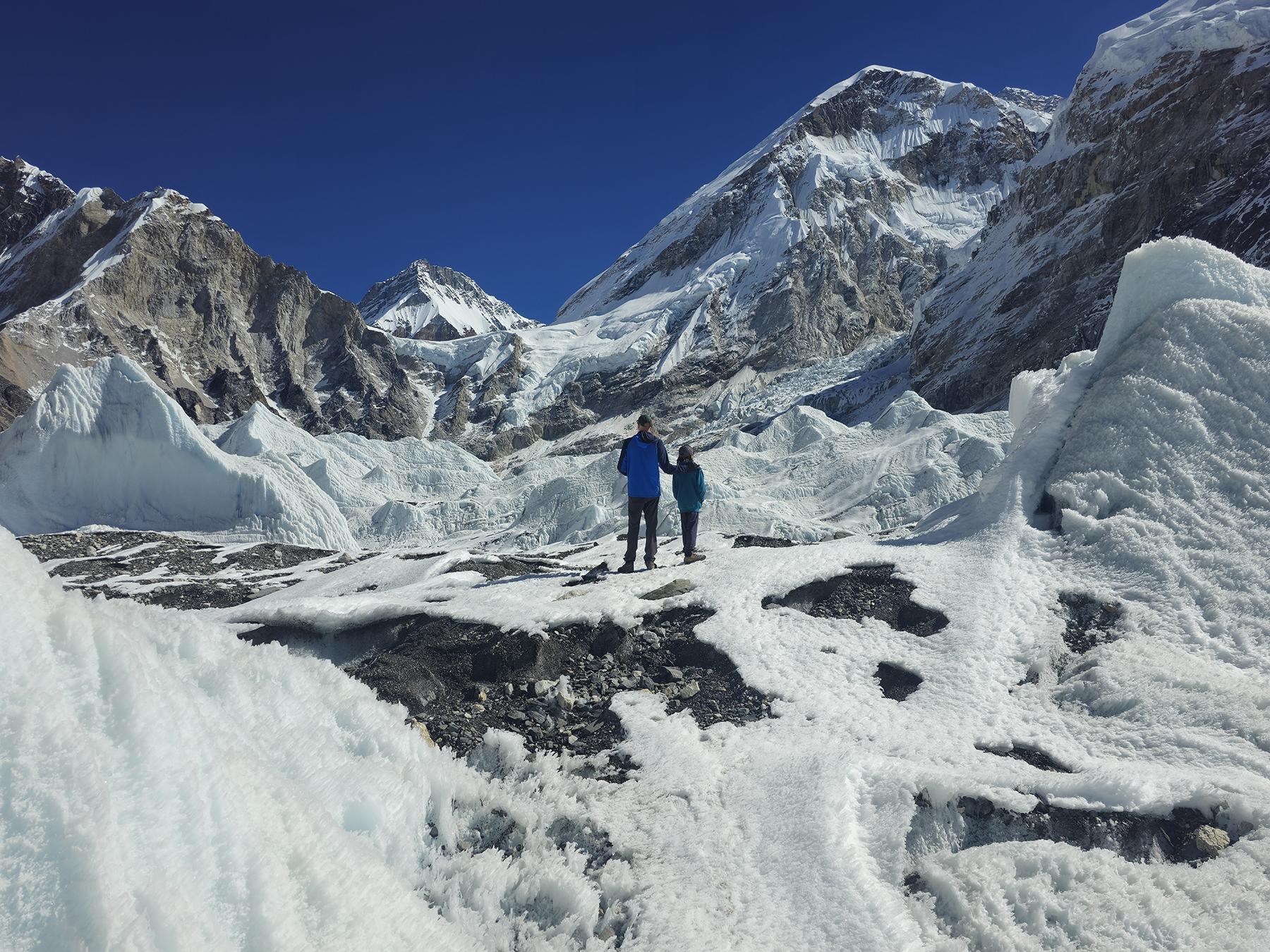
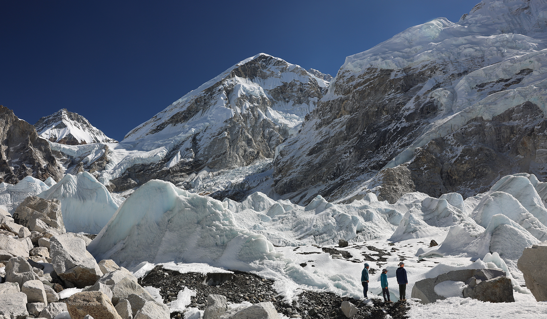
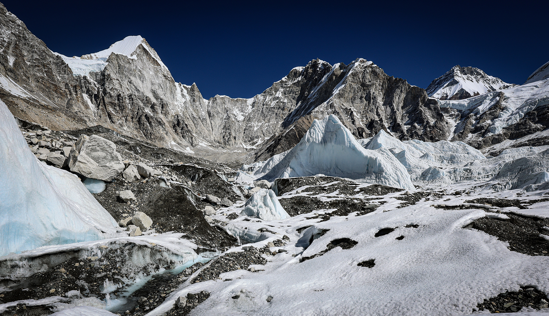
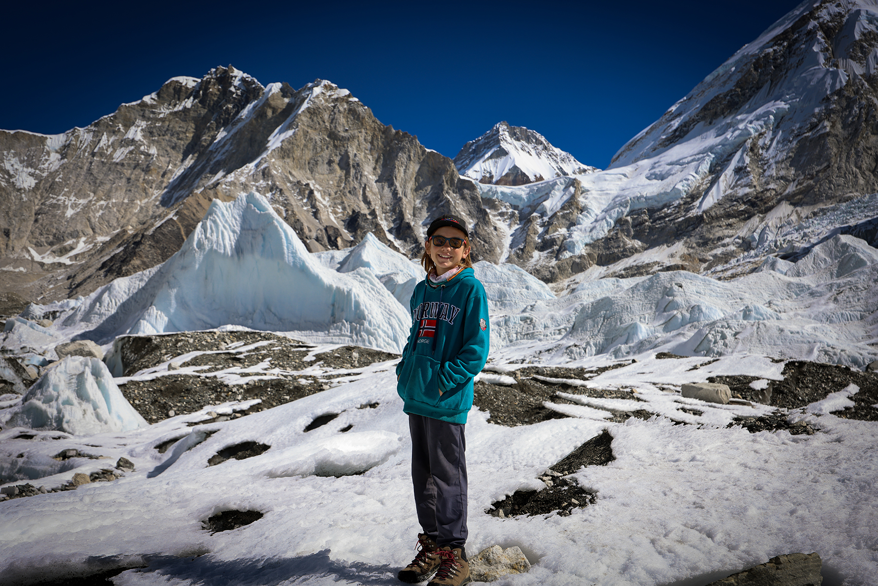
A cold night of the best sleep we could manage at nearly 17,000 feet brought us to the morning of the day we had been talking about with our kiddos for years! We set off in the late morning, hiking undulating terrain along a moraine wall overlooking the jumbled mass of ice blocks of the Khumbu glacier. Amazingly, the crowd of trekkers we had shared the trail with yesterday had entirely dissipated, and we found ourselves nearly alone as we hiked the last kilometers towards Base Camp. H first spotted some prayer flags on the glacier from a distance, and with increasing anticipation we took the last steps towards our goal, stepping off of the moraine wall and onto the glacier itself. We had arrived!
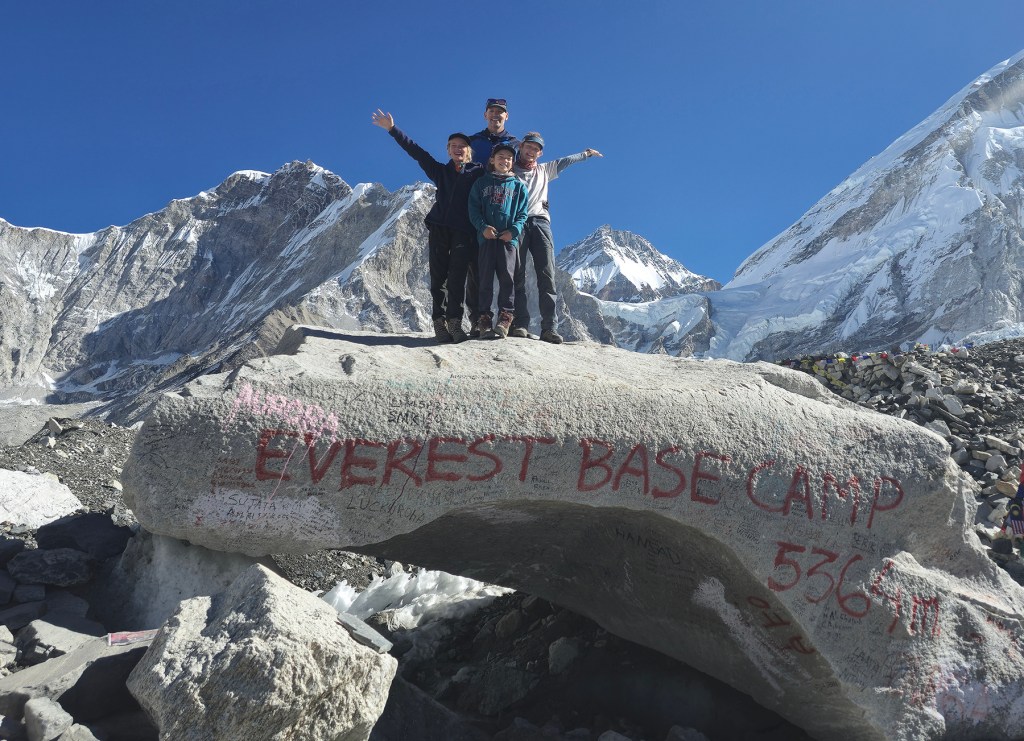
In a flood of emotion we shared family hugs and took pictures in front of the famous rock marking EBC, which the kiddos refer to as the “ugly graffiti rock.” As late fall is well outside of the traditional springtime climbing season, the city of tents we had seen at Ama Dablam Base Camp was nowhere to be found. Thanks to our late morning start, also missing from the site were other trekkers! We spent some time wandering a bit further onto the glacial ice, exploring around the towering seracs of ice and meltwater streams covering the glacier’s surface.

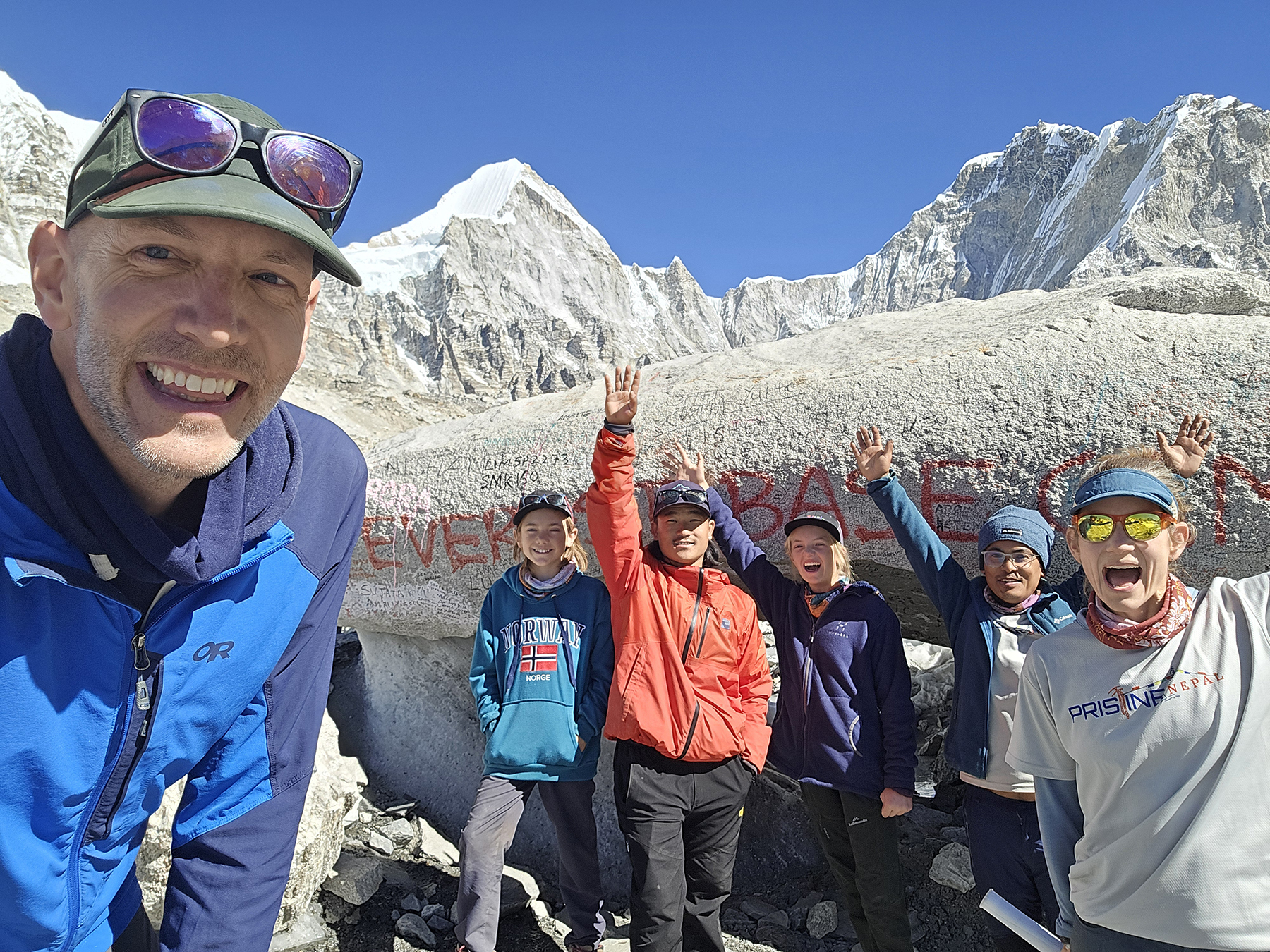
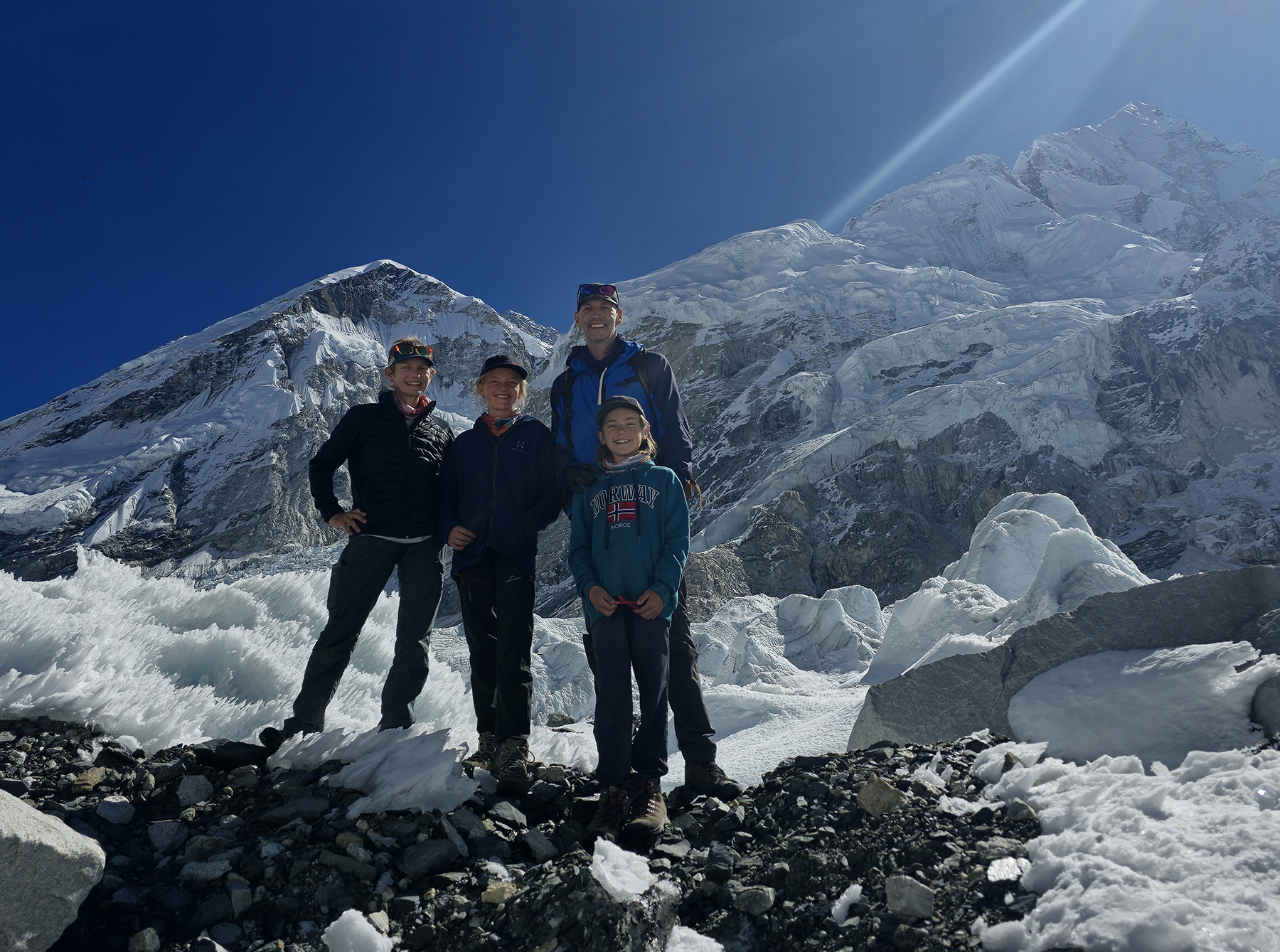
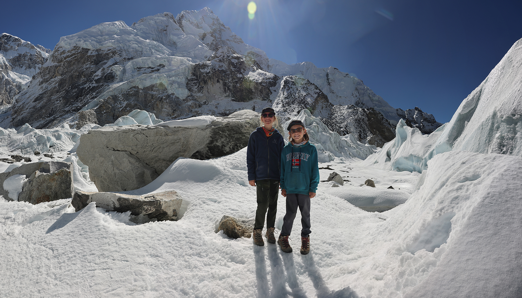
A few times during the morning sweet Sonya was overcome with emotions, and shed a tear or two on our arrival to and departure from EBC. For years we had joked with the kiddos each time a hike got difficult to think about what good training they were getting for our hike to Everest Base Camp. Now that we had finally made it, it felt like a turning point – midway through our trek, and midway through our sabbatical year of adventures. It is shocking to think that our kiddos are now big enough to have achieved this goal, and made us ponder what they will set their sights on next in their lives.
Day 14! Lobuche (16,210 feet) to Dzonglha (15,846 feet)
Leaving Everest Base Camp, we next had to consider that we still had a lengthy trek ahead of us! We found some interesting statistics indicating that of the people who set out from Lukla, some 70% reach EBC, 50% make it up to Kala Patthar, but only 30% complete the trek back out, with the remainder taking helicopter transport from locations up valley to shorten the trip. We aimed not only to complete the trek all the way back to Lukla, but also to cross over the Cho La Pass into Goyko as well.


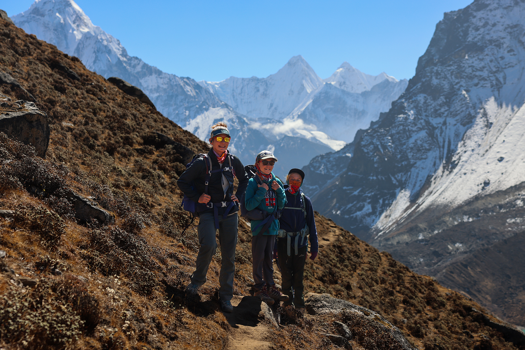
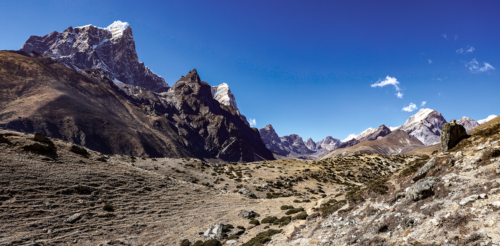
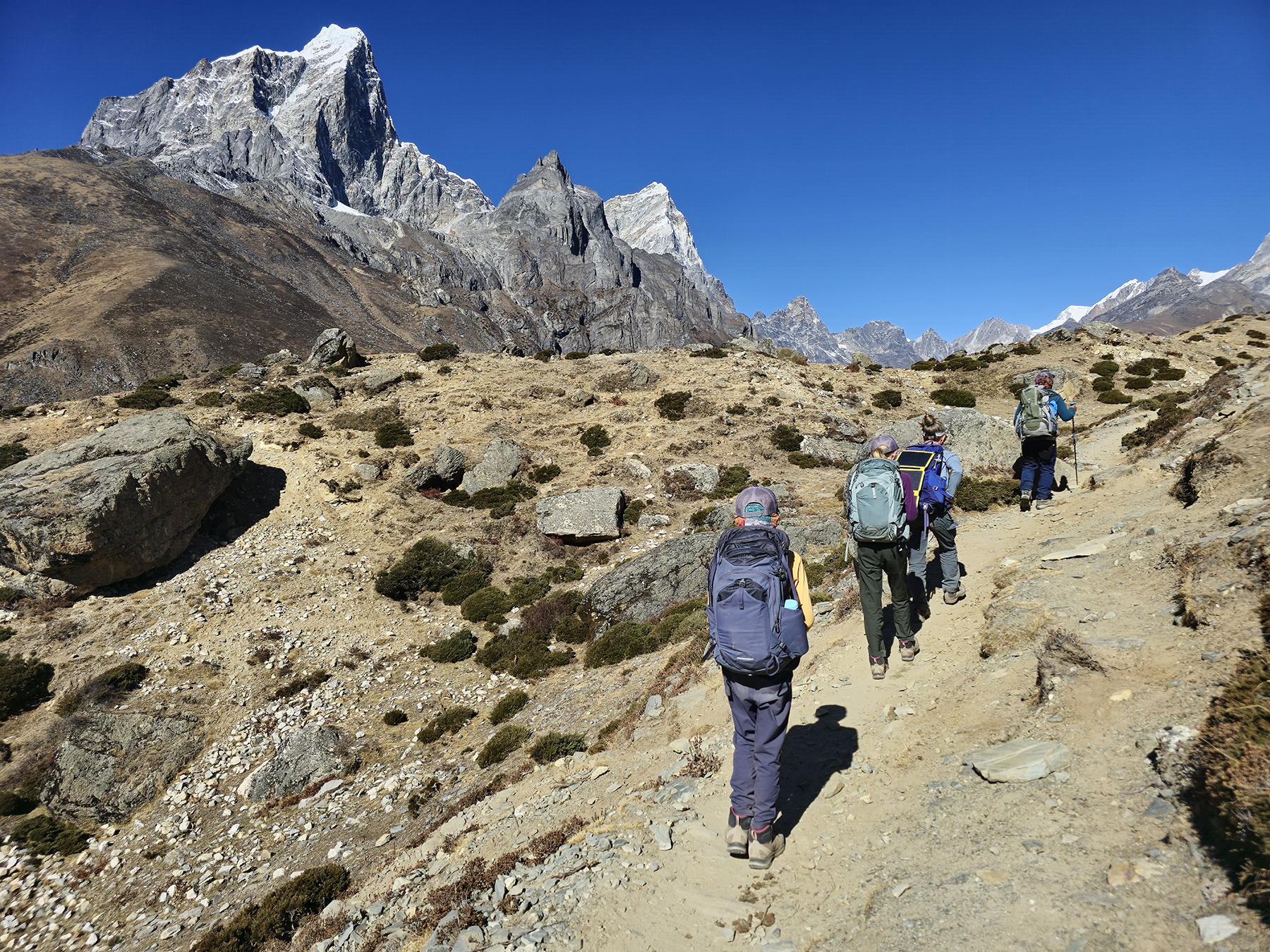
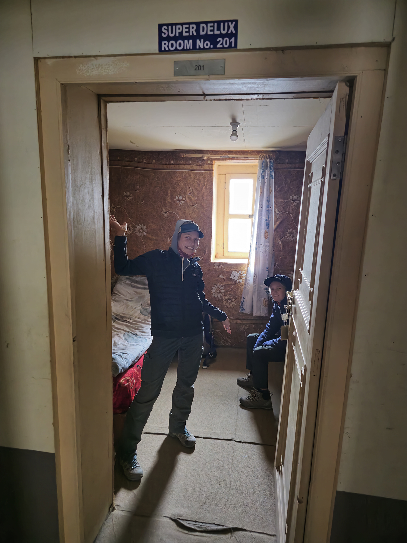
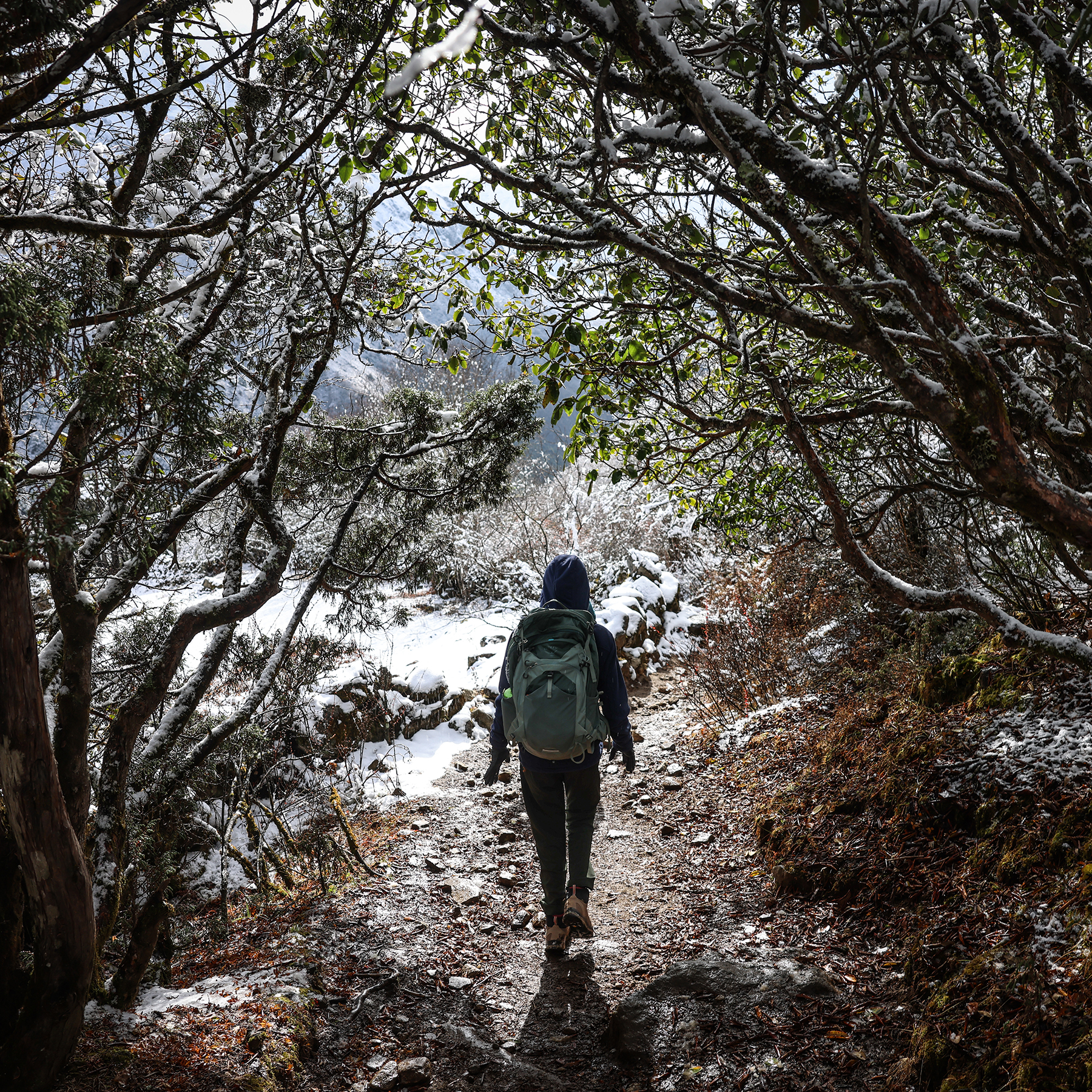
Our second night in Lobuche was spent in a much more comfortable teahouse than we had stayed in on the way up, though we missed the overly optimistic signs declaring our rooms to be “super deluxe”! Leaving Lobuche, we trekked briefly down the valley until our path diverged from the standard EBC route, heading off towards Dzonglha and the Cho La pass. Much of this section of trail was a delightful high altitude traverse along a relatively flat and fantastically scenic trail. The views swept across the open hillsides to include many of our now familiar companion peaks, including Pumori, Nuptse, Kantega,Taboche, Cholatse, and of course the ever-present Ama Dablam. H was delighted to be joined by a few trail dogs here, which followed us all the way up to the small village of Dzonglha. Thanks to our efforts to make it all the way back to Lobuche yesterday, today’s trek was short and sweet!
Day 15! Dzonglha (15,846 feet) to Cho La Pass (17,782 feet) to Gokyo (15,580 feet)
Today would end up being our most difficult day trekking for the family, compounded by poor MB’s ongoing nausea that still has not resolved itself since the day of the fateful chicken sandwich. It was yet again a day in which our sweet kiddo showed she was capable of doing amazing things in difficult circumstances! We again would have considered taking a rest day, but we were concerned by the most recent forecasts that predicted an approaching storm. As such, it was decided that we would not only cross the high Cho La pass as planned, but also continue on another two to three hours past our planned stopping point at Thangnak in hopes of making it all the way to the Gokyo lakes.

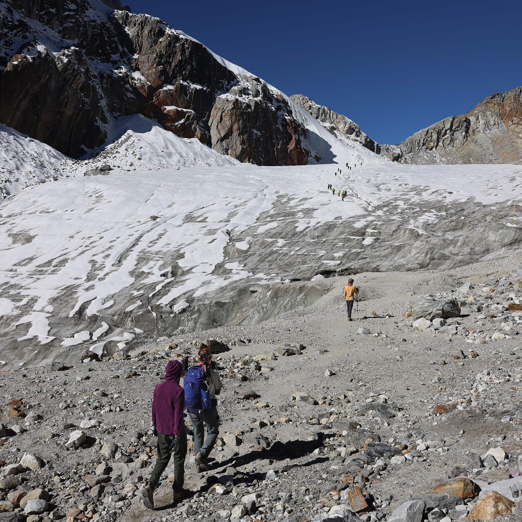

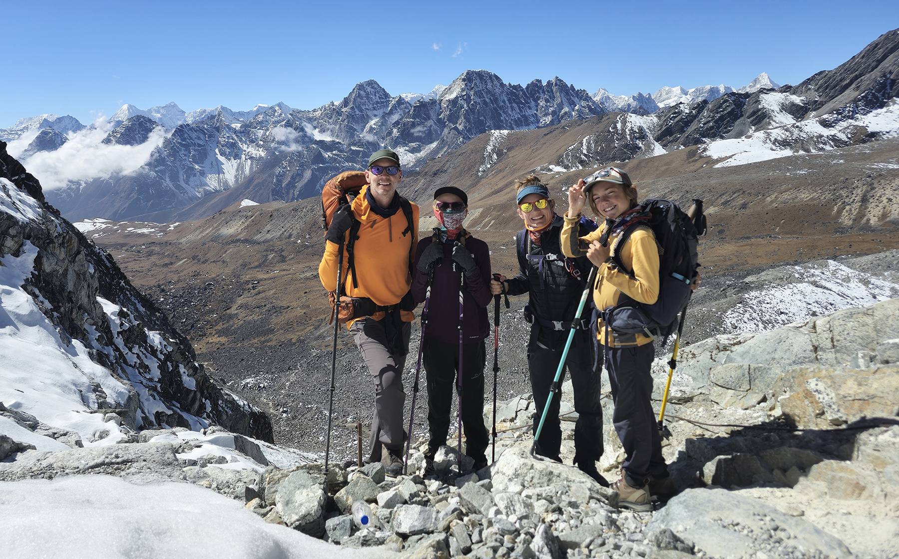

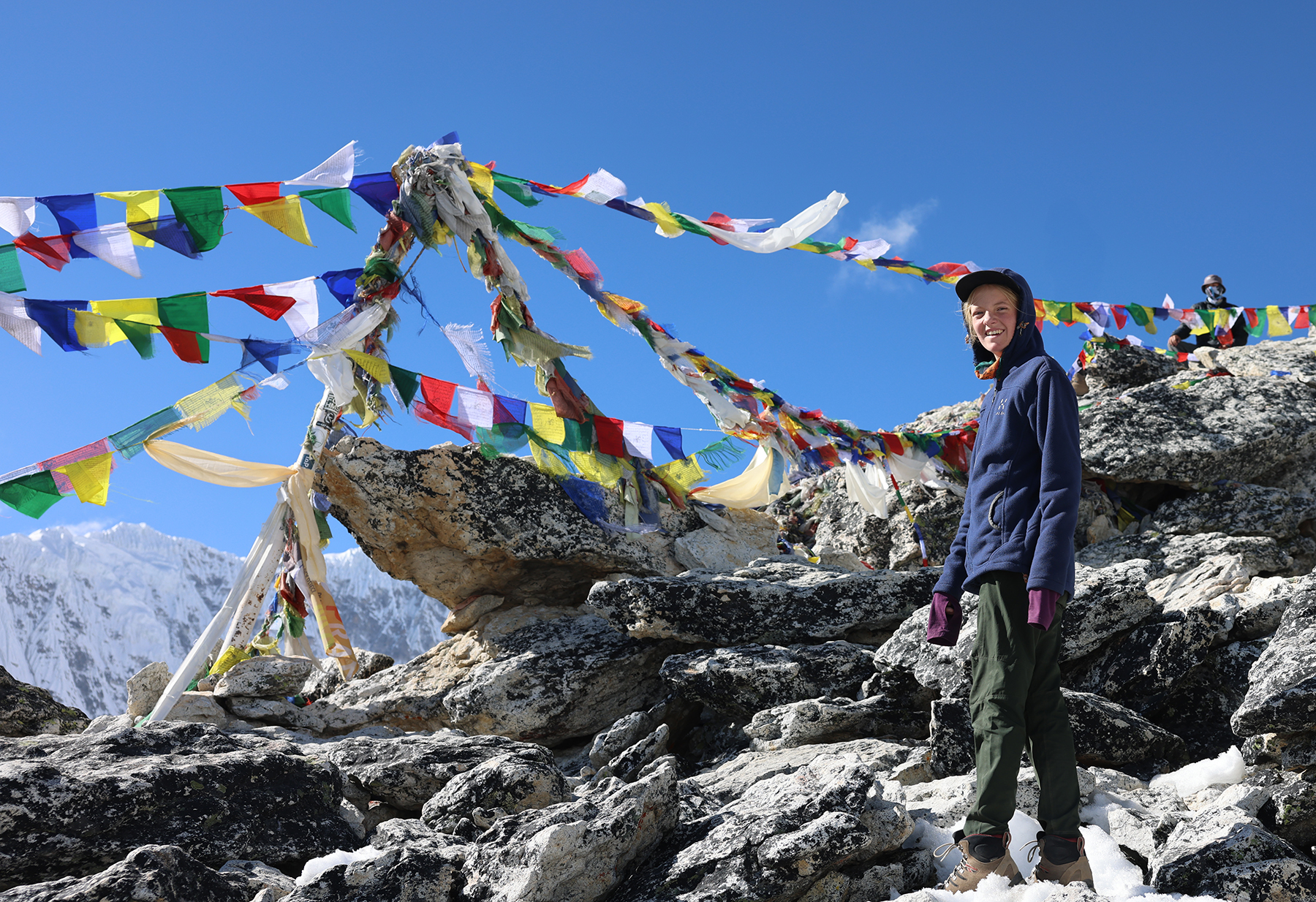
We managed a rare early start to the day, and enjoyed a rather chilly hike until the sunshine finally reached the valley floor. Unfortunately, within an hour of the start of our hike MB’s upset tummy again slowed her pace. She nonetheless pushed bravely on ever upwards, though it was a struggle to make it to the edge of the glacier that guards the final approach to the pass. Having reached the glacier, we put on our microspikes and continued laboriously onwards up the glacial ice in the now blazing hot sun until at last we reached the day’s high point, the Cho La Pass. We were greeted by a beautiful view of a new valley, and a large number of tired but happy trekkers from around the world resting, snacking, and singing together.

The descent from the pass was steep and rocky, making it difficult to pass the slower moving large trekking groups on our way down. The kiddos have always excelled at hiking downhill, and MB seemed to feel somewhat improved as we continued across rolling terrain. As the daily afternoon clouds swallowed up our route, we hiked onwards beneath the cold, grey blanket until reaching Thangnak for a late lunch.
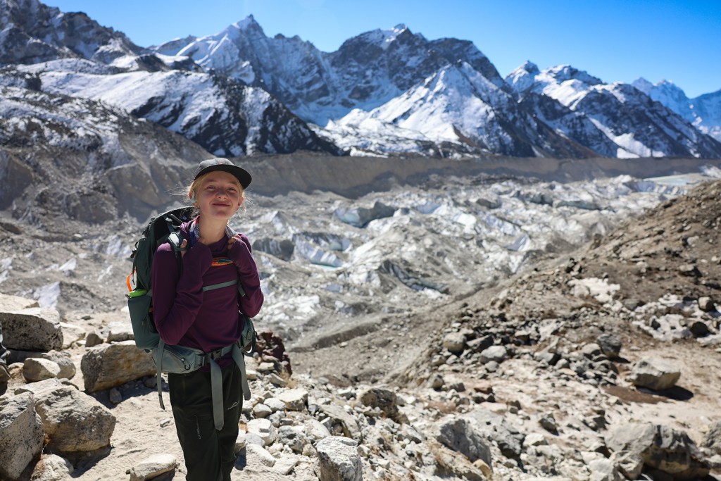
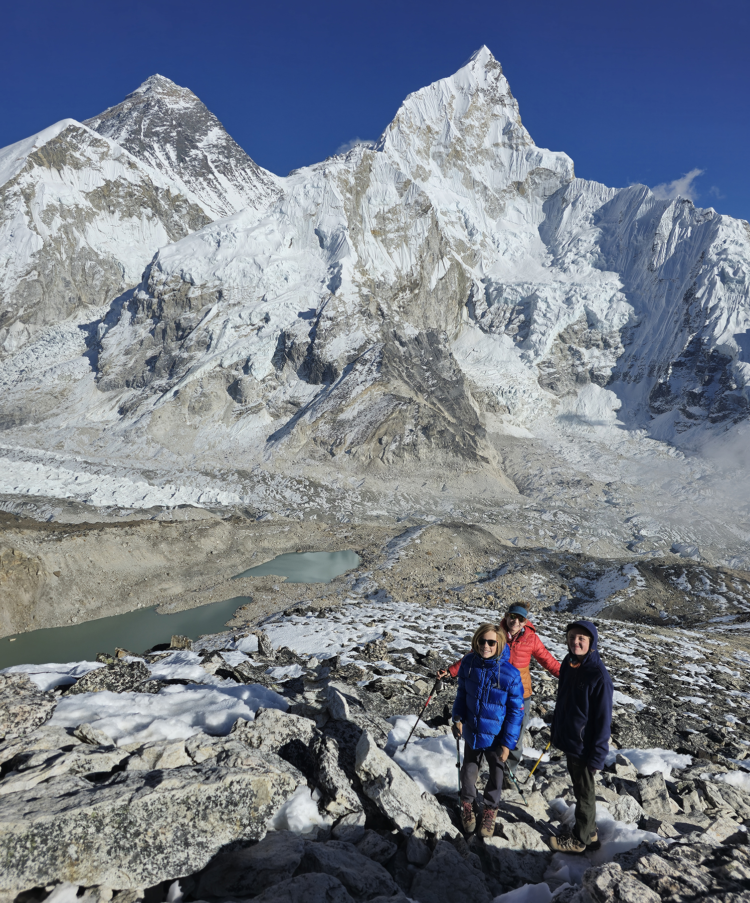
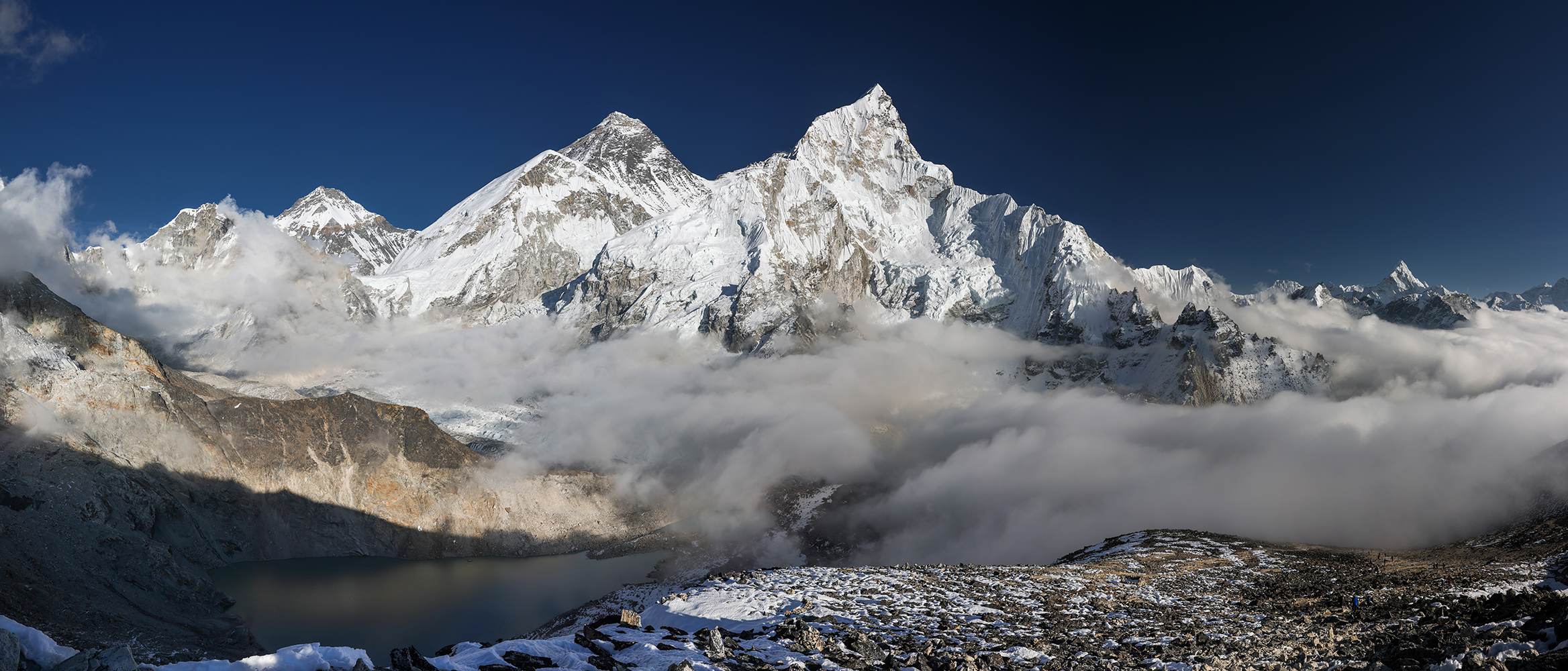
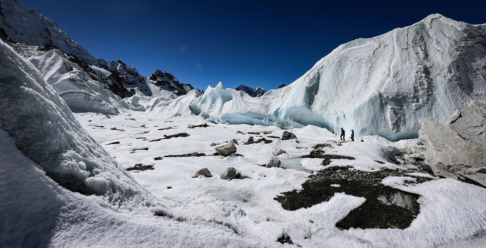
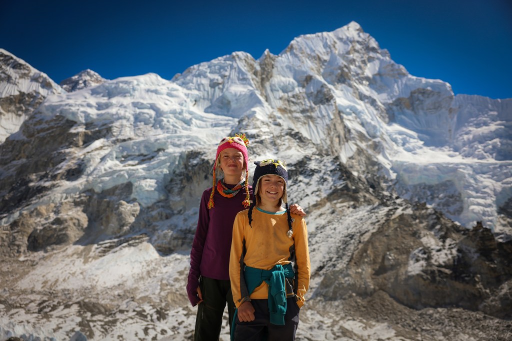
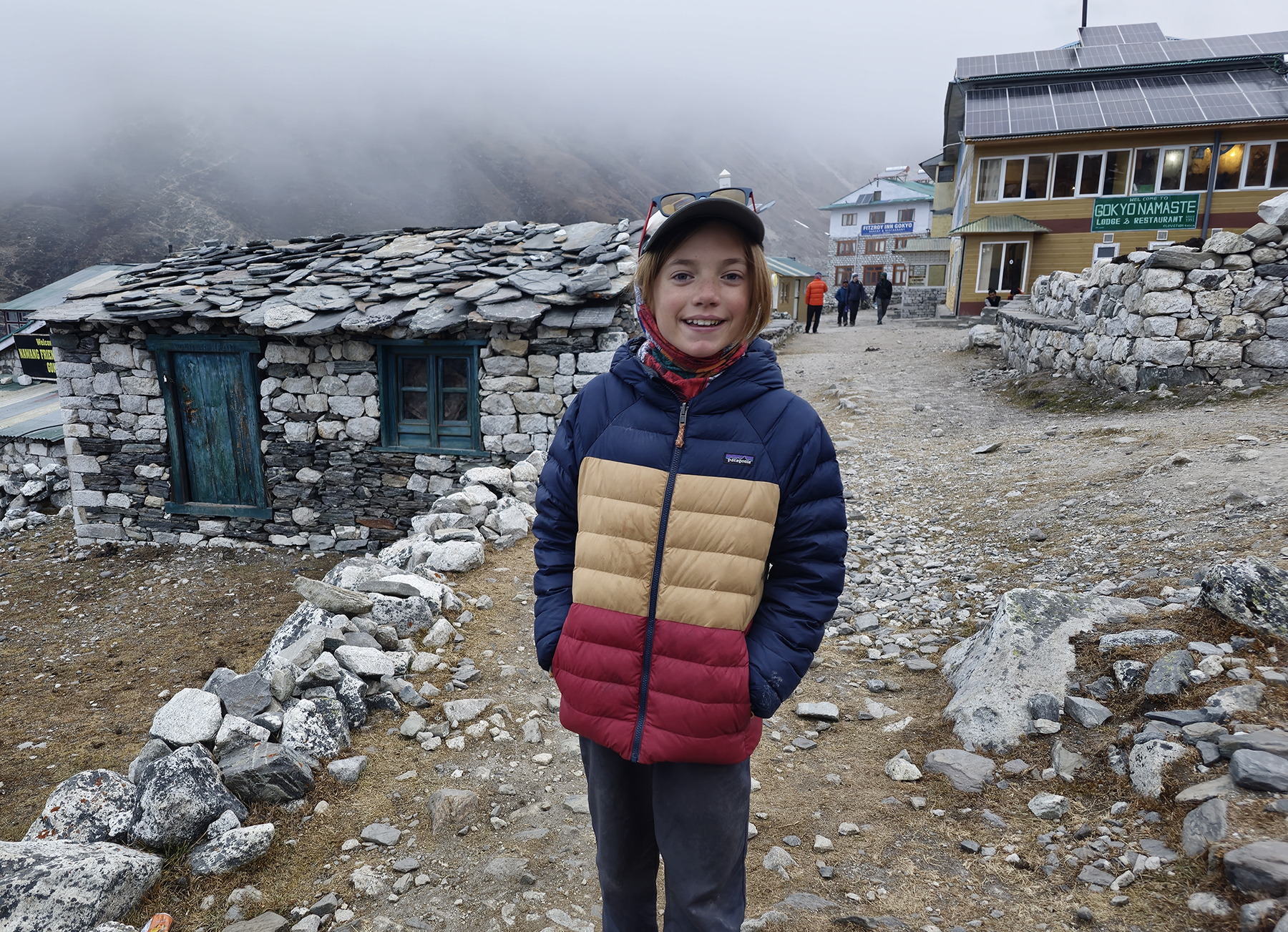
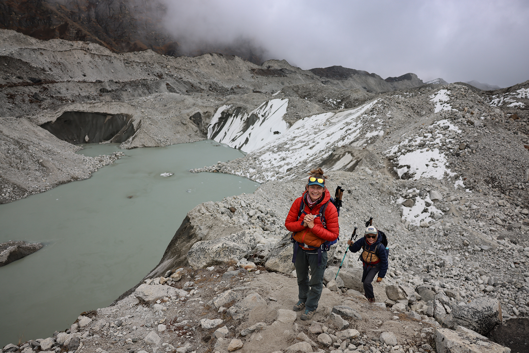
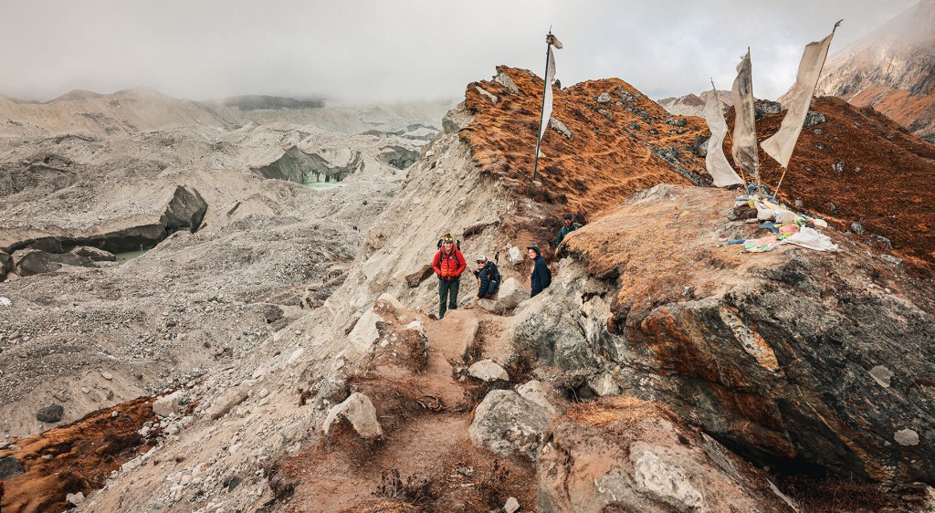
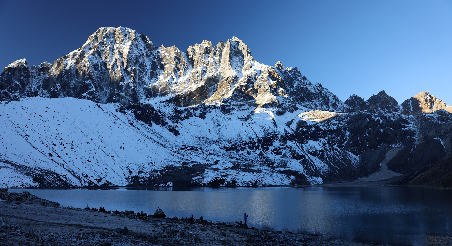
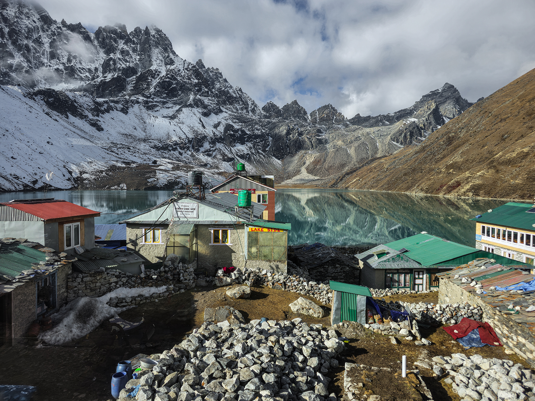
From Thangnak the absolute distance to Gokyo is not far, but one must cross the rocky expanse of the Ngozumpa Glacier in order to reach Gokyo’s turquoise lakes. Ngozumpa Glacier originates near the Tibetan border in the southern cirque below the enormous masses of Cho Oyu and Gyachung Kang, the sixth and fifteenth highest mountains in the world, respectively. The glacier crossing was fascinating, featuring endless ascents and descents through the jumble of rock and ice, weaving around meltwater lakes of numerous different colors. The kiddos, somehow feeling much better after hours of hiking, greatly enjoyed skipping rocks across the lakes and trodding across the unfamiliar terrain, which felt very dynamic and unsettled. A last ascent up the moraine wall finished our crossing, at which point a brief descent led us at last to the welcome sight of Gokyo Lake, our home for the next two nights.


Day 16! Gokyo (15,580 feet) to Gokyo Ri (17,575 feet) and back
After yesterday’s epic all-day outing across Cho La, Sonya and the kiddos had earned a well-deserved rest break. With that plan in mind, Indra and I set off early while the family slept to hike up Gokyo Ri, the minor summit that lies just above Gokyo Lake. At this point in our trek we are feeling so well acclimated to the altitude that we are able to reach the summit with what feels like minimal effort – the two thousand feet of elevation gain passes quickly and we soon find ourselves looking out at yet another superlative landscape.


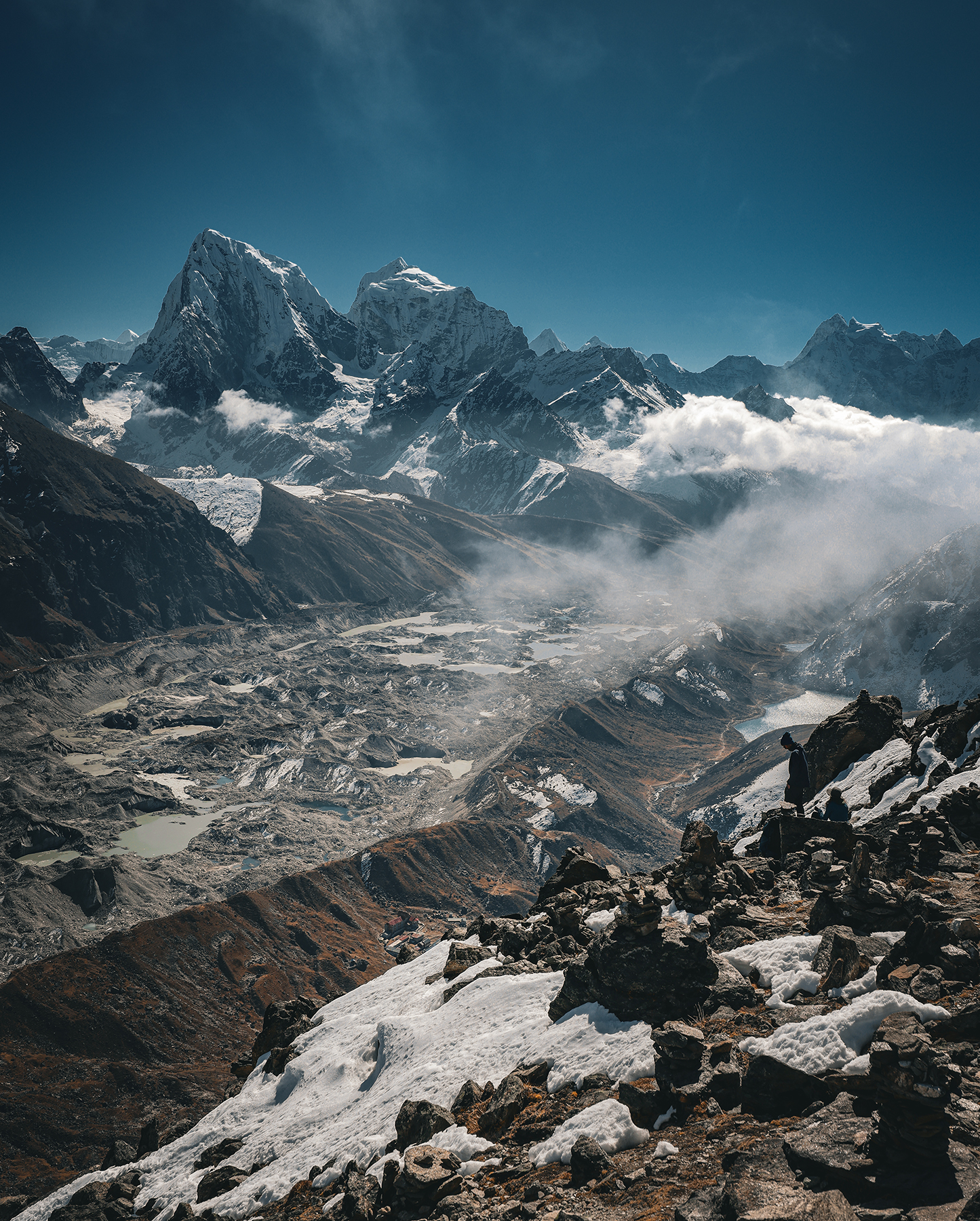
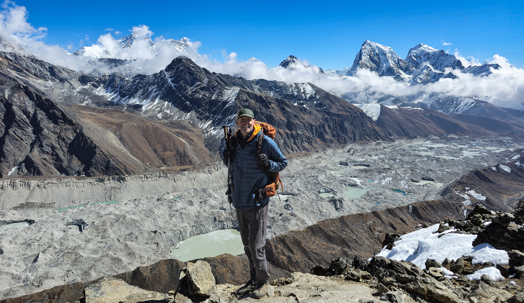
We lingered at the summit for quite some time, having found a quiet spot some ways off to watch the day’s cloud show, have some snacks, and take a few (OK, 500) pictures of the surrounding peaks. Mt. Everest looks even more impressive from Gokyo Ri than from Kala Patthar – from this vantage point it truly stands out as the “goddess of the sky,” Sagarmatha. I was happy to get the chance to visit this special place with Indra, as even though he has guided many trips to EBC, this was his first time in Gokyo! After a few hours at the summit we made a quick descent to Gokyo to see how the recovery day was treating the family.
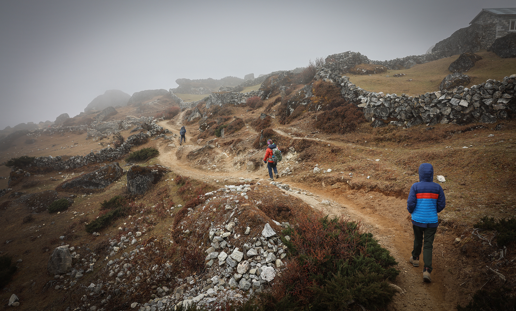
Day 17! Gokyo (15,580 feet) to Dhole (13,248 feet)
At last, after sixteen days of trekking and ten straight days without dropping below 14,000 feet, we have begun our descent and trip back out towards Lukla. The incoming storm, our reason for rushing over the pass to reach Gokyo, is scheduled to arrive later in the evening and bring with it a few inches of snow to the lower elevations, and potentially more to the higher elevations. We left Gokyo in the morning as mist and clouds reached the lake, hiking down easy angled terrain and passing by a few other glacial lakes. For a while the fog became quite thick as we descended alongside a roaring river, through yak pastures and the occasional small settlement. A final afternoon traverse across a broad hillside brought us to the village of Dhole, and a welcome sight – we had made it back down to treeline! The evening was spent in a cozy teahouse, watching the first snowflakes fall from the sky.


Day 18! Dhole (13,248 feet) to Namche Bazaar (11,286 feet)
Today began with a beautiful walk through rhododendron forest dusted in a few inches of fresh snow, under a deep blue partly cloudy sky! We were happy to be heading downwards, instead of up and over the high passes that had received quite a bit more accumulation. The trail was slippery at times, but it was fun to see the clearly defined snowline on the hillsides below us. Following a big initial descent, we made what would be our final long climb up and over Mong La, where we stopped for lunch at a teahouse with spectacular views of Kantega and Thamserku overlooking the Dudh Koshi river.


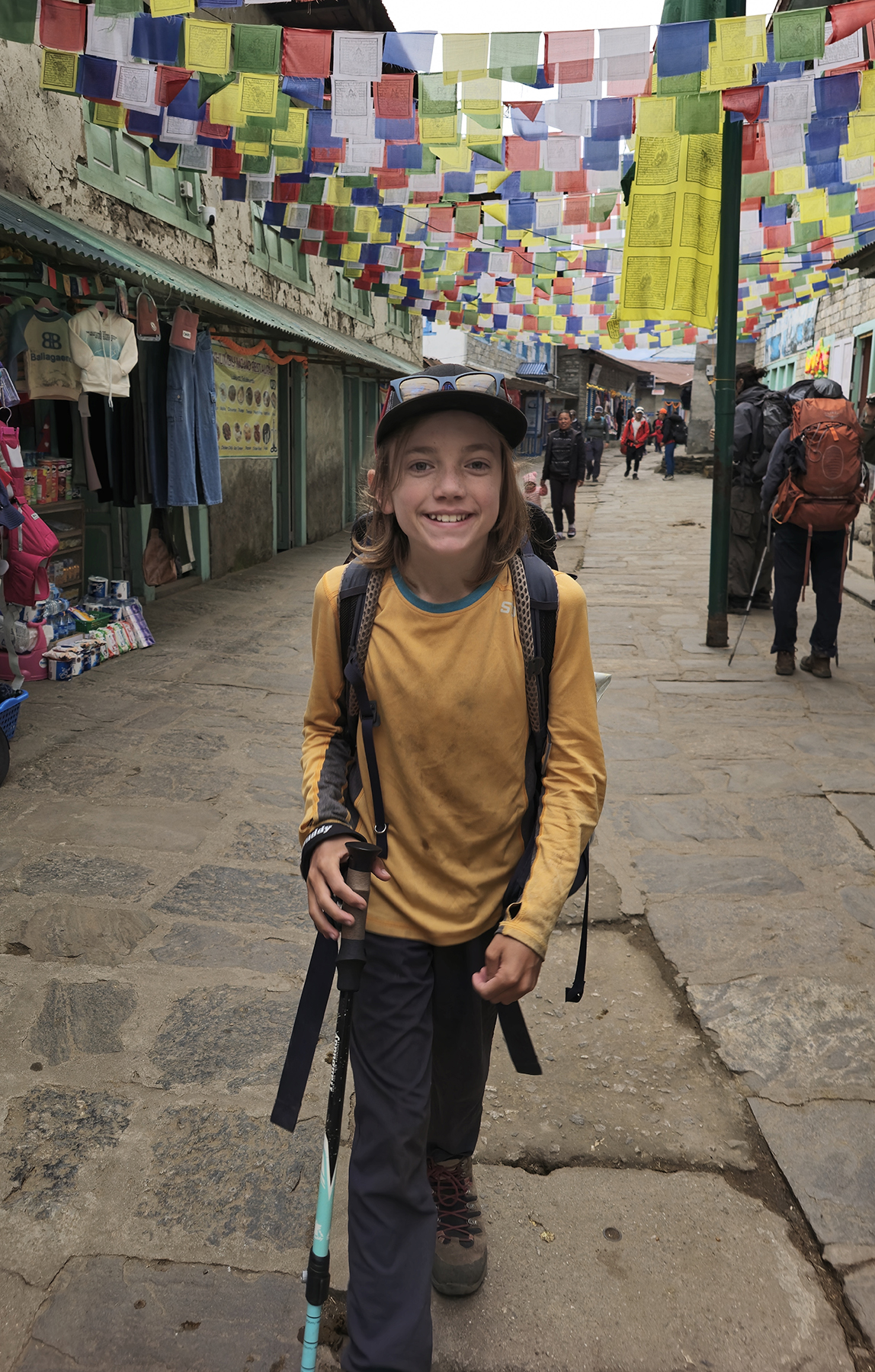
After lunch our Cho La / Gokyo Lakes trail finally rejoined with the traditional Everest Base Camp trail, and we started to feel some excitement about our approaching return to the comforts of civilization. In the late afternoon we rounded a final corner, and were greeted by a welcome view of Namche Bazaar! We made our way back through the crowded alleyways into town and spent the afternoon looking for tourist trinkets, visiting the bakery for treats, and stopping by our new all-time favorite spot for hot chocolates, the locally-famous Yakbucks Coffee! Even knowing that we still have a long day of hiking ahead of us tomorrow, it started to get a bit emotional to be nearing the end of our trek through the Khumbu.


Day 19! Namche Bazaar (11,286 feet) to Lukla (9,383 ft)
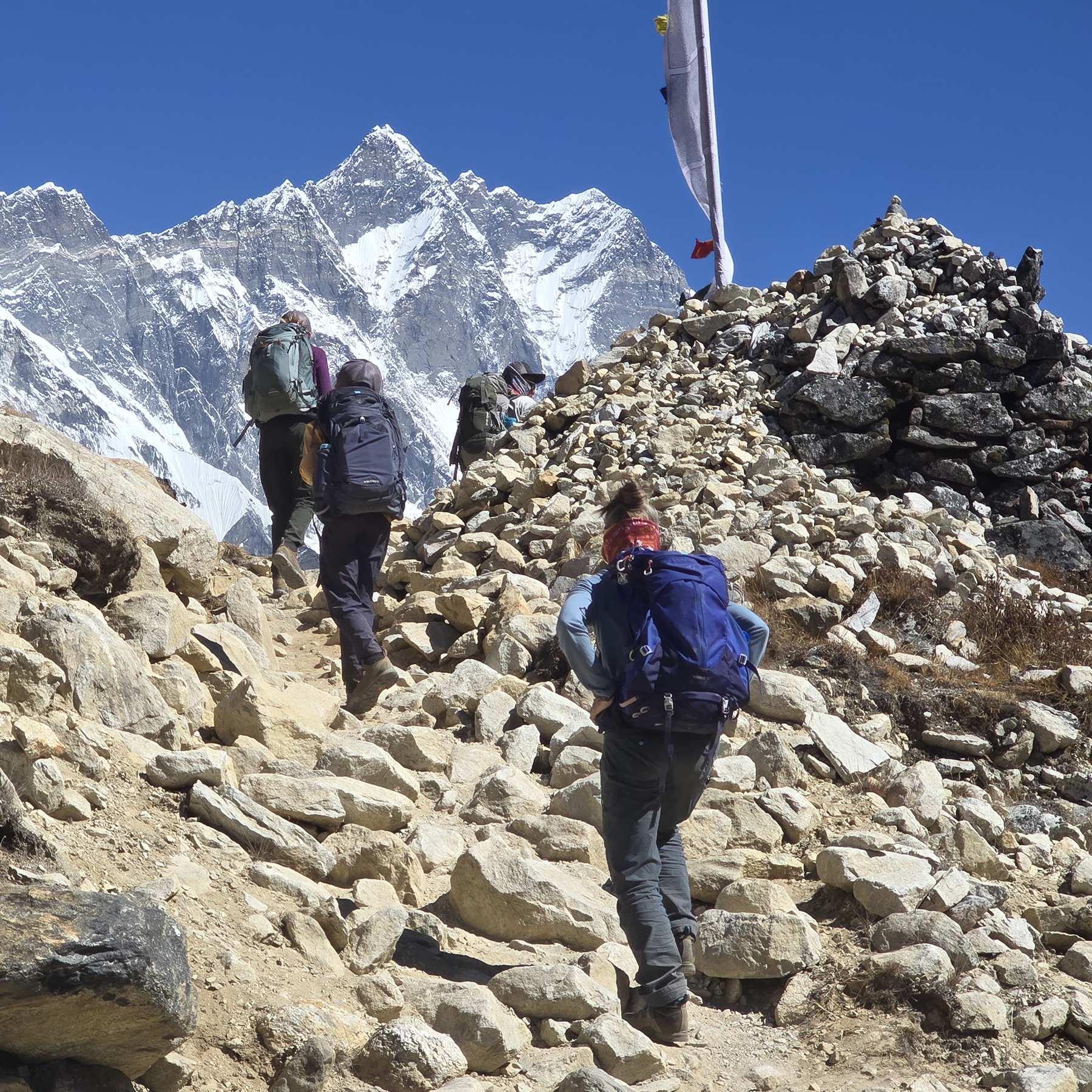
Our last day of hiking reversed the path of the first two days of the trek, compressing our itinerary by a day in hopes of increasing our chances of catching a timely flight out of Lukla. We had been hearing news that another backlog of trekkers was building up at the airport, as flights had again not been able to arrive or depart for several days due to the weather. After picking up some trash bags to carry out (trying to do our part to keep the Khumbu clean!), we found the initial hike out of Namche to be a relatively painless, mostly downhill stroll through glorious, oxygen-rich air.

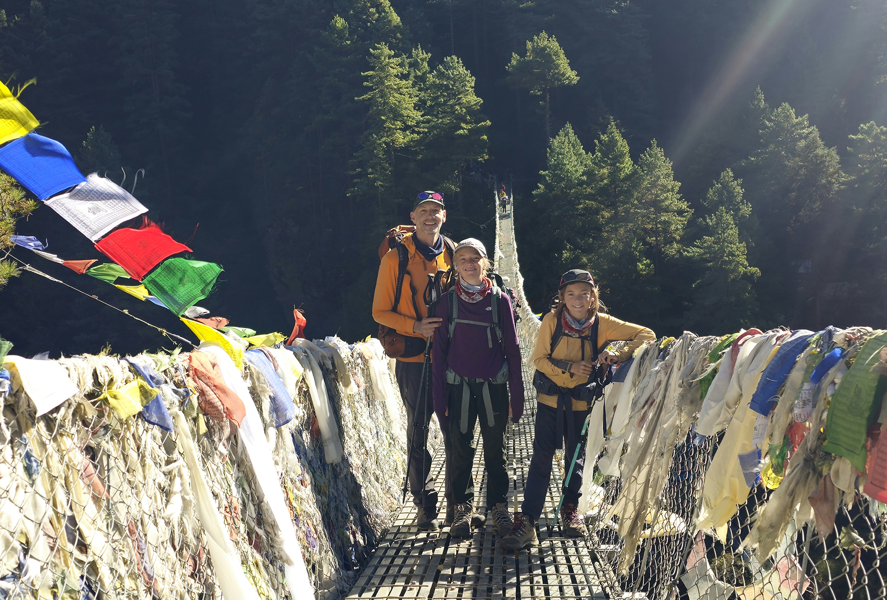
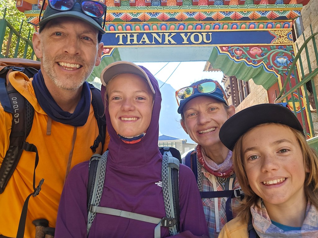
We celebrated our return to the Hillary bridge with a round of photos and hugs before continuing on to Phakding for a final lunch of dal bhat. The afternoon’s hike was a bit more strenuous, as by cruel fate, the final path to Lukla requires a few hours of uphill to give one’s tired legs a final test. As we made our way up the final rocky path up to the entry gate in the warmth of the late afternoon sun, passing spinning prayer wheels and the occasional train of yaks, there were lots of hugs and reflections on the core memories we formed during our trek. All that remained was a final celebration dinner with Indra, Naresh, and BBC to celebrate our successful return!


Day 20! Lukla (9,383 ft) to Kathmandu (4,600 feet)
We had made it back to Lukla, but the journey was not done yet! We still needed to catch a flight to Ramechhap via a notorious twenty five minute bumpy ride that leaves from the most frightening runway I have ever seen! Because we had arrived back a day ahead of schedule, we were last in line to board a flight. Lukla does not operate in quite the same manner as other airports – there are three airlines that fly out of the area, each with a couple of small planes. Some days they can’t fly at all due to wind or visibility issues, but on days of good weather they will make as many flights back and forth as they possibly can until they run out of trekkers to transport! Usually the morning is best for flights, as the afternoon generally brings cloud cover and less stable air. We somehow lucked out, as the clouds which had been rolling in each day held out until much later in the afternoon for their arrival. We watched as plane after plane of trekkers boarded their flights, then took off with a lurch down the steeply sloped runway (downhill for takeoffs to gain momentum, uphill for landings to help slow down)!

Finally, after hours of waiting, our tickets were called to board the last flight of the day and we nervously packed into a small propeller plane. Moments later we were hurtling down the slope, thankfully making it up into the air just as the runway ended and the hillside dropped away below us. We soared along, sometimes incredibly close to the steep mountain ridges, looking out at glacier-capped peaks, and down to the lowland rice terraces at the valley floors. It was an incredible experience, and when we landed H knelt down to kiss the solid ground beneath our feet!


This adventurous flight was then followed by an epic journey by jeep from Ramechhap back to Kathmandu. Following the devastating flooding that occurred the day before our arrival to Nepal, what had previously been a 132 km, three hour drive connecting the cities has turned into an eight hour off-road marathon. For nearly the entire length of the trip the road has washed out, at times along with enormous portions of entire hillsides. To remedy this situation, the road has been frequently re-routed into the rocky riverbed, weaving bumpily along on makeshift paths that somehow all connect back to Kathmandu. As painful as our journey was, I worry it will not compare to what will happen when the summer monsoon rains return – travel through much of Nepal may be nearly paralyzed when the rains begin again and the river levels rise. Fittingly, on a trip that has felt somewhat precarious from the start, we made it back to Kathmandu with only 2/5 of our travelling companions having vomited along the drive. So sorry, Sonya and Indra!
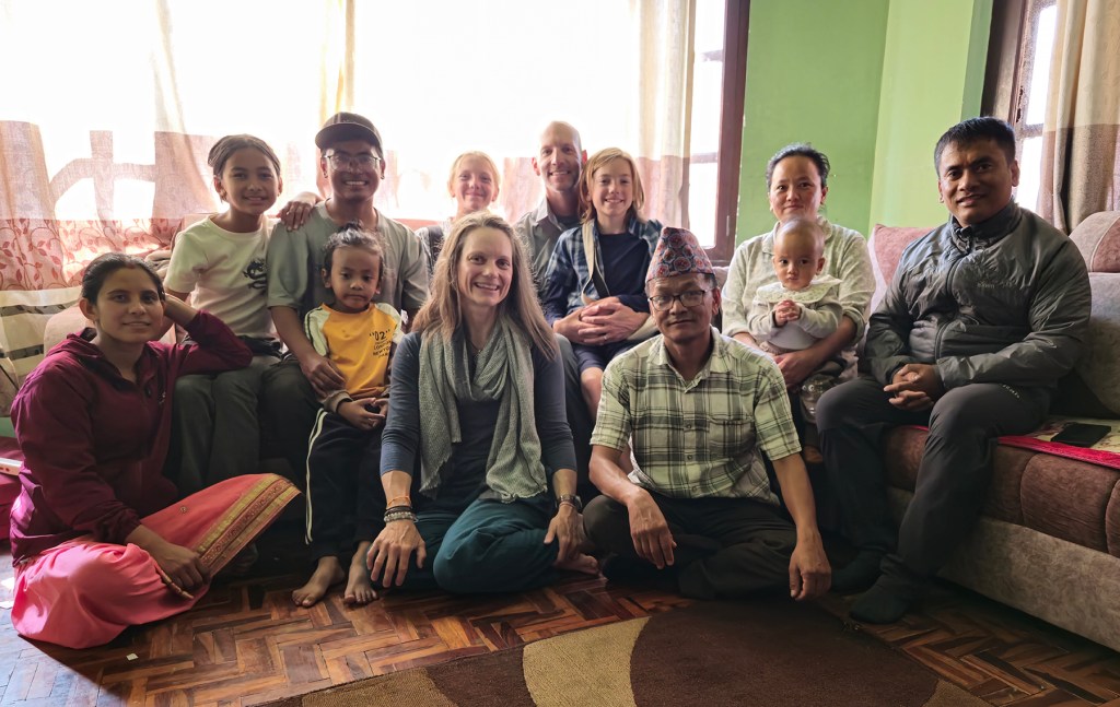
And then, we were back! It was surreal to arrive in Kathmandu, having just experienced a trek that was everything we had dreamed it might be, and more. I was so hopeful that Sonya and the kiddos would find the same joy and allure in the Himalaya as I had felt half a lifetime ago, and I was overcome with happiness when Sonya declared that our time in Nepal has been her favorite experience of our year thus far. Before leaving Kathmandu, we were treated to one of our most cherished nights of our adventure, as we joined Chin and his family in their home for a delicious traditional home cooked meal of dal bhat and curries. A heartfelt thank you to Chin, Ganesh, Kul, Dipak, BBC, Naresh, and all of the Pristine Nepal family members who made us feel so welcome. A special thank you to Indra, our amazing companion for these six weeks, who not only kept us 100% alive the whole time, but did so with patience, humor, and true kindness to our family. And thank you to Sonya and the kiddos for being my forever adventure buddies, making our dream into reality!
Nepal – More Kathmandu and Everest Base Camp – Sonya’s addendum
Before we left Colorado, one of the most common questions our friends asked was “what part of your year are you most nervous about?” My answer was always “Oh man – definitely our SIX WEEKS in Nepal! I hope we survive!” Most of this anxiety was wrapped in the “what-ifs.” What if we get food poisoning, what if we get altitude sickness, what if someone gets injured, what if we get caught in a storm at high altitude… and my personal favorite: what if our plane crashes during landing or take-off at Lukla?! Honestly, my mind would spin and spin as I tried to fall asleep some nights.
Well, oddly enough – all four of us got sick from food poisoning, all four of us had trekking pains and injuries, H had several days of a significantly elevated resting heart rate as we ascended above 15,000 feet towards Everest Base Camp, and there was one night where our oldest kiddo vomited the entire night and then had to hike for 12 hours over a 17,800′ pass to avoid a rapidly-approaching snowstorm (what a tough rock-star)! In summary, it was six weeks of intense character building experiences for our family! Luckily, our flights in and out of Lukla were *relatively* uneventful.
In retrospect, what I learned was a lot of my “what-if” concerns were actually completely rational (also definitely out of my control), but we worked together as a team and navigated through it all. I’m so very, very proud of our kiddos and what they accomplished! Trekking for weeks to stand at the foot of the highest mountain on the planet is an incredibly special feeling – a deeply meaningful moment we shared as a family and will carry with us for the rest of our lives.

Some final thoughts on this remarkable country and its people: Our time here was not the “easiest” part of our year, but I did find it to be profoundly moving. Unfortunately, Nepal is the poorest country in south Asia, with little political power/influence, and landlocked between the giants of India and China (Tibet). As with many developing countries, the government is not always super-functional (in 2001 the entire royal family was murdered and there was an ongoing civil war until 2006), and the young people of Nepal find their educational and career options to be very limited. On top of all this, the area is plagued by earthquakes and frequent flooding which makes ongoing infrastructure efforts a nearly impossible task. But through all of these challenges, the Nepalese people are the most honest, proud, and exceptionally hardworking people I’ve ever met. It was an honor to share six weeks with our team at Pristine Nepal. They became like family to us, even inviting us into their homes for meals with extended family! I am hopeful we will be able to return again some day to explore more of this colorful, vibrant country and spend more time with our incredible Nepalese friends (family). ❤️

Leave a comment